


EVER FOUND YOURSELF in the woods arguing over what species of fir you’re standing under? (Or is it a pine?) Help is on the way, in the form of cell-phone applications that employ a new technology called “augmented reality.” AR uses the latest smartphones’ spatial self-awareness, made possible by three built-in gizmos: GPS, accelerometer (a level meter), and digital compass. These tools allow your phone’s camera to know exactly where it’s looking. And by connecting that picture to the Web, the phone can also identify exactly what it’s looking atand then overlay the image on your screen with everything from highway names to landmark histories to daily lunch specials. Eventually, phones will also access powerful image-recognition engines on the Web, allowing you, for instance, to point your phone at a mushroom and find out if it’s poisonous. Put simply, AR makes the world clickable. The first AR programs for the iPhone 3GS may hit the iTunes App Store as early as October.
Now Playing
iPhone 3GS compass
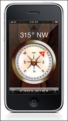 iPhone 3GS compass
We also downloaded and tested dozens of currently available iPhone programs. These were the best.
Google Earth
3-D views, pinch/pull navigation, and resolution down to individual cars. Now you can take your God complex with you wherever there’s a cell-phone signal. $0
Topo Maps
Of the handful of GPS-enabled USGS topo apps, this one is the cleanest; it allows you to easily plot your location in UTM, DMS, or lat/long. Download maps for free and use them even when you’re out of cell range. (For laying down GPS tracks, try Trails.) $7
iTrailMap 3D
Track your vert and map your runs, in real time, on a 3-D rendering of any ski resort in America. $5
RiverGuide for Kayakers
Up-to-the-minute USGS flow data for every river you’d want to kayak in the country. $5
Surf
Web cams, tides, and swell data for every major surf spot on earth. $5