

When I first started hiking, I used��whatever navigational resources��were conveniently available and seemed sufficient. Before thru-hiking the Appalachian Trail in 2002, I purchased the ��and downloaded the Appalachian Long Distance Hikers Association’s��. And to explore Colorado’s Front Range the following summer, I bought a few that covered the area.
But when I started adventuring off the beaten path—beginning with the Sierra High Route,��culminating with the , and continuing with high routes of my own—I had to create some or all of my navigational materials��from scratch. Through this process, I��formulated��what I believe is an optimal combination of maps and resources.
Paper Versus��Digital
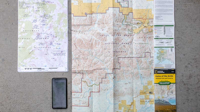
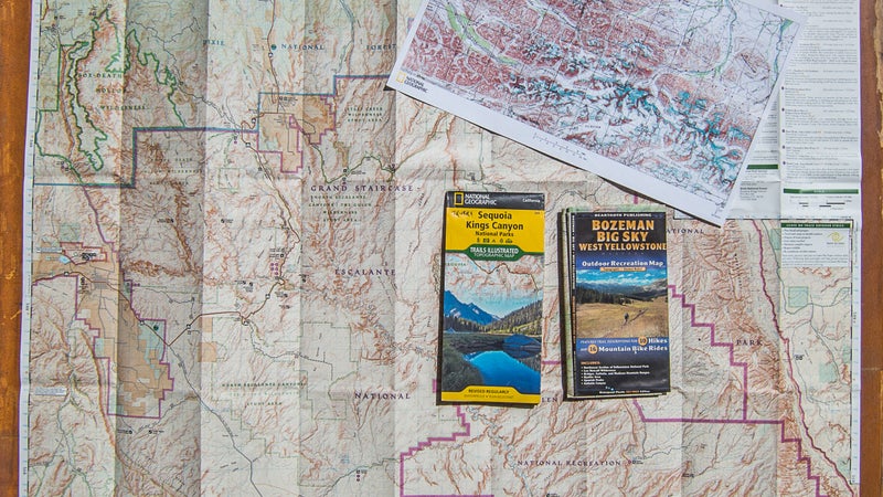
I normally bring��three types of topographic maps: a��paper small-scale overview map, paper large-scale detailed maps, and digital maps (sometimes including additional imagery or data) on a smartphone.
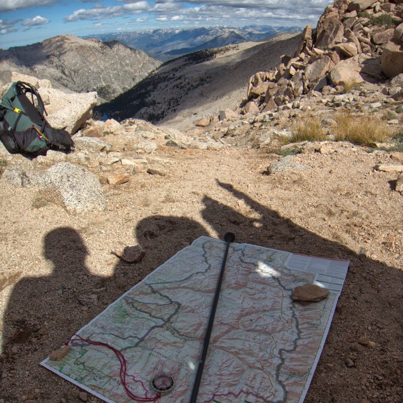
The current generation of thru-hikers might consider me old-school��for my continued reliance on paper maps. But overall��I think they are functionally superior to digital maps. They offer a significantly large��viewing window: an 11-by-17-inch��sheet amounts to 187 square inches of topographic detail, or about 13 times more than the screen on my Google Pixel 2 XL. Paper maps can also��be written on, which is useful for making route notes and drawing bearings. Unlike electronic devices, there’s little to no impact if they’re dropped or sat on, they remain functional after being exposed to water (so long as they’re��), they don’t��require batteries or recharging, and they’re��more easily viewed together by multiple people when discussing route choices.
I understand the appeal of digital maps, however. They don’t require a good printer or a trip to your local gear store. A phone or handheld GPS is easily��pocketed��and less unwieldy. The mapping software can reliably pinpoint your location��and quickly calculate distance and vertical gain or drop—and, for a long trip, it’s also more cost-effective.
Paper Overview Maps
Overview maps normally have a scale of between��1:50,000 and��1:100,000, meaning that one unit on the map (e.g., an inch, a centimeter, a thumbnail) equals 50,000 or 100,000 units in the field. While planning a trip, I use these small-scale maps to develop a general understanding of the landscape, including the main watersheds, road systems, and trail networks. They aid with identifying a general route and potential alternates and working through logistics like travel, permits, and resupply points.
In the field, overview maps are useful for pinpointing distant landmarks and serving as a reference for midtrip planning discussions, self evacuations, and detours.
On its own, an overview map can be adequate for on-trail navigating. However, I’d caution that not also bringing a large-scale map is��a missed learning opportunity.��By definition, the topographic detail on a small-scale map is compressed, making it difficult to associate features on the map with features in the field, particularly subtle ones. If your map-reading skills are only so-so, trying to improve them using small-scale maps will generate limited results.
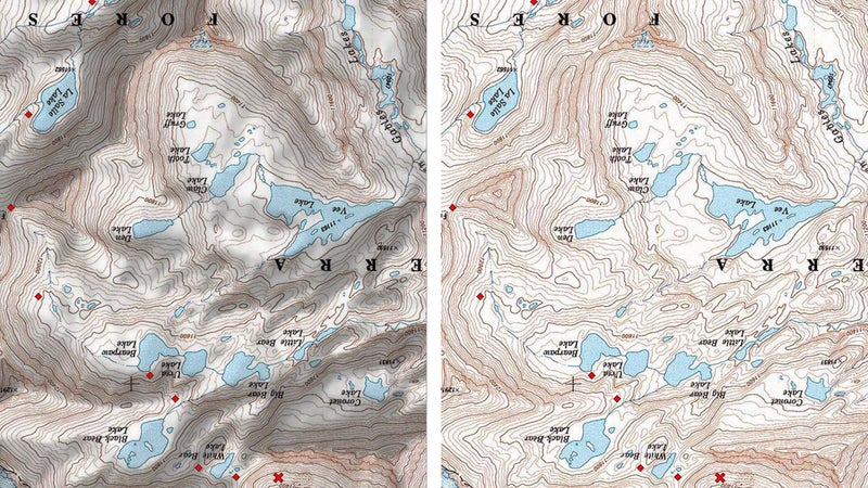
Making matters worse, popular overview maps do not use a standard scale or contour interval (the vertical difference between��contour lines on a topographical map), so your brain must relearn this relationship with every new map. For example, the overview map of Yosemite National Park that I used in July is printed at 1:80,000 and has 50-foot contour lines, whereas the map I’ll use in Rocky Mountain National Park next month is printed at 1:50,000 with 50-foot contour lines, making the topography appear 37 percent less steep.
Also, these popular maps almost always have shaded relief. The shading causes features to stand out more��but plays tricks with your eyes when not viewed from the south side of the map and looking north.
For an overview map, I prefer to use a commercial recreation map, like one��from , , National Geographic, or��, because they are revised and updated regularly and conveniently include things like parking areas, backcountry campsite locations or zones, and services like permit offices��and visitor��centers.��They usually also encompass a defined��area, like a national park or wilderness area, where my entire trip will probably take place.
Individual recreation maps cost $10 to $15 and are available online and from local retailers. If you are a premium member of ($40��per year), you can access the Trails Illustrated maps digitally via the website or app. (From the website, they can also be printed.)
For more remote spots where recreation maps are not available, the next best option is to create your own. I recommend using��the MapBuilder Topo layer in . In GaiaGPS, the best layer is probably Gaia Topo, but it’s also worth looking at ��or .
A final option is to purchase U.S. Geological Survey (USGS) 30-by-60-minute maps, which are at a scale of 1:100,000. (In this instance, minutes��are not in reference to time. The earth is divided into 360 degrees of longitude and 360 degrees of latitude; within each degree, there are 60 minutes of latitude and longitude, and within each minute there are 60 seconds.)��Unfortunately, these maps are not updated regularly—many are more than 25��years old—and they omit many useful recreational details.
Paper Detail��Maps
At home��I use detailed maps to more precisely plan my route. In the field, I rely on them to navigate and find campsites and water sources.
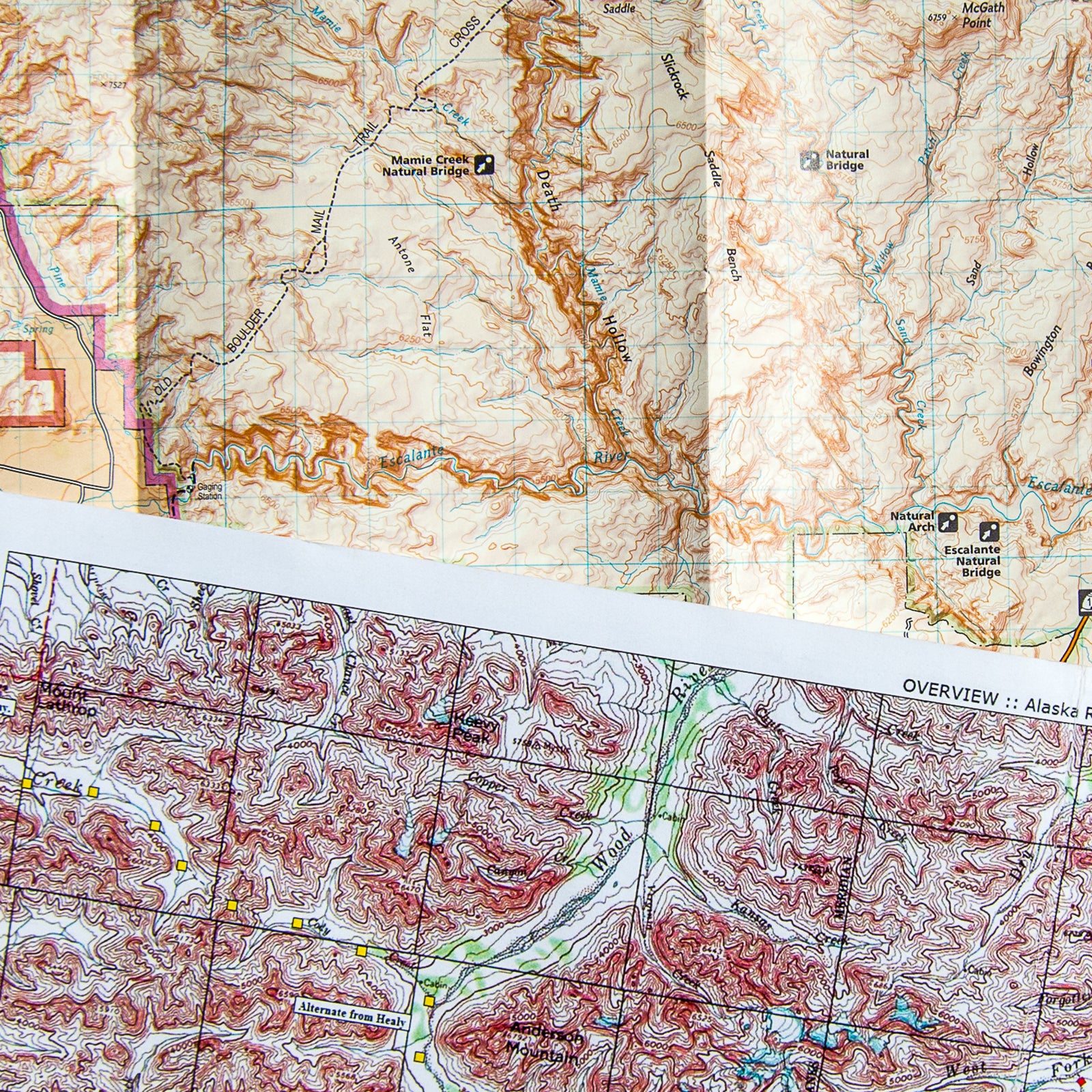
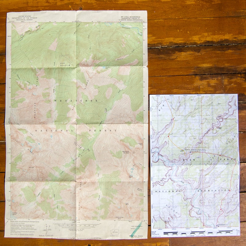
In the U.S., the gold standard for large-scale maps is the now digitized��, produced by the USGS. US Topo maps are modeled after the pre-digital 7.5-minute quadrangles.
Each paper quad—about 55,000 were originally made—represented��7.5 minutes of latitude and 7.5 minutes of longitude.This equated to about 8.5 miles of latitude (the map height) and about 5.5 to 7.5 miles of longitude (the map width), since the physical distance between lines of longitude decreases toward��the poles.
The USGS��quads have a scale of 1:24,000. One inch on these maps equals 0.3788 mile, since there are 63,360 inches in one mile. The most common contour interval is 40 feet. But the USGS was not always consistent in its units or contour intervals. For example, some parts of the High Sierra have 20-meter contours (about 66 feet), while 80-foot contours were used in the Tetons and Glacier National Park.
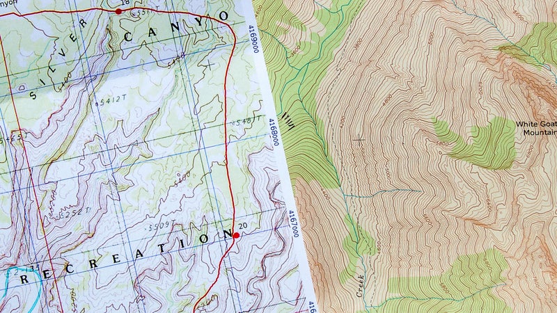
Today��scans of the quads can be accessed digitally, using platforms like CalTopo (my pick) and GaiaGPS. A related product that is better for Forest Service lands, , is also available through these sites. Both USGS and FS maps can be exported out of CalTopo and Gaia into print-ready PDFs.
An 11-by-17-inch��tabloid printout does not rival the beauty or quality of an original quad, however. If you’re��nostalgic, purchase them directly from the USGS, or look for them at your local outdoor retailer (most likely in a wooden bureau with coin-slot-style drawers).
Special Circumstance: Alaska
The maps available for Alaska are generally different than those in the lower 48. Recreation maps are becoming more common, particularly for the national parks. For other areas, make your own map in CalTopo or Gaia, or track down the beautiful one-by-two-minute series that are printed at a 1:250,000 scale with 250-foot contours, available from the USGS.
The digital US Topo��layer is increasingly available for Alaska, but I still prefer to use scans of the older 15-minute quads, which are printed at a scale of 1:63,360 and normally have 100-foot contour lines. A lot of topography can hide in these maps, due to the wide contour lines, but the Alaskan landscape is so huge that I find the large scale and contour interval more becoming of it. The incredible detail of the standard 1:24,000, 40-foot-contour series undermines its usefulness in this terrain.
Digital Maps
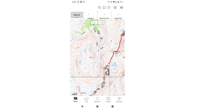
As a backup and supplement to my paper maps, I also load digital maps onto a smartphone or GPS unit, and sometimes other layers, too, like Landsat imagery and property��boundaries.
Digital maps have inherent value, even aside from the powerful software they bring.��If I lose my paper maps or get way off route—both have happened—digital maps become invaluable.��I’ve found other people’s maps, and I’ve had clients lose their maps. And on one of my first guided trips, we bailed out of the Alaska Range and ended up 100 miles away from our intended exit point, way off both our overview and detailed maps.
Other Resources
In addition topographic maps, I like to have the following two��other items.
A Route Description
A route description is useful for providing general information about a route (or a part of it), interesting historical and scientific knowledge, personal anecdotes from the author, and in-depth explanations of tricky sections. I tend to avoid those containing��wordy descriptions of information that would be more efficiently conveyed by a topographic map.
While preparing for treks for which no route description was publicly available, I have made my own. In these DIY guidebooks, I consolidate bits of information from email and phone conversations, online forums and trip reports, land-manager websites, and travel reservations. I copy the content verbatim��because its full meaning often can only be interpreted once in the field.

Data Sheets
A data sheet is a list of key landmarks (such as intersections, passes, creek crossings, and shelters) and corresponding data, usually��including incremental and cumulative distances. Premade sheets are available for some well-trodden routes, like the Appalachian Trail, but I often make my own. In my high-route guides, I also include vertical change because it’s .
A data sheet it not useful for a spontaneous itinerary—you’ll be off it after an intersection or two—but it’s extremely convenient for established trails and routes, like a long-distance trail. With a data sheet, I can quickly dead-reckon to future landmarks, identify realistic camping areas for the night,��and determine if I’m ahead or behind pace.
The information on a data sheet can be calculated manually from a paper map, using vertical change and distance, but it’s��tedious work. Digital measuring tools in CalTopo and GaiaGPS will yield more accurate data and make much quicker calculations.
Data sheets can be edited down to create��other quick-reference lists, including water sources in an arid area, resupply points on a thru-hike, or designated campsites.
Storage
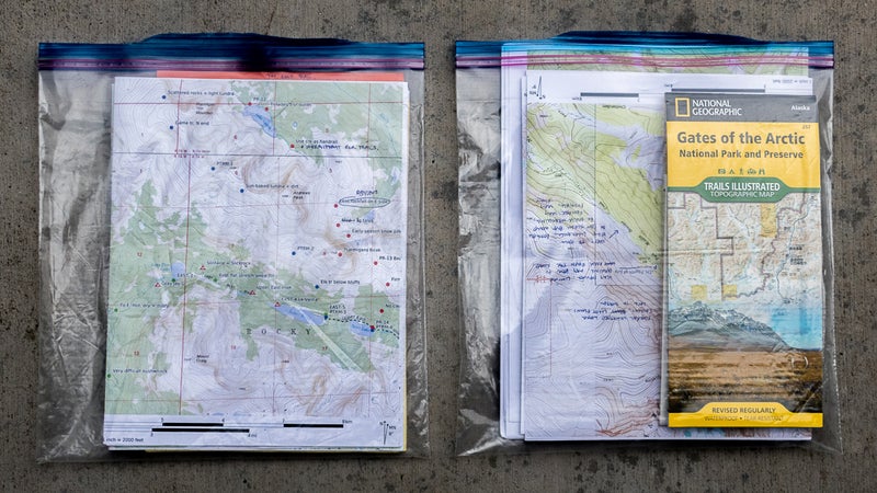
To keep my maps and resources clean and dry, I store them in gallon-size��freezer bags. Resealable plastic bags��are tough and inexpensive, and they fit my 11-by-17-inch��maps perfectly (after their half-inch margins have been removed and they’ve been folded in half). Usually,��I carry two bags.��For trips longer than about five days, I’ll take a third bag so that I have a fresh and clear bag for the second half of the trip.
One bag is for materials that I’m using that day��or will be using soon, like before the end of the day��and possibly before a long break, when I would have the chance to resort things. I keep this bag free of clutter—the more that’s in it, the less accessible things are—and I store it in a secure but easy-to-reach��location, like a dedicated side pocket on my backpack.
The other bag is for materials not presently in use, as well as other paperwork, like my backcountry permit and sometimes some writing paper. I try to compartmentalize maps and resources that I’ve��already used��so that I don’t waste time looking through them for my next map. I store this bag inside my pack, usually sandwiched between the liner and the��body fabric.
This is part one of a four-part series��about navigation. Part two is��“The Gear You Need to Navigate in the Backcountry.”��Part three is��“How to Master Navigational Storytelling.”��Part four is “Test Yourself: How Well Can You Navigate?”��