

Lhasa, Tibet – After three flights we have finally made it to Lhasa, Tibet. We managed to check in 14 kayaks and 26 bags weighing 30 kilograms each all the way through with very few problems. From San Francisco, Cathay Pacific styled us all the way to Chengdu, a huge industrial city in western China. One night in a hotel to rest, then load up an Airbus for the mountain flight to Lhasa. This proved to be a spectacular flight as we crossed huge valleys of the Mekong, Yangtze, and Yellow Rivers.
Chengdu, Tibet
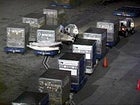 Spotting the boats being unloaded in Chengdu, always a good sign
Potala palace, Lhasa, Tibet
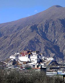
 Lhasa’s sacred Potala palace
Our GPS devices told us where the Tsangpo Gorge was laying as we had entered the longitudes and latitudes from the Space Imaging Software. We hoped for a view of the peaks of Namcha Barwa or Gyala Pelri but the cloud cover was thick in that area. We where flying just 50 miles north of the gorge the only things we could see were huge plums of cloud rising around where we guessed the peaks were laying. The occasional glimpses of a high ridge made the heart pump as it was obviously towering above the surrounding landscape by a long way.
As we approached the dry Tibetan Plateau the clouds subsided, in the distance we could see the peaks of Bhutan and Sikkim, and then Kachenjunga. In the far distance we cold see the main Himalayan range with the pyramid of Everest slightly visible above the snow-capped peaks. The Tsangpo valley spread out over the plateau below, our first view of the mighty Yarlung Tsangpo. Thousands of feet below us the valley was wide and flat, the river wound between vast sandy islands deposited from past floods. There was mixed reaction from our group—the river was definitely green, slightly glacial blue which could mean it was at a low level. But in a few sections there seemed to be quite a substantial flow with small wave trains clearly visible. This was discouraging as we were at 36,000 feet and the villages surrounding the river were mere dots along a fine line that would be the road to Pe (our planned starting point).
Not even 300 miles from Rainbow falls we landed at Lhasa Airport (11,730 feet) on the right bank of the Tsangpo River. Our journey would continue for two hours by road up to Lhasa city to the north. This meant we would be crossing the full flow of the Yarlung Tsangpo and estimates of river flow could be made. Here the river is wide and braided; the flood plain in places is several kilometers wide, which make estimating river volume incredibly hard, if not impossible.
At the crossing bridge the river was whole, a single channel. This time things were encouraging: The water was blue, slightly milky, which showed us the snow melt had not started—this was just a residual low from the thousands of glaciers in the 700 miles the river had flowed thus far. Continuing our journey to Lhasa, a figure of 7,000 to 8000 cfs seemed like a good figure, which, although by no way a small amount of water, is according to our Tibetan guides the lowest the river ever flows.