

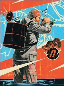
IT HAS CREPT UP ON ME SLOWLY, like an illness. Last night, studying the map beside a small campfire, I knew. I just refused to believe it. I crawled into my sleeping bag haunted by my dawning certainty.
Now, another day deeper into the mountains alone, it is undeniable. The long drainage I’m descending is curling southeast, but I should be going west. The physiography of this valley is V-shaped, incised, river-cut; I should still be in a U-shaped glacial trough. And I’ve dropped into an impossible bamboo jungle; I should still be above timberline. After six weeks of pushing into one of the most remote and isolated regions of the Himalayas, I admit it: I’m lost.
I stop. I sink onto a moss-padded boulder, slide out from under my humongous pack, reach into my back pocket, and retrieve a worn Ziploc bag. I slip out the precious contents, and for the thousandth time open the map.
The creases are almost torn through and the print worn away; hand-scrawled numbers and symbols are scattered across the page like unfinished equations; notes and sketches fill the margins as if it were some forgotten alchemist’s scroll; soup stains blot the middle; a candle burn chars one edge. It is a declassified U.S. Defense Mapping Agency 1:500,000 topographic Tactical Pilotage Chart H-10B. Magnetic variation, 1° west. Contour interval, 1,000 feet.
I tug on a lanyard and a plastic rectangle swings out of my front pocket: the compass. It’s scratched and grimy, with smears of sunscreen on the base plate—a Suunto M-3G Global Leader with all the standard features: magnetic needle, meridian lines, two-degree graduations on a rotating dial, direction-of-travel arrow, magnifying glass.
Perched on the boulder, I spin the map, forcing north to roughly match the disconcerting direction the compass needle is pointing. Using the magnifying lens, I once again scrutinize the cryptic brown contour lines.
One inch equals eight daunting miles. Two days ago, hiking up and down for ten hours across magnificently serrated terrain, I covered a quarter of an inch. Unbelievable obstacles hide between the lines. At this elevation, an unscalable ridge or a spire 900 feet high will not necessarily appear on the map. Likewise an uncrossable canyon 900 feet deep. Just two thread-thin contours can represent an insurmountable 2,900-foot wall. Navigating by foot through this part of the Himalayas with this map is akin to trying to walk across Alaska’s Brooks Range using a state highway map. But it’s the best available. This is a much-disputed, military-controlled region: the borderlands where India, Myanmar, and China are uneasily adjoined. There is a bold disclaimer printed in a box in the center of the map: “Aircraft infringing upon Non-Free Flying Territory may be fired on without warning.”
I study the map, but it’s no use. I don’t know where I am.
I set up camp, collect firewood, cook. Sitting cross-legged in the dirt, I watch a very large red ant crawl up onto my bare knee, bite me, then march back down onto the ground.
It’s at this moment that I decide it’s not true: I do know where I am. I’m right here. Beside my campfire, in a forest surrounded by mountains, eating rice, drinking creek water. Is the ant lost? Hell, no. OK, then neither am I. I’m in the eastern Himalayas, somewhere in the 118,400 square miles of my map. I’m not actually lost, just temporarily misplaced. Like the car keys you find the next day, right where you’d put them.
Too much is made of getting lost. Many people ludicrously equate getting lost in the wilderness with imminent death—an ironic, self-fulfilling fallacy. You get lost, hence presume you’re a goner, and what do you do? Panic. Make dumbass decisions, do dumbass things. It’s your behavior, not your location, that cooks your goose. Humans can go a month without food. All you need is water, shelter, and the good sense to avoid hypothermia, heatstroke, and injury and you can survive for weeks in the wild. Being lost should only be a temporary affliction with minor consequences.
There are exceptions, however. Like my present scenario. It’s not the mountains that will kill me. I’ve been warned that if the Myanmar military catches me, I’ll be executed. If the Indian Border Security Force arrests me, I’ve been informed, I’ll be sentenced to several years in prison. On the other hand, experience tells me that if the Chinese military nab me, I could conceivably bribe my way out with a plausible fib, a $100 bill, and the last of my whiskey.
I scrunch into my bag beside the campfire, record the barometric pressure, the altitude, the temp, take a hit of single-malt, sleep.
The next morning I mentally backtrack to my last known whereabouts. In the process, I realize how I misplaced myself. It was a seemingly insignificant choice between crossing on the left-hand or right-hand side of an ominous pyramidal peak. I was exhausted, trudging mindlessly uphill, and it was snowing. I took a few cursory bearings, chose the left-hand side for no good reason, and laboriously punched over the murky, drifted 15,000-foot col. It was the wrong pass.
Identifying the problem isn’t the same as fixing it. I spend the rest of the morning scaling the highest peak I can find, a 6,000-foot ascent. Fortuitously, it’s a clear day. Standing atop a cold, windy, unnamed, unknown summit somewhere in Asia with my humble map and compass, I begin taking bearings. I triangulate off three, then four, distant mountaintops, and still can’t reconcile the lay of the land. It’s only after triangulating off seven separate summits that I determine where I am: China. Ahhh.
I place a tiny dot on the map but write in block letters in the margin: “GPS, please!”
THE GLOBAL POSITIONING SYSTEM is a network of 24 satellites that circle the globe once every 12 hours, ceaselessly transmitting precise location, velocity, and time information via low-power radio signals. The system was conceived by the U.S. government as a Cold War military project, cost $10 billion to develop, was inaugurated in 1973, and is operated by the Department of Defense. GPS technology was first made available to the public in 1983.
In recent years, GPS receivers have become as compact and lightweight as cell phones. Switch one on, wait just a minute (while the battery-powered receiver interpolates the distance and time from a minimum of three satellites), and the little screen will give you your exact coordinates. Military receivers can achieve close to a one-meter level of accuracy, while civilian receivers are now accurate to within 15 meters. Day or night, rain or shine, anywhere in the world, you can pinpoint where you are.
Since time immemorial, human beings navigated by the stars, stories, and rudimentary maps—frequently getting lost, often not returning home. It’s unclear exactly when the compass was invented, but by the 12th century Chinese mariners sailing from Canton to Sumatra were using some kind of magnetic device to set their course. By the 13th century, Arab merchants and Viking explorers were wielding primitive compasses as they traded and pillaged. By 1519, when Magellan’s fleet embarked on its circumnavigation of the globe, marine compasses were standard sailing equipment, revolutionary tools for exploration, if not safety. (Only one of the explorer’s five ships managed to limp back into Seville in 1522, carrying a crew of 18 survivors, a tiny remnant of the 270 sailors who’d left three years earlier. Magellan was not one of them. He was killed in a skirmish in the Philippines.)
Meanwhile, rough-and-ready precursors of the sextant—a mariner’s device for celestial navigation—had been used for hundreds of years. But the modern sextant, the second revolutionary navigational tool, wasn’t invented until the mid-18th century.
Hence, for much of the past millennium, the heavens and the simple, unassuming compass guided mankind across oceans, over continents, through deserts, into wars.
GPS technology is the next revolution in navigation. When I return home from the Himalayas, I get one.
ONE YEAR LATER I RISE early, stirred by dreams of navigation. On the staircase a cool foredawn gloaming falls through the window. I step inside my office, close the door, and unfurl the maps.
Great journeys always begin with a map—some kind of drawing or diagram that communicates the relationship between here and there and what lies in between. Marks with a stick in red sand or clay, reed-pen sketches on papyrus, satellite images: It’s all the same. A map is the promise of discovery, a geography of odysseys to come.
The maps surrounding me, enlarged color photocopies of 1:200,000 Russian topographic maps, are better than the ones I used on the previous trip. I can’t read the Cyrillic type, but it doesn’t matter. What matters is that the contour interval is a much more reasonable 264 feet. One inch equals 3.3 miles.
I’ve already perused them, but, just as you reread a favorite poem in order to grasp more layers of meaning, I retrace the contour lines, those thin veins of brown ink that connect points of equal elevation.
The contour line is the hallmark of a topographic map. Atlases place countries in their proper locations upon continents; country maps place cities and highways, rivers and mountain ranges in their proper places within a national border. Thematic maps offer graphic representations of everything from military expenditures and food production to financial wealth and biodiversity. Loads of info, but it’s all two-dimensional, flat as a pool table.
Topo maps, even more than relief maps, are 3-D software, resplendent with precise mathematical depth. The more tightly the contour lines squeeze together, the steeper the slope; the more space between contours, the more level the terrain.
As I interpret the contours, geography blooms in my mind. I follow draws, circumnavigate summits, cross passes. I descry knife-edge arêtes with insurmountable aiguilles, potentially climbable couloirs, hanging glaciers, lateral moraines, gaping bergschrunds, inescapable cirques.
I pencil in a traverse through the mountains, identify likely stream crossings, cul-de-sacs, saddles. Using previous Himalayan journeys as a gauge, I estimate daily travel distances and mark potential campsites. It’s all perilous conjecture, at once marvelously exact and abstract.
Now for the GPS. Using a sleek Garmin eTrex Vista (only five ounces, this beaut has a built-in altimeter and electronic compass), I punch the map coordinates of each theoretical campsite into the receiver—”waypoints,” in GPS-speak—and give them names. Glacier Camp, Cirque Camp, Valley of the Nymphs Camp—all of it stored in the receiver’s memory.
If I were planning a trip in the United States, I could simply download USGS topos directly onto my GPS. Still, a miniature LCD screen is no match for the soon-to-be-antiquarian paper map. Until portable-display technology catches up with the virtues of paper and ink, no navigator worth his worn boots wants to travel without a map.
Waypoints entered, I set aside the GPS and stare at the maps. I see avalanche paths, ledges, ice faces, summits. This is the genesis of adventure.
WHO HASN’T AT SOME POINT in his life been seduced by a map? The voluptuousness of the mountains, the mellifluousness of the rivers, the warm blue water. The names alone conjure images of dangerous romance, mystery, dazzling chances. Tamanrasset and Timbuktu; Massif du Kerkour Nourene and Munkhafad el Qattâra; Kirkjubaejarklaustur, Krasnogorodskoye, Kathmandu, Kunming. Maps are like mirrors in the room of your mind, expanding their dimensions to the very edges of the globe.
Which is not to say that maps always tell the truth. They don’t. Maps can deceive, distort, dissemble, propagandize, aggrandize, belittle. Take, for example, the standard Mercator projection of the world. On this map North America and Europe appear enormous; Scandinavia is much larger than India; the U.S. and Canada are much larger than Africa. Using an equal-area world map like the Peters projection, you will see that India is nearly four times the size of Scandinavia, and Africa is 25 percent larger than North America.
Maps—military maps, political maps, commercial maps, even road maps—present not only specialized information about the world, but a specific worldview.
Soon enough, the handheld GPS will supplant the paper map, the compass, and the altimeter. It will become a map library and an encyclopedia. On screen, you’ll be able to locate yourself on any kind of map anywhere in the world. At some point, even the most obscure corners of the world will be scanned and rendered cartographically in painful, nearly microscopic detail, and you’ll be able to find out not only where you are but how to get where you want to go. The glory of getting lost will be lost forever.
Fortunately, you still need to understand the argot and idiosyncrasies of a map and compass (UTM, UPS, magnetic north, etc.) to make the most of a GPS. You still need to correlate what you see before you—bulging, diving, soaring geography—with its graphic representation, the map, to figure out where you are and where you’re going.
For just a little while longer, knowing how to read a map is a necessary backcountry skill—and you can still find yourself fascinatingly tricked. It’s an experience that can happen only outside, in the wilderness, the best, if most brutal, teacher.
I’M BACK IN THE HIMALAYAS—India this time. I click the GPS on at the first camp. Bar graphs instantly pop up, showing which satellites the GPS is locking onto. In 60 seconds I have my current coordinates—waypoint one. I mark my location on the map with an X. No bearings, no declination, no calculation, no triangulation. It’s like using a calculator after you’ve been trained with a slide rule. Magic.
The expedition gets off to a slow start. Each morning the GPS gives me a straight-line azimuth to the hypothetical campsite I plugged in at home, but it’s meaningless. My mule skinner has his own idea of how far we will travel each day and will go no farther. When he gets to a campsite he likes, he simply yanks the slipknot on the pack horses and my gear tumbles to the ground. So in the evening I use the GPS to carefully plot the location and elevation of our actual campsite. It works like a charm. I always know where I am. Almost.
For three days we have to creep up a narrow, ticklish canyon. The trail is precarious, chopped out of an overhanging stone face above a thundering river. Always wet and slick and sloppy, the trail is just waiting to throw us off the cliff. Dubious rope bridges cross and recross the torrent. I want to mark the most hazardous places, but for the first time, the GPS fails me.
GPS receivers are line-of-sight devices. They have to be able to “see” the satellites. Their weak radio signals cannot pass through rock, metal, wood, flesh. Deep in the canyon I have such a thin slice of sky that the GPS can’t lock onto the satellites. I must revert back to fundamental map-reading skills, sketching in a skull and crossbones in the most sinister places along the river.
Later in the expedition, after I’ve left the mule skinner and his ornery pack horses behind, I begin to pass through forests so dense, so thickly roofed with canopy, that the GPS is again rendered useless. My trusty old compass repeatedly saves the day.
With only a week remaining, I’m negotiating a delicate rimrock traverse when I accidentally knock my receiver off a ledge, and I’m reduced to navigating the old-fashioned way. I now feel naked without the GPS (and will buy a replacement for the lost unit as soon as I get home).
Eventually I arc back down onto the shadowy green floodplain of the Indian subcontinent. Malevolent bamboo forests once again. After a while I have to give up on even the inimitable map and compass. No matter what direction the compass points, or what the map shows, the foliage is so impenetrable I can’t move ten feet off-trail. The footpath is all that matters.
On what turns out to be the last day of the journey, I get lost. I slump to the ground at the bewildering junction of three trails. It’s crushingly hot and humid. My eyes are burning with sweat, my legs covered with scratches, bugs crawling all over me. I’ve been following paths that wiggle and dogleg for so long I feel as if I’m trapped in a maze. I don’t know where I am and I don’t care. I just want to get out. Too bad I have no idea which path leads me back to civilization.
I drink the last of my water and apathetically try to determine exactly how much I would pay for an ice-cold beer. I’ve got it down to somewhere between 50 bucks and a year’s salary when a little girl appears.
Across her small forehead is a tumpline that cinches a large, conical basket of rice against her back. She is barefoot, her head lowered. When she sees me, she stops. I think she’s going to run away, but she doesn’t. I smile and go into a pantomime. I make the motions of eating and drinking. I make the sounds of cars and trucks. I throttle an invisible motorbike. I honk and toot and wave. Then I nod toward each of the three paths and raise my arms in the air.
She laughs and, with one lithe brown arm, points—the most ancient way of navigating known to humankind.