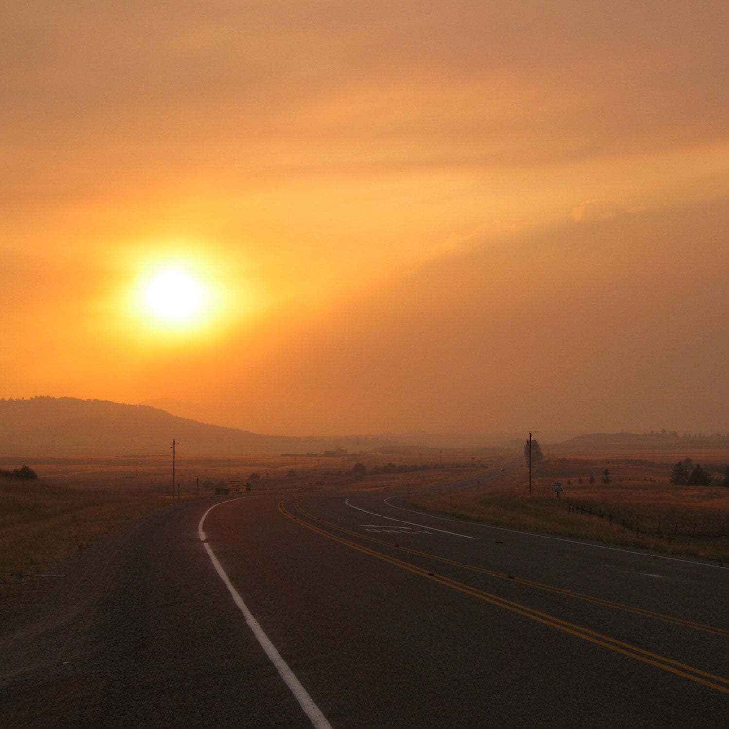
For the past month, I’ve been watching the , a 100,000-acre blaze on the western outskirts of Yosemite National Park, to assess and predict its effects on my planned backpacking trip there next week. I had to change my destination airport (to Reno instead of Fresno), and I’m expecting some smoke, but fortunately the fire has been brought under control.
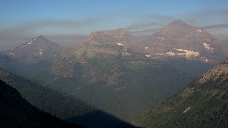
Other backpackers this summer have been less lucky and had to endure thick smoke or reschedule, relocate, or cancel their trips. Notable closures (full and partial) have been ordered in Colorado’s San Juan National Forest, New Mexico’s Philmont Scout Ranch, Glacier National Park, and Grand Canyon.
Wildfires and smoke are a fact of life, and increasingly frequent in the semiarid West. Here are some strategies and resources to better manage these factors and increase your odds for unimpeded dry-season fun.
Strategies
How can backpackers best manage the risk of wildfires and smoke?
1. Schedule Purposefully
After a winter with normal precipitation, July seems to be the most reliable month for backpacking. The snowpack has just melted, and peak summertime temperatures have not yet dried everything out. Unfortunately, July also coincides with peak mosquito season (view my ).
August and September are higher-risk months for fires. Hopefully, just before your trip, an active monsoon pattern or an early winter storm will suppress fire activity or blow out lingering smoke.
Drier winters make scheduling harder. July becomes a higher risk for fire activity, and bad conditions in August and September are almost inevitable. And June does not necessarily become the preferred month: Lower elevations can be scorched by long days and high temperatures, and higher elevations may not yet be melted out.
2. Have a Plan B
If your planned trip becomes impractical (due to, for example, thick smoke on the John Muir Trail), do you have a backup plan? Yes, you will need to plan two different trips. That means two permits, two map sets, and two travel plans, but the extra effort may prove worthwhile.
3. Have Flexible Reservations or Travel Insurance
It can be difficult to cancel flights, car rentals, and motel rooms without being charged fees or losing your deposits. When booking travel, try to maintain flexibility (if possible, fly Southwest Airlines, which makes it cheap to change a flight, or buy a fully refundable fare) so that you’re not financially committed to a plan. Or buy travel insurance so you can recoup any losses.
Resources
Here are a few places you can find current information about wildfires and smoke across the United States.
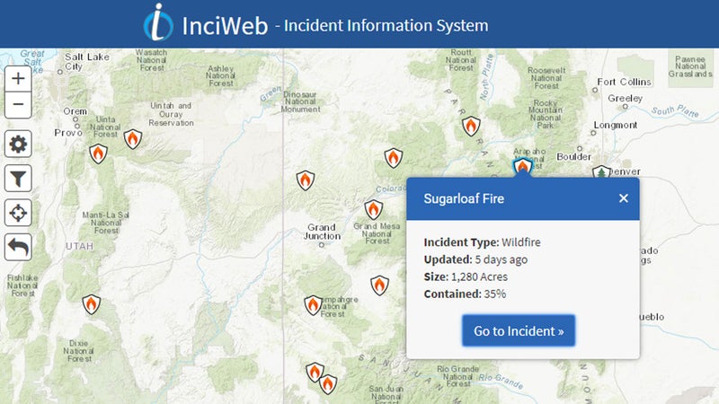
InciWeb
is an interagency all-risk incident information management system and the best starting point for wildfire-related information. Landing pages are created for each incident (for example, the ) and are updated regularly with new developments. Land managers may post fire-related information on their websites, too, but even they use InciWeb as the definitive resource.
Wildfire Agencies
Most of the information on InciWeb is retrieved from the regional wildfire agencies, like the . In addition to incident information, these agencies are responsible for issuing fire restrictions, fire potential outlooks, and other materials.
Wildland Fire Air Quality Response Program
is also an interagency platform and focuses specifically on smoke. Forecast outlooks are issued in areas where wildfire smoke may be of concern.

If a smoke outlook from WFAQRP for your area of interest is not available, you may be able to find information from other organizations. For example, the has issued smoke advisories for the Front Range this summer.
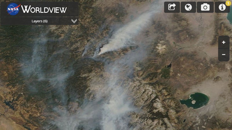
NASA Worldview
In this app, you can browse , which are usually updated within three hours of observation. Given current technology, this is as close to knowing what Earth looks like at the moment. For our purposes, it’s useful for determining smoke coverage and trends.
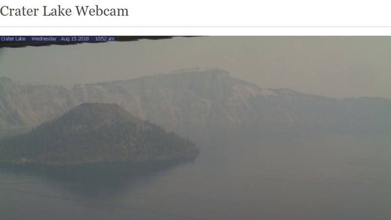
Webcams
This technology is laughably stuck in the 1990s but remains remarkably useful for on-the-ground observation. Rangers and online trip reports can be helpful, too, but webcams contain more real-time information. I don’t believe there’s a consolidated list of webcams, so Google is your best bet.
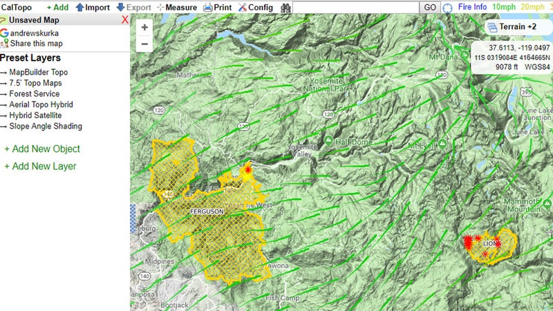
NWS and CalTopo
In a recent backcountry weather forecasting tutorial, I wrote about my favorite tools from the , so I won’t repeat that information here, but I will highlight one tool that received only cursory mention. can retrieve NWS point forecasts (for temperatures, precip, and wind), as well as fire data, to create an insightful map for short-term behavior of wildfires and smoke.