
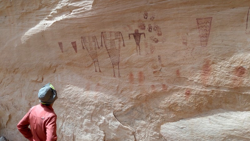
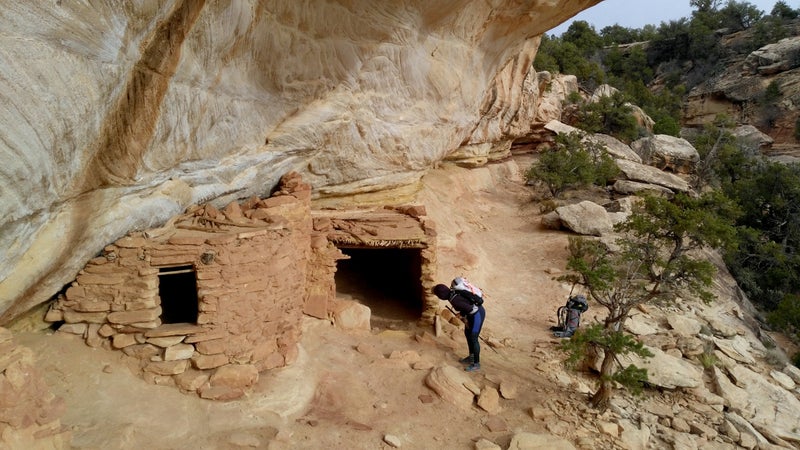
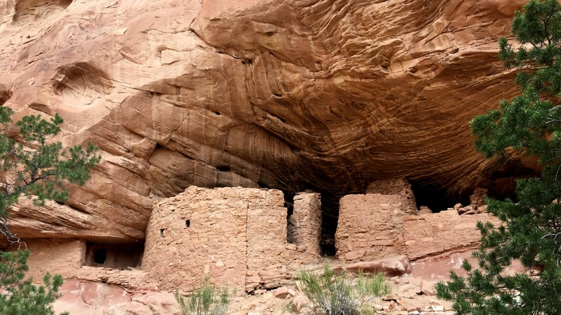
I first heard about Cedar Mesa a few years ago from , but it was the inspiration I got this spring from the roamings of that finally motivated me to plan a trip of my own to the southeastern corner of Utah. It was a perfect couple’s outing for me and my wife, Amanda: the wilderness that I needed after a winter inside, with an additional and more unique dimension for her—thousands of ancestral Puebloan cliff ruins and rock art.
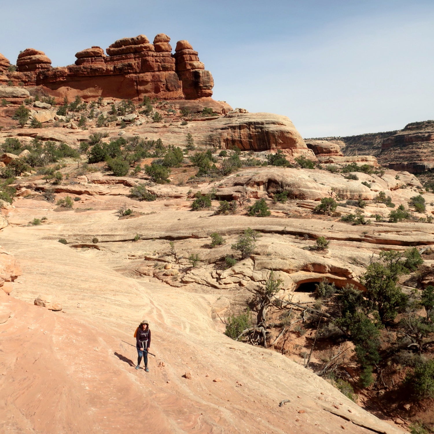
Cedar Mesa is an uninhabited 400-square-mile plateau with elevations ranging from 4,500 to 7,000 feet above sea level. Starting below Elk Ridge in the north, the (surprise) cedar-covered mesa slopes southward to the San Juan River, a major tributary of the Colorado, and is bordered by Combs Ridge to the east and Grand Gulch to the west. It’s a wilderness playground of deep canyons, lonesome plateaus, and endless slickrock. Overall, Cedar Mesa combines a wilderness experience on par with Dirty Devil, Escalante, or Dark Canyon with an archaeological experience of a scaled-down Mesa Verde National Park. You will not find tourists, paved walking trails, restrictive backcountry regulations, or a glossy visitor center here.
The of Bears Ears National Monument set by President Obama included Cedar Mesa. But President Trump established after intense lobbying by conservatives who believe that the added protections were a Constitutional overreach and who want to retain the opportunity to grow their local economy with more grazing and resource extraction, boom-and-bust cycles and environmental fallout be damned. Many locals in the poor and historically Mormon towns of Monticello and Blanding (and perhaps to a lesser degree in Bluff and Mexican Hat) do not seem enamored by the prospects of a more sustainable tourism-based economy that would bring in more outsiders and that they fear would Moab-ize their towns.
Trump’s executive order is being contested in the courts, and I suspect the story of Bears Ears is not over yet. Still, my goal in going this year was to enjoy this unspoiled wilderness without having to see drilling pads or uranium mines. In short: It’s one of the loveliest slices of the former Bears Ears monument, and I wanted to experience it for myself while it’s still lovely.
How Do I Get There?
Cedar Mesa is in a figurative middle of nowhere. It’s two hours from Moab, three from Durango, four from Flagstaff, and nearly six from Salt Lake City. It cannot be reached with public transit, so a personal or rental vehicle is necessary.
When Is the Best Time of Year to Go?
Right now! Cedar Mesa is a high desert. Winters are surprisingly blustery, and summers are insanely hot. Spring and fall are ideal.
When I visited in late April, new leaves and sprouts injected lively color, and the days were pleasantly long.
Where Can I Stay and Eat?
There are no commercial services on Cedar Mesa. Bring all the food and water you will need, and plan to car camp or wilderness camp.
On your approach to or departure from the area, you’ll find limited services in the gateway towns of Blanding and Bluff, as well as Mexican Hat. Expect small grocery stores, tired-looking motels, and short business hours.
We had a very good experience with at its facility south of Monticello. We also considered in Blanding, but it was full.
What Should I Bring?
A recommended gear list is beyond the scope of this quick-start guide. Consult my and for discussions of appropriate gear, supplies, and skills.
In general, be prepared for ample sunshine, brushy canyon bottoms, fine sand, and (usually) little water.
Is Cedar Mesa Suitable for Beginner Backpackers?
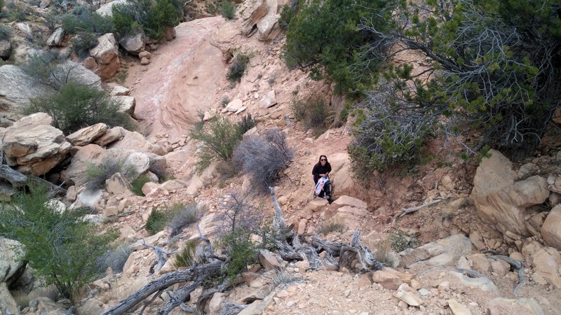
I would not recommend Cedar Mesa for first-time or beginner backpackers unless they’re accompanied by someone with more experience. It’s an unforgiving place with few gimmes. The roads and trailheads are well marked, but otherwise there is no signage. The most popular canyons have unmaintained use trails with unreliable cairns. Water is scarce. Cell service is nonexistent.
What Should I Do While I’m There?
Cedar Mesa is appropriate for car camping, day hiking, and backpacking. I did not see promising terrain for or evidence of mountain biking or off-roading; I’m told that bikepacking opportunities exist.
The San Juan River is navigable, and a terrific (albeit ambitious) loop could be made by floating from Slickhorn Canyon to Grand Gulch.
The most popular canyons are those closest to the Kane Gulch Ranger Station and Highway 261. Loops can be formed by combining Grand Gulch proper with the side canyons of Kane, Toadie, Coyote, Shieks, or Bullet. These loops do entail some overland travel that’s comparable to navigating the open ocean: There are few landmarks.
Do I Need to Get Permits or Be Aware of Other Important Regulations?
A permit from the BLM is required to overnight camp in most Cedar Mesa canyons and to visit some day-use areas. () The permit can be reserved beforehand on Recreation.gov and must be picked up from the Kane Gulch Ranger Station between 8 a.m. and noon.
Fires are not permitted in the canyons or on the mesa. Pack out toilet paper—it does not degrade quickly in this environment—and do not foul the water sources.
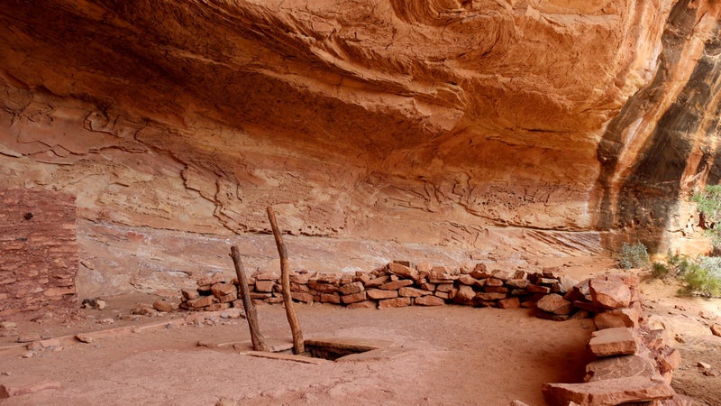
Finally, and perhaps most important, please “take only photographs and leave only footprints” in Cedar Mesa. The ecosystem is very sensitive, and the ruins and rock art are even more so.
Where Can I Get More Info?
- The BLM has free .
- For weather at Kane Gulch, use this from the National Weather Service.
- has good information about many of the canyons.
- National Geographic Trails Illustrated offers a of the area that’s helpful for transportation and trip planning.
- Use to plan your route in greater detail and to print small-scale topographic maps, including USGS 7.5-minute tiles.
- Peter Tassoni has written the sole guidebook for the area, . It is the most comprehensive reference and can supplement or be supplemented by online information.