

On Tuesday morning, three days after Hurricane Helene ravaged swaths of the Southeastern United States, I began making calls to old friends and hiking experts who live along the Appalachian Trail.
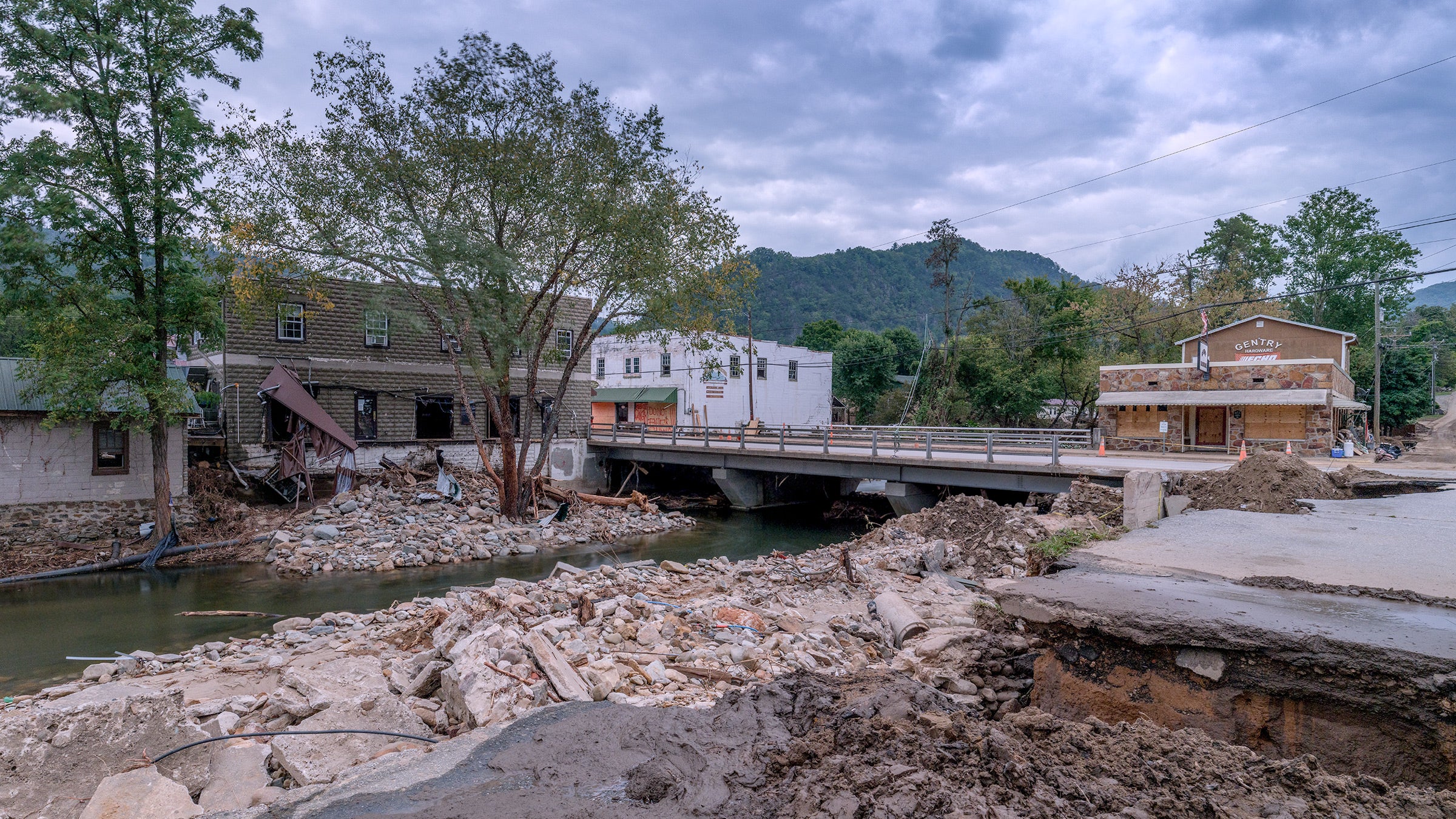
I had seen the of Hot Springs, North Carolina—a place I called home for years and one of the few towns the 2,200-mile trail bisects via sidewalk—drowned in the brown waters of an incoming creek and the mighty French Broad. I had seen images of the in Erwin, Tennessee, which leads just past one of the trail’s famous hostels and from one sweeping ridgeline to another. And I had seen the near Damascus, Virginia, one of the trail’s spiritual epicenters, cracked in pieces like overcooked pecan brittle. I had seen reports of the 220 dead and many more missing. Communities of longtime friends were entirely marooned, and little towns I’d cherished as a lifelong Southerner were ripped open like wet cardboard boxes.
I asked them about the state of the trail—a pathway that has changed so many lives (including my own). I assumed the worst, that it was either washed away or buried by landslides in extended stretches. Online prognosticators didn’t improve my assumption.
“One-third of this trail is destroyed,” a TikToker named said in a by Wednesday. Using a map of the AT as her greenscreen, she speculated about the devastation. “This catastrophic storm is actually going to change the map of North Carolina and Tennessee, the actual topography.”
But my phone calls yielded a surprise. As best as anyone can tell right now, the claims of complete destruction aren’t true, either for the AT or for the half-dozen other long-distance trails that radiate through the lower reaches of some of the world’s oldest mountains. Misinformation and assumptions based on that request—and then broadcast for TikTok likes—make a bad situation worse, unnecessarily adding to the weight of a region’s already seismic loss. The Appalachian Trail is a point of pride for people there, for people in the midst of losing everything; saying it is destroyed based on no data adds insult to inestimable injury.
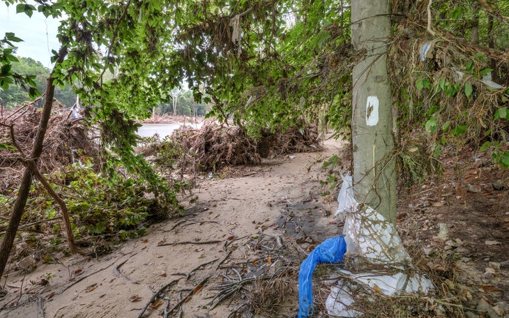
While it is true that the Appalachian Trail Conservancy, the nonprofit that helps manage the path and the lands surrounding it, has , or its lower third, it is not true that those miles are destroyed. Sources I spoke to talked of toppled trees, down branches, and flooding.
“It should be posted that—on four miles of this 2,200-mile trail—there’s a lot of devastation. It’s four miles of flood devastation like I’ve never seen before,” Warren Doyle, a longtime AT expert and the person who’s hiked the AT more than anyone else ever, told me Wednesday afternoon. Doyle’s estimation takes in the stretches that pass through the towns hit the hardest along the trail. “But that doesn’t mean you close the whole trail down,” he said.
The same seems to hold for the , which takes an alternate path through the Appalachians. “Nothing out of the ordinary—branches, limbs, and a few blowdowns,” the president of the trail’s association, Bob Cowdrick, told me late Wednesday of the trail’s southern half. He hopes to get eyes on the rest of it within two weeks.
But information on trail conditions remains scant, as efforts to save lives and communities continue. In that light, the ATC’s request is reasonable.
Joshua Niven and Amber Adams Niven live just outside of Hot Springs, the Appalachian Trail oasis 275 miles north of the southern terminal. Its famous outfitter has been ripped apart like a box of candy by a black bear. It is the Nivens’ favorite place in the world, Joshua tells me, and it will not be a functioning trail town for a while. The safety of its own residents, of course, is paramount now.
But Niven can see the trail from his window, and he seems almost sanguine about its status. He and Amber are chronicle of the trail for Falcon Guides; he ticks through the places in those first 865 miles that may be a problem and names surprisingly few—perhaps the Roan Highlands, where Tennessee, Virginia, and North Carolina meet, or maybe the steep embankments leading north out of Hot Springs itself. Like Doyle, he is concerned for the tiny Appalachian towns themselves but suggests workarounds for hikers.
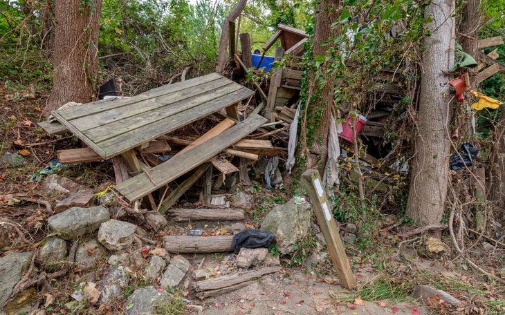
“Saturated trees—that’s always going to be a thing. But I haven’t seen anything that’s catastrophic that a hiker couldn’t navigate,” Joshua said, adding the caveat that there will likely be pockets where destruction is greater. “It might be unpleasant, given how many trees are there,” he said. “What’s the issue with hiking in woods that have trees down?”
And there are, of course, a lot of trees. To put it in perspective, the highest point on the Appalachian Trail is , at 6,644 feet (The entire range tops out at 6,684.) There are many trailheads on the Pacific Crest Trail and the Continental Divide Trail higher than that. This means that the AT rarely exits treeline—that is the essence of its so-called “green tunnel.” It’s constantly passing through terrain where wet ground and even mild winds can clot the trail with a seemingly infinite number of downed trees. That’s the worry.
Betsy Brown is the associate director of Friends of the , an 1,175-mile path that meets the AT atop Kuwohi before extending east toward the North Carolina coast. More than a third of the trail is , as employees await reconnaissance on its conditions. So far, one volunteer has been able to hike just two miles near the famous Blue Ridge Parkway, which has been . There were 27 new trees across it. That kind of cleanup will take time to complete.
“The trees down is a huge problem,” says Brown. “But the bigger problem is that, in these more remote places, our volunteer crews are smaller, with vigorous retirees. Having to walk in with chainsaws and fuel is hard. And for now, they’re dealing with their own issues, just trying to get back to normal.”
Indeed, time will be key to reversing the damage—not outright destruction, at least in most places—on the trail. Dan Ryan, who works with land stewards along the AT, outlined an extended process for clearing the trail of downed trees and fixing any sections where running water ripped it asunder.
He told me that, over the next month, the National Forest Service and National Park Service will assess damaged areas and offer a report about what needs to be done where. Only then, Ryan said, can the ATC begin deploying its half-dozen volunteer trail crews to begin work. Restoring every mile, he said, may take years; some of its most beautiful places have been forever changed, as hiker and runner Sarah Baker recently noted at the Walnut Mountain trailhead, an exquisite bit of Appalachia. Ryan worries, too, about the damage so many newly downed trees might have on long-term ecosystem health, from new pests to wildfire risks. But they have to start somewhere.
“Trail clubs are champing at the bit to get out and help,” Ryan said. “It won’t be a challenge of deploying resources, because those are in place, regardless. It’s just a matter of putting them where they need to be—in safe conditions, in the priorities those agencies have dictated to us.”
While these agencies assess damage and determine how to address it, the ATC is advising that hikers—even southbound thru-hikers, with less than 1,000 miles left in their walks—to stay off trail. Visitors will require resources from towns simply trying to survive and rebuild, like Hot Springs. Again, this seems reasonable enough. But I also understand the perspective of Doyle, who sees the trail as an absolute avenue of liberation and is still more than miffed about the ATC’s stance on Covid-19 back in early 2020, when the trail was actually closed.
“It is another liability-informed directive from the ATC,” he told me. “It’s an overreaction.”
Still, even Doyle—perhaps the AT’s most important living evangelist—had to change his plans for the week when he learned how many trees had fallen near his home not far from flood-ravaged Damascus, Virginia, one of the epicenters of AT hiking culture. On Tuesday, he took five new students at his Appalachian Trail Institute for a six-mile hike. I’ve done that walk in Doyle’s weeklong seminar before, and it takes a few easy hours. His students spent six arduous hours climbing over fallen trees.
So on Wednesday, he dropped them off again, and told them to hike two hours in one direction, and then walk back to the car. The damage is extensive, he told me, but it can be overcome. “When they came out of the woods yesterday, they were talking and laughing. They worked as a team, and they learned a lot of important things about each other,” he said, sitting in his car, awaiting their return. “They experienced adversity.”
Doyle knows, of course, that such adversity withers in comparison to what his neighbors are facing just down the mountain road. But he’s still proud to be teaching people to get ready to hike the AT, hopefully next year.