The Best Hike in Every State
Alpine scrambles and beachfront strolls; multi-day singletrack adventures and quick urban escapes; soaring trees and rolling sand dunes—every state in the country has something to offer intrepid hikers. So we rounded up a bucket-list-worthy, best-of-the-best guide.
New perk: Easily find new routes and hidden gems, upcoming running events, and more near you. Your weekly Local Running Newsletter has everything you need to lace up! .
Hiking is the great equalizer. Everyone enjoys a long (or short) walk in a pretty place. But that doesn’t mean all hikes are created equal. Some are objectively better, with taller peaks, greener trees, and more flowery flowers. So we polled our writers and editors to come up with what we feel is the very best hike in each of the states of our glorious union.
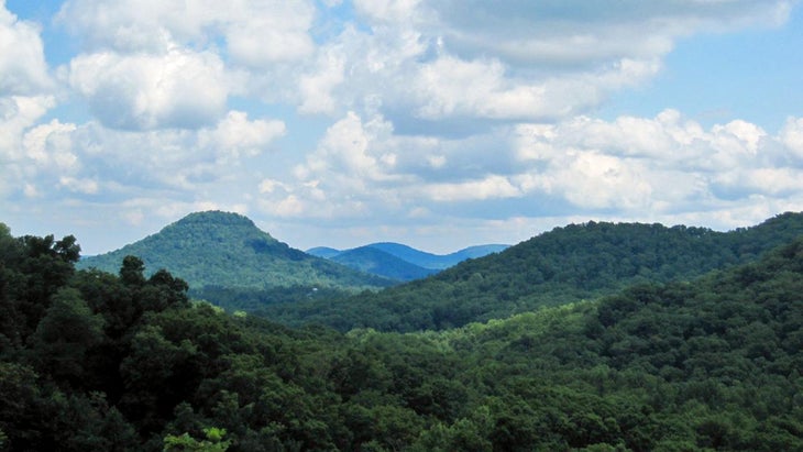
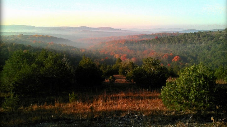
Alabama
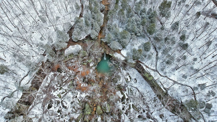
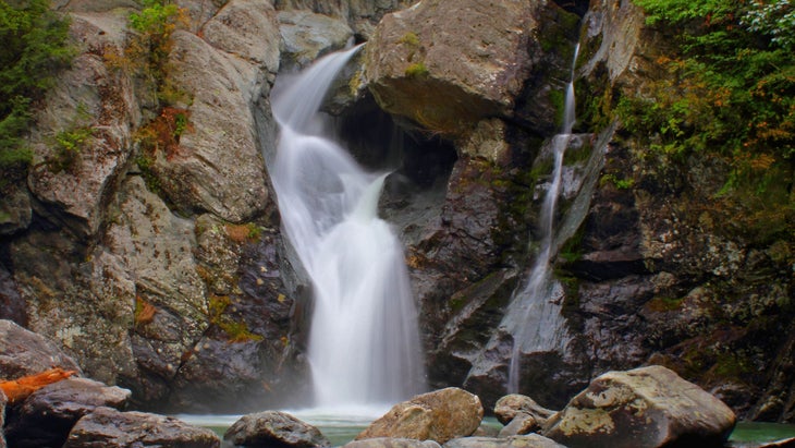
Sipsey Wilderness
The northwest corner of the Cotton State includes the largest wilderness east of the Mississippi, and it’s chock-full of waterfalls. The 25,000-acre is wrinkled with deep sandstone chasms that turn the region’s abundant streams into cascades. One of the tallest is the 90-foot Fall Creek Falls, where the stream spills over a 20-foot ledge before fanning out over a jumble of boulders. Reach them from the Sipsey Recreation Area, following trails 200 and 209 for three miles through old-growth hemlocks and white oak. —Kelly Bastone, contributor
Alaska
Harding Icefield Trail
It’s a little touristy by Alaska standards, and there are definitely more-secluded hikes in the state, but the 8.2-mile Harding Icefield Trail, in Kenai Fjords National Park, is still . Starting at Exit Glacier, you’ll climb 1,000 feet through forest and meadows, eventually ending above tree line at the edge of a 700-square-mile ice field. —Kelsey Lindsey, assistant editor
Arizona
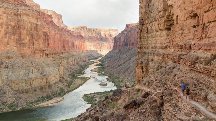
Rim-to-Rim
If you can handle 21 miles with 5,700 feet of vertical gain and 4,700 feet of loss, hiking rim-to-rim via the Grand Canyon’s South and North Kaibab trails is the best way to see the big ditch on foot. If you have the legs to turn around and do it again, you can partake in one of ultrarunning’s most sought-after FKTs: Rim-to-Rim-to-Rim. The current records are held by Jim Walmsley (5:55:20) and Taylor Nowlin (7:28:58). —K.B.
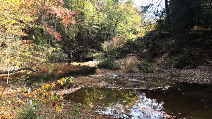
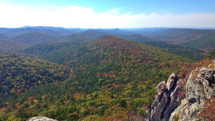
Arkansas
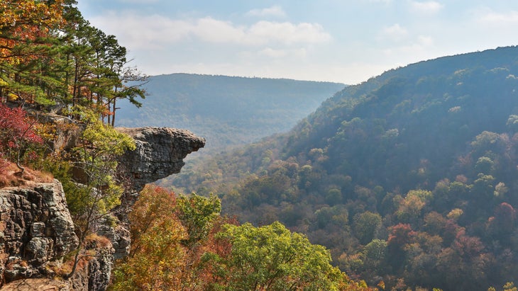
Whitaker Point
Ask any native Arkansan where to find the best view in the state, and they’ll all point you to the same place, though they may call it by different names. , better known to some as Hawksbill Crag, is a rocky prominence in the Upper Buffalo Wilderness Area that juts out nearly 150 feet over the surrounding landscape below. Go on an early autumn morning, when the low sun floods the valley and lights up the changing maple, beech, hickory, and ash trees for a sight you’ll never forget. —Nicholas Hunt, associate editor
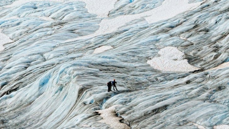
California
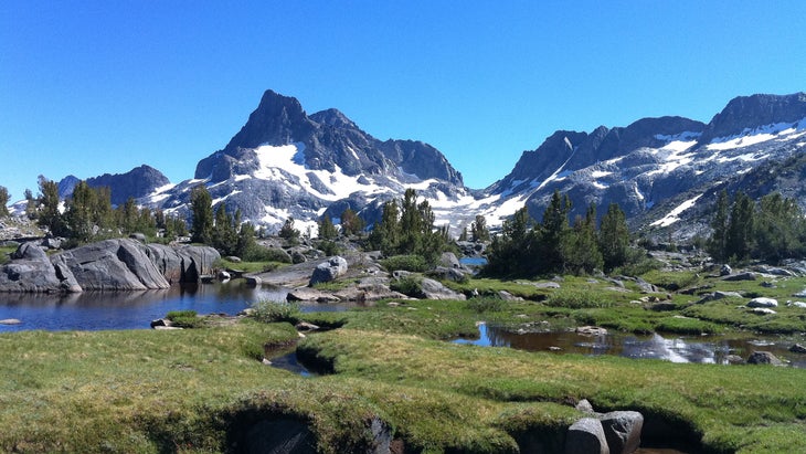
John Muir Trail
How to Hike Faster
Because hiking faster means hiking fartherThe Pacific Crest Trail Association the John Muir Trail the “land of 13,000-foot and 14,000-foot peaks, of lakes in the thousands, and of canyons and granite cliffs.” It runs for 211 miles through the Range of Light from Yosemite to the summit of Mount Whitney, the tallest peak in the contiguous United States. Most people hike the trail from north to south over the course of a week or more between July and September. —K.B.
Colorado
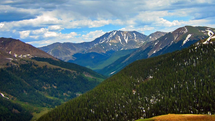
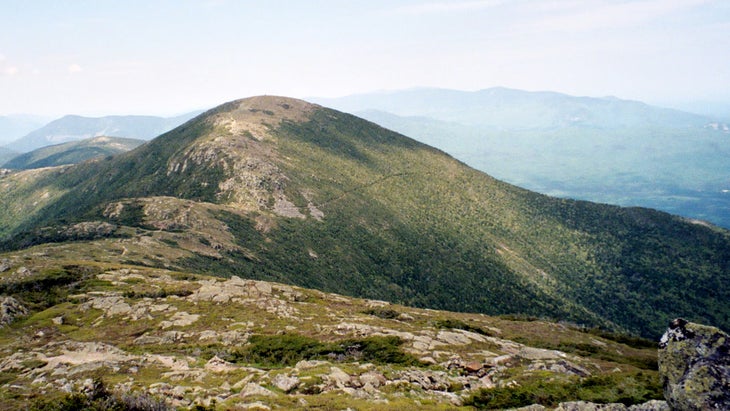
La Plata Peak
At 14,336 feet, La Plata is the . It’s great for people who want a long day hike with top-notch alpine views. The hike from car to summit and back is around ten miles with 4,500 feet of gain. You get some good forest time for the first few miles, then you’ll switchback up to a ridge and ascend the last couple miles on a talus scramble. —Ariella Gintzler, assistant editor
Connecticut
Bear Mountain to Lion’s Head
Sorry, New Haven, but white clam pizza isn’t Connecticut’s greatest attraction. It’s the views from the state’s loftiest corner, where the 2,316-foot Bear Mountain (Connecticut’s highest) to Lion’s Head, a stony knob affording 180-degree views of the surrounding lakes and farmland. From State Route 41 near Salisbury, hike northbound for 2.7 miles to tag Lion’s Head, then continue 3.3 miles to Bear’s summit and its views of steely Mount Greylock (Massachusetts’ highest) hulking on the horizon. —K.B.
Delaware
Brandywine Creek State Park
offers the state’s wildest paths, with bona fide hills, ponds, and a tangle of unnamed, unmarked trails for meanderers. From the park office, strike out on Hidden Pond Trail though 190-year-old tulip poplars. Cross Thompson Bridge and follow Rocky Run Trail through evergreen-choked hills before descending to Creekside Trail, which parallels Brandywine Creek, where beavers and turtles are often spotted. Retrace your steps to complete the 11-mile circuit. —K.B.
Florida
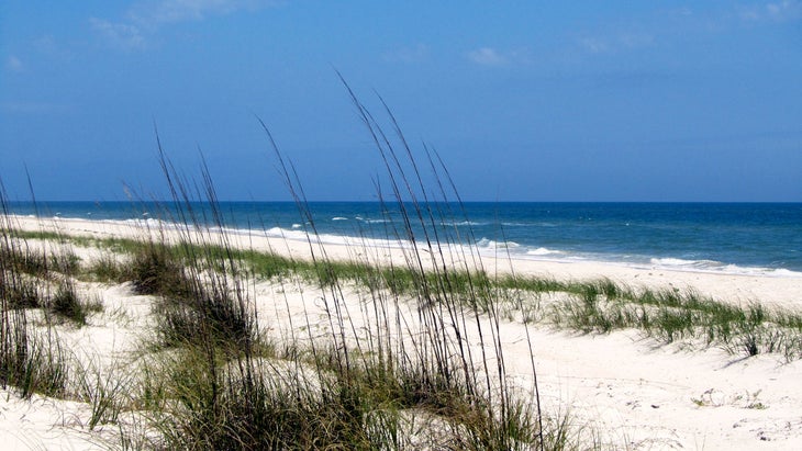
Little St. George Island
You’ll need a boat to access , ten miles south of the Panhandle town of Apalachicola. But once there, you may want to stay forever. Seven primitive campsites sit tucked among the pine-studded dunes on the island, a web of hiking trails spans its 9-mile length, talcum beaches extend along the gulf shore, and fishing off the east end at a dredged channel known as Bob Sikes Cut produces a bonanza of redfish, flounder, sea trout, and drum. —K.B.
Georgia
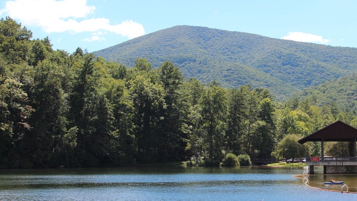
Blood Mountain
Treeless vistas are rare in Georgia, where dense forest dominates, so ’s grandstand views offer hikers a highly sought-after view of rolling peaks. The Appalachian Trail runs right over the summit. To tag it as part of a nine-mile out-and-back, start from Vogel State Park and follow the Bear Hair Gap, Coosa Backcountry, Duncan Ridge, and Appalachian trails to the 4,458-foot Blood Mountain. —K.B.
Hawaii
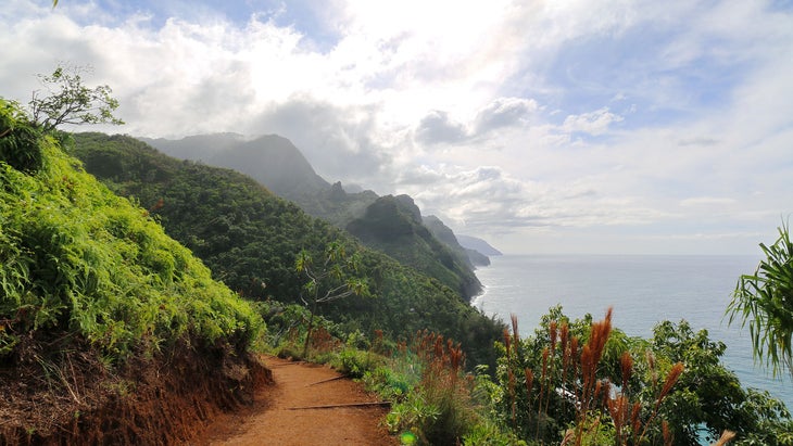
Kalalau Trail
The hike from the at Kauai’s Ke’e Beach to the waterfall pool at the end of Hanakapiai Valley is safer and far more achievable than doing the whole Kalalau Trail, but you still get the beyond-spectacular views of the Na Pali coast and a dip beneath a 300-foot waterfall. If you get an early start, you can get back to Ke’e in time to snorkel the glorious protected reef, chill on the beach, and watch the sunset. —Aleta Burchyski, assosciate managing editor
Idaho
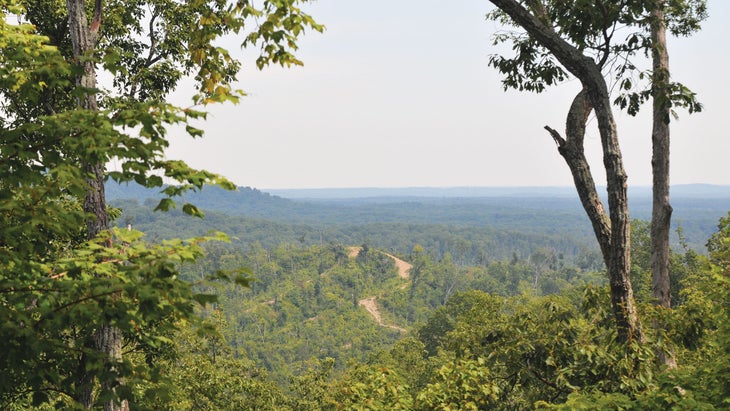
Hells Canyon
Hells Canyon, on the border of Oregon and Idaho, is deeper than Grand Canyon—nearly 7,000 feet from river to rim in some spots—and receives just a fraction of the visitors. Hike any of the trails in spring (the Snake River National Recreation Trail is one of our favorites) for moderate temperatures and blooming wildflowers, like paintbrush and mountain balm. —K.B.
Illinois
Jackson Falls Trail
Shawnee National Forest covers a 415-mile chunk of southern Illinois. The area gem? The 3.7-mile , which features numerous scenic overlooks and terminates at a spectacular waterfall. Bring your climbing gear—the 70-foot sandstone walls offer the most climbing routes in the state. —Samantha Yadron, editorial production fellow
Indiana
Knobstone Trail
Thru-hikers climb 10,500 cumulative feet along the 58-mile , which offers bona fide backpacking in the otherwise snoozy Hoosier State. The KT’s southern portion requires the greatest sweat equity but provides the biggest scenic payoff: Hike 31 miles from Deam Lake to Elk Creek Lake for ridgetop views over rolling hills and the nighttime lullabies of coyotes. —K.B.
Iowa
Effigy Mounds National Monument
On Iowa’s eastern edge, Effigy Mounds National Monument preserves more than 200 earthworks, some shaped like bears, lynx, bison, and birds. Explore them and gaze across the wooded bluffs of the mighty Mississippi River along the monument’s north unit trails. (Not to mention the thousands of native remains housed on the monument, more than 2,000 of which disappeared in the 1990s until this detective tracked them down.) The seven-mile round-trip hike from the visitor center to Hanging Rock visits Great Bear Mound (the largest effigy, at 138 feet long), skirts tallgrass prairie, and overlooks the river from 400-foot cliffs, where hawks and eagles cruise the thermals. —K.B.
Kansas
Elk River Hiking Trail
The will make you swear you’re not in Kansas anymore. This 15-mile point-to-point trail weaves through evocative rock sculptures and pinched corridors with 30-foot-high walls. Trek eastward for sweeping vistas over Elk City Lake as your grand finale. The trail hugs the bluffs of this 4,000-acre reservoir, which looks big enough to be one of the Great Lakes. In spring, the shoreline turns pale purple with blooming redbud trees. —K.B.
Kentucky
Pinnacles of Berea
Avoid the crowds of Red River Gorge and head to Berea, Kentucky, and that overlook the area. These dog-friendly hikes offer sweeping overlooks and different vantages of the surrounding area—try West Pinnacle for its sunset views—as well as various levels of difficulty and distance, depending on your capabilities. Thanks to its proximity to Lexington and Daniel Boone National Forest, you’ll be hard-pressed to run out of things to do around here. —Abbey Gingras, editorial assistant
Louisiana
The Backbone Trail
It’s hard to get high in Louisiana, where the mean elevation is just 100 feet and New Orleans actually sits below sea level. But the though the Kisatchie Hills Wilderness offers escape from the swamp. This 7.7-mile path scales sandstone hills topped with Dr. Suessian longleaf pines. Savor on-high views from 300-foot outcrops and, in spring, blooming azaleas. Keep an eye out for armadillos. —K.B.
Maine
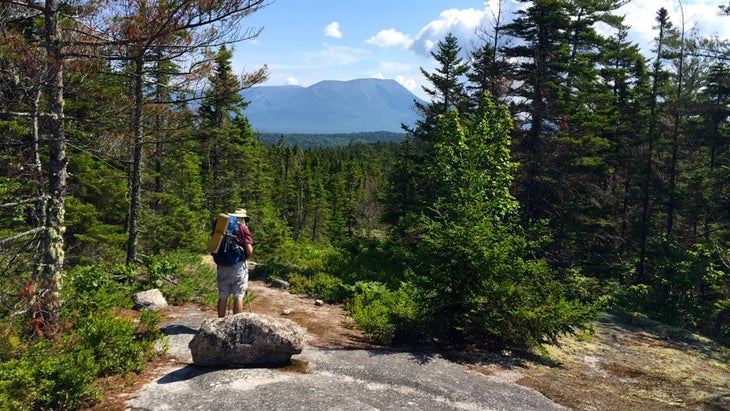
100 Mile Wilderness
Even out west, you’d be hard-pressed to find 100 miles of trail that’s uninterrupted by towns and other human-built intrusions, but the Pine Tree State preserves exactly that: The famed section of Maine’s Appalachian Trail plumbs fir forests so dark and dense, they unnerved even Henry David Thoreau (who documented his chilling explorations in ). Starting at the tiny outpost of Monson (home to Shaw’s Hiker Hostel), pilgrims trip across rooty paths, ford swampy ponds where moose chill out, peer into the grey slate maw of Gulf Hagas (the “Grand Canyon of Maine”), and end up at Abol Bridge, the Baxter State Park campground and resupply opportunity before the final push up 5,269-foot Mount Katahdin. —K.B.
Maryland
Annapolis Rocks to Black Rock Cliff
Hop on the Appalachian Trail at South Mountain State Park and hike about 2.5 miles for sweeping views of northwest Maryland. Continue on to an even more scenic lookout spot called . About 7.5 miles round-trip. —Svati Kirsten Narula, associate social media editor
Massachusetts
Bash Bish Falls
At the western edge of Massachusetts lies , home to a probably haunted 80-foot waterfall, the highest in the state. Easy hiking and good summer swimming abound, but take care: 25 people have died after slipping from the top of the falls. —Madeleine LaPlante-Dube, digital media producer
Michigan
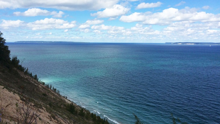
Pyramid Point
Part of the Sleeping Bear Dunes National Lakeshore, this easy goes to the top of a sand bluff and offers great views of Lake Michigan. Continue to the right after the scenic lookout to follow smaller trails that wind through beech and maple trees and lead to more secluded sand dunes. —K.L.
Minnesota
Border Route Trail
The 65-mile Border Route Trail follows (surprise) the border between the United States and Canada and allows you to experience the tranquility of the Boundary Waters Canoe Area Wilderness on foot. It’s a place of breathtaking cliffs, almost impassably dense trees, and serene, untouched lakes where you can feel the elves and faeries watching you through the mossy gaps in the trees. —Emily Reed, assistant editor
Mississippi
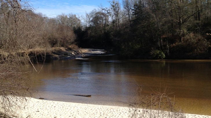
Black Creek Trail
Soft white beaches and sandbars make Black Creek, a designated National Wild and Scenic River, feel more like the Caribbean than Mississippi. The links those paradisial swimming holes with 41 miles of waterside hiking. Ten miles of the trail traverse the Black Creek Wilderness and feature pine-topped bluffs and dogwood trees that glow with white petals in spring. —K.B.
Missouri
Hercules Glades Wilderness Area
Nearly cut across rocky, steep terrain that offers a mix of grass-covered hillsides and hardwood forests teeming with wildlife. Park at the Tower Trailhead—the fire tower on the east side of the wilderness area. From there, warm up on the relatively flat Pees Hollow loop. You’ll be ready for steep paths up and over the hills as you head down the Long Creek Trail to the falls and over to the Coy Bald Trailhead. There are few different trail combinations to choose from for the route back—Upper Pilot Trail is a solid option. Just be sure to take a map, because finding and staying on the trails here requires a little work. —Ryan Van Bibber, senior editor
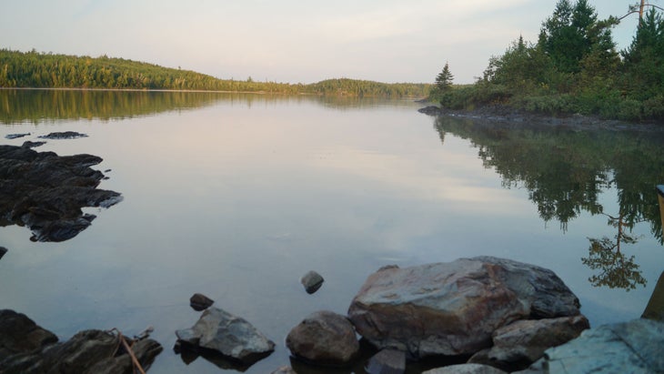
Montana
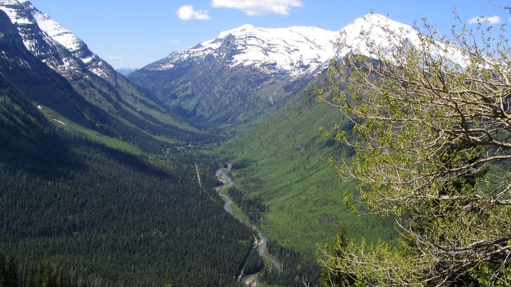
Dawson-Pitamakan Loop
As great as Montana is, National Park takes it to a whole different level. One of the very best hikes in the park is the 17-mile Dawson-Pitamakan loop, which circles Rising Wolf Mountain. Alpine lakes and jagged peaks make this truly one of the last best places. —K.B.
Nebraska
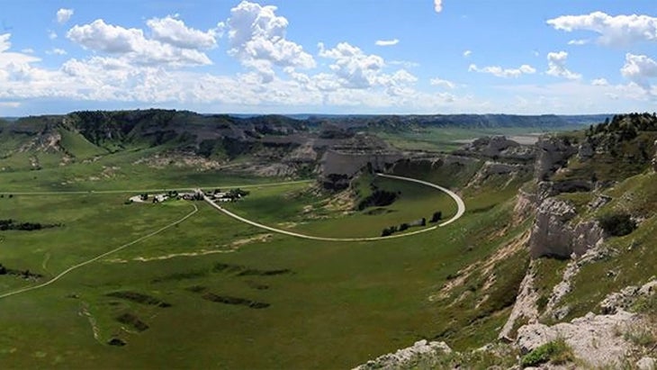
Saddle Rock Trail
Hills in corn land? You’ll find them on the 1.6-mile (one way) , which gains a lung-wringing 500 vertical feet on its climb up a chiseled butte in Scotts Bluff National Monument. The route tunnels through a sandstone fin before emerging atop a wind-raked crag with views over rolling prairie peppered with more buttes. —K.B.
Nevada
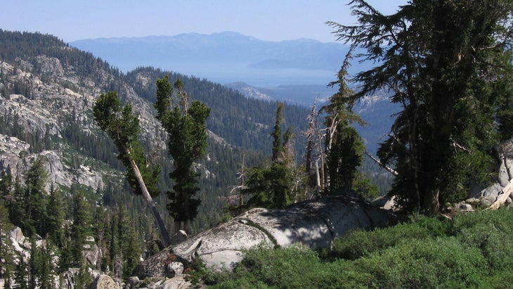
The Tahoe Rim Trail
The 165-mile is one of the most beautiful circuits you’ll ever do. “The scenery changes around every corner—from towering granite walls to lupine-covered hills—and because it’s circular, you can always see where you’ve been and what’s to come,” says Nancy Greenhalgh, former president of the Tahoe Rim Trail Association. The difficult 21-mile section from Mount Rose to Brockway is like a highlight reel of the trail. The views of Tahoe from the narrow trail (and on a steep side hill, to boot) are incredible. If you do it in summer, the aroma of pine and sap warming in the high-alpine sunshine just enhance your hike. —Tasha Zemke, copy editor
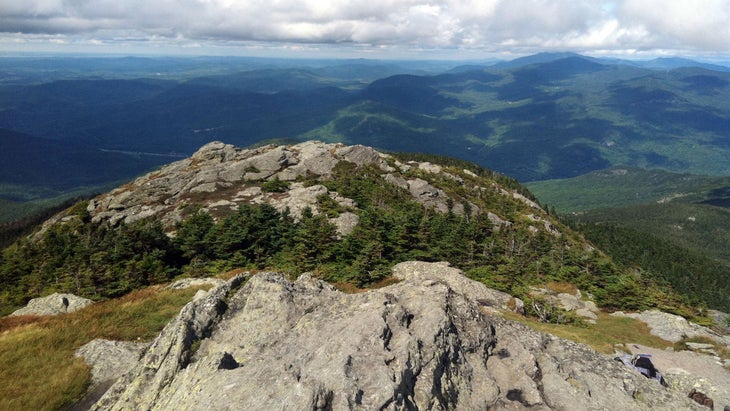
New Hampshire
Crawford Path, White Mountains
Most people summit Mount Washington by heading straight up Tuckerman’s Ravine, which means the trail is like a highway in summer. Avoid the crowds by taking the , which starts in Crawford Notch and spends five of the eight total miles on a ridge above tree line. You’ll pass two alpine huts, operated by the Appalachian Mountain Club, where you can refill your water bottles and stop to rest. —Ben Fox, associate reviews editor
New Jersey
Sunfish Pond
Wear sturdy-soled boots on the rock-studded route to Sunfish Pond, a glacial lake perched at 1,379 feet in the Garden State’s swatch of the Appalachians. The eight-mile round-trip trek on the AT and green-blazed Dunnfield Creek trails plumbs pristine forest made musical by little waterfalls along Dunnfield Creek, which hikers follow for part of the route. At the crystalline spring-fed lake, lounge on rock slabs surrounded by the Appalachians’ time-softened summits. —K.B.
New Mexico
Anatoli Route
Russian mountaineer Anatoli Boukreev used to live in Santa Fe. To train, he’d summit the 12,631-foot Santa Fe , then traverse over to Deception, Lake, and Penitente peaks before descending the ski area. The whole loop is around 16 miles. Hike it in fall, when the aspens are changing. —Mary Turner, deputy editor
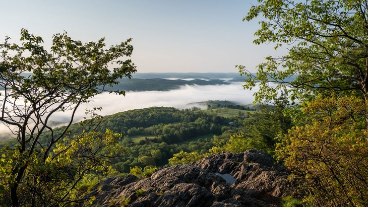
New York
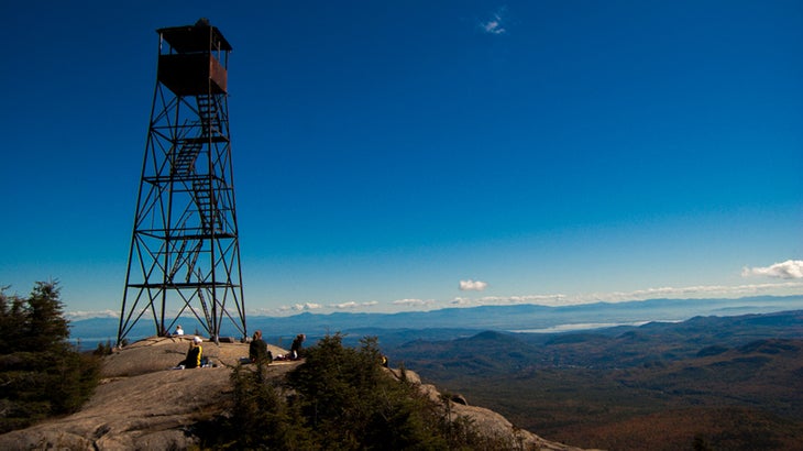
Hurricane Mountain
Climb in the Adirondacks in fall for spectacular colors and crisp weather. The sixish-mile trail tops out on a smooth summit with a fire tower and expansive views. —Abbie Barronian, assistant editor
North Carolina
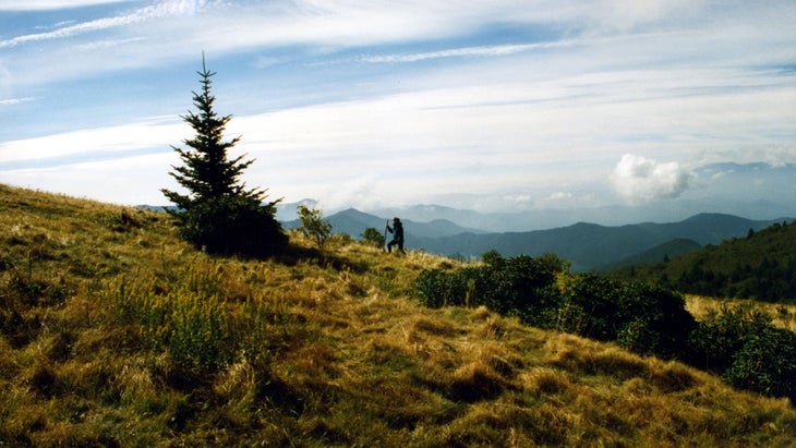
Carvers Gap to 19E
One of the finest sections of the entire Appalachian Trail, the section from to 19E runs north for 13 miles, meandering above and below tree line. Wild ponies, 360-degree views, and a small taste of trail magic make shuttling a car worth it. —Elizabeth Hightower, features editor
North Dakota
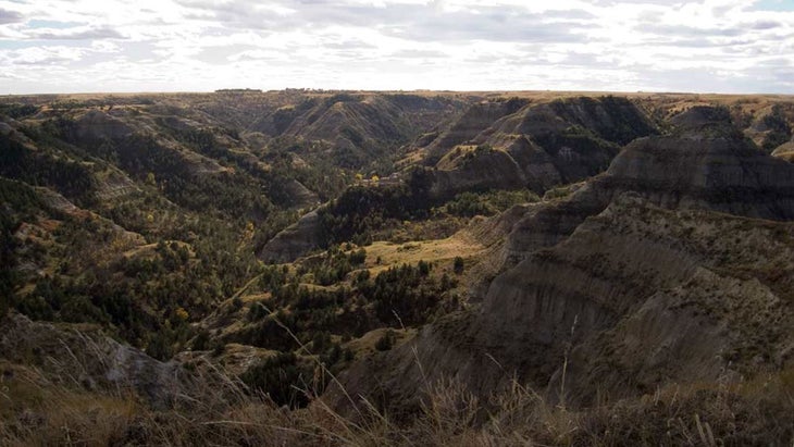
Maah Daah Hey Trail
The 144-mile —which roughly translates from the native Mandan language to “an area that will be around for a long time”—traverses the wild and rugged badlands of western North Dakota. Keep an eye out for bison, wild horses, and bighorn sheep as you make your way across broad plateaus and prairies. —K.B.
Ohio
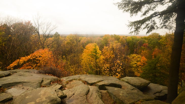
Virginia Kendall Ledges
are probably not the first images that pop into your head when you think of Ohio, but the two-mile Ledges Trail in Cuyahoga National Park skirts the tops of sandstone cliffs that tower a couple hundred feet above the Cuyahoga River. Go in the evening for spectacular sunsets. —E.R.
Oklahoma
Ouachita Trail
You’ll need three to four weeks to thru-hike the 192-mile , bridging Oklahoma and Arkansas. Weekenders can nab the choicest 20-mile segment by starting at Talimena State Park, the trail’s western terminus, and hiking east over steep, rocky terrain that ranks as the trail’s toughest but rewards hikers with expansive views. Spur paths to the Potato Hills, Panorama, and Holson Valley vistas overlook mountains that melt into the horizon. —K.B.
Oregon
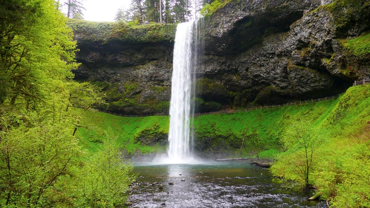
Trail of Ten Falls Loop
This descriptively named 7.8-mile loop in Silver Falls State Park features, well, , one of which is 178 feet tall. The trail winds through enormous old-growth Douglas fir and hemlock and even dips behind one of falls for a rare through-the-curtain view. The hike is lovely year-round, but spring runoff puts the falls at their girthiest. —A.B.
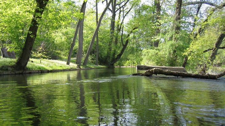
Pennsylvania
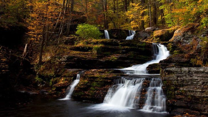
Tumbling Waters Trail
Panoramas across the bucolic Delaware River Valley are reason enough to hike the , a three-mile loop in the Delaware Water Gap National Recreation Area, but the trail also passes a delightful two-tiered waterfall surrounded by black birches. From the Pocono Environmental Education Center, hike clockwise to explore groves of red cedar, glacier-scarred bedrock, IMAX-sized views of New Jersey’s verdant Kittatinny Ridge (a 400-mile arm of the Appalachian Mountains), and wetlands filled with singing frogs. —K.B.
Rhode Island
Long Pond Woods Wildlife Refuge
Even if you’re not mad about birds, the Audubon Society’s 220-acre dazzles with vistas over hemlock-shrouded Long Pond. Warblers and hooded mergansers congregate here because the terrain is too rough for most everybody else. The 2.2-mile hiking trail is steep and rocky enough to require scrambling in some sections, but from its high points, you overlook Long Pond’s shimmering waters and hardwoods that blaze red and orange come fall. —K.B.
South Carolina
Foothills Trail
Escape low-country heat and humidity on the , which follows the Middle Fork of the Saluda River on its cascading route out of the Appalachians. Arrive early to beat weekend crowds: Rangers at Jones Gap State Park, where the trail originates, block access when the park has reached max capacity, which ensures that the Saluda’s swimming holes stay pristine. —K.B.
South Dakota
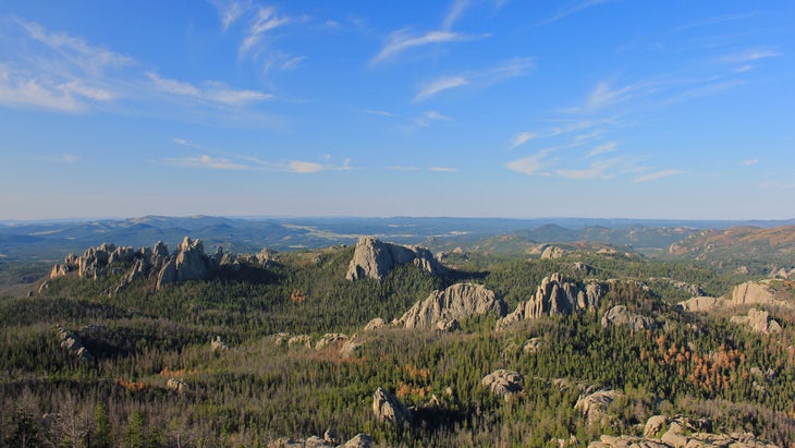
Black Elk Peak
After more than 150 years as Harney Peak, South Dakota’s 7,242-foot high point was renamed in 2016, but its stunning views of granite cliffs and ponderosa pines remain unchanged. From Sylvan Lake in the Black Hills’ Custer State Park, hike four miles east on Trail 9S to Black Elk’s granite summit and its medieval-looking stone fire tower. Then loop south for four miles on Trails 3 and 4, following the scrambly spur atop Little Devil’s Tower for jaw-dropping views of the knifelike Cathedral Spires. —K.B.
Tennessee
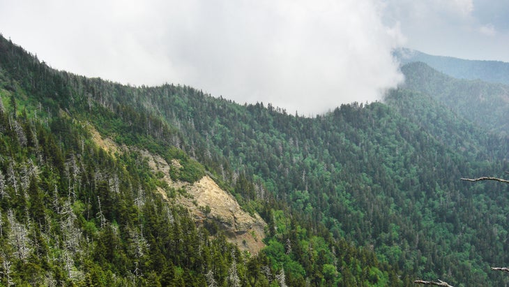
Alum Cave Trail to Mount LeConte
There was no question that Great Smoky Mountains National Park would be home to Tennessee’s best hike, but with more than 850 miles of footpaths in the park that lead to waterfalls, mountaintops, trout-filled streams, historic cabins, overlooks, and wildflower meadows, exactly which trail deserved top honors was a harder decision. The 11-mile round-trip is as good a pick as any. It leads you through old-growth hardwood forest, on log bridges over gushing mountain streams, and up stairways cut into the living rock to the massive rock overhangs for which the trail is named. Continue past the caves and be rewarded with one of the best views in the park from atop the 6,594-foot Mount LeConte and a stay at the rustic LeConte Lodge, the highest guesthouse in the eastern United States. —N.H.
Texas
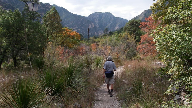
McKittrick Ridge
In any season, , in Guadalupe Mountains National Park, dazzles hikers with its vast panoramas of limestone peaks and feathery pines. But in October, the views pulsate red and gold as McKittrick Canyon’s maple, walnut, and ash trees ignite with fall color. From Dog Canyon, on the park’s north side, hike 7.5 miles east to the ridge. Camp at 7,700 feet for sunset and sunrise views over the ribbon of amber. —K.B.
Utah
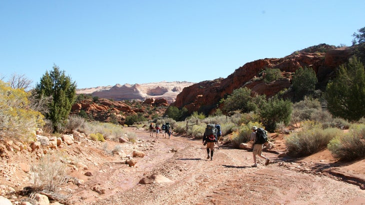
Wire Pass–Buckskin Gulch Trail
The likelihood is slim of ever getting a lottery permit to hike the super-popular Wave, and Antelope Canyon is expensive. For something that rewards with both slot canyon scenery and red serrated sandstone formations, the , in south-central Utah, is ideal, especially for novice hikers or those with kids. You can opt for the 3.4-mile Wire Pass round-trip hike, or enter Wire Pass and extend your trip along Buckskin until you’re ready to turn around. —T.Z.
Vermont
Camel’s Hump
Most people who want to knock off one big hike in the Green Mountains tend to head for the summit of Mount Mansfield, the tallest peak in Vermont. But for fewer crowds and equally stunning views, hike to the top of . At about six miles long, this out-and-back trail climbs over 2,000 feet and past the wreckage of a plane crash before you hit the summit. It’s a great day hike that usually takes a few hours to complete. —A.G.
Virginia
Three Ridges Hike
�ճ��� takes you through the scenic vistas of the George Washington and Jefferson National Forest along the Appalachian Trail. Plentiful shelters along the loop make this circuit perfect for an overnight backpacking trip for hikers of all levels. —Jeremy Rellosa, assistant editor
Washington
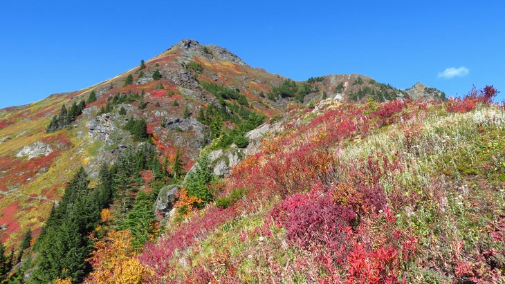
Yellow Aster Butte
Unlike Mount Baker or Shuksan, requires no mountaineering equipment or experience—though it does offer a great view of both peaks. You’ll gain 2,500 feet as you traverse south-facing slopes before you top out at 6,150 feet. Turn around for a view into Canada. —Ruben Kimmleman, editorial fellow
West Virginia
Spruce Knob/Seneca Creek
This 16.5-mile circuit offers pockets of deciduous and Pacific Northwest–like evergreen canopies, secluded waterfalls, meadows, and panoramic views of West Virginia’s Monongahela National Forest. You can rest at Judy Springs, one of the most scenic campsites in the region. For the cherry on top, go in mid-October, when the air is crisp and the leaves are at peak color. —J.R.
Wisconsin
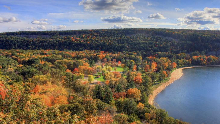
Devil’s Lake Loop
It’s not the length that makes this quick five-mile loop the best in the Badger State, but the views, which range from waterside——to the thick forest of the East Bluff Woods. On the lake’s northwest side sit 100-foot quartzite cliffs that are popular with climbers. Devil’s Lake State Park, the third oldest in Wisconsin, is home to 100 bird species and 800 types of plants. An elevation gain of 1,000 feet—a lot of vert for the rolling hills of Wisconsin—is enough to earn a plate of sliders and a flight of whiskey at , three miles from the trailhead. —Abigail Wise, online managing editor
Wyoming
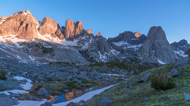
The Cirque of the Towers Trail
The granite spires that make up the Cirque of the Towers, in the heart of Wyoming’s Wind River range, contain some of the finest rock climbing in the country. But the range is also a hiker’s dream: lake, rivers, fishing, views, wildflowers, you name it. The 18-mile out and back Cirque of the Towers Trail gets you right into the business. And don’t forget to stock up at the Great Outdoor Shop in nearby Pinedale before launching off into the backcountry. —K.B.