

Video footage of Mount Everest continues to get crisper, clearer, and more dizzying. If climbing to the roof of the world on your own two feet seems out of reach, you can now take to the skies—virtually—and see the summit for yourself.
On July 10, Chinese drone manufacturer DJI released a stunning video of the world’s highest peak. The four-minute clip takes viewers on a high-definition aerial ride from Base Camp, at 17,598 feet, all the way up to the mountain’s 29,032-foot summit. The video was filmed via a DJI Mavic 3 Pro drone—yep, a device you can��purchase at your local Best Buy.
As a self-proclaimed geek of Everest footage, I wholeheartedly recommend this video. No, it’s not quite as breathtaking as the virtual reality film��The QUEST: EVEREST VR, which I viewed earlier this year. But it does surpass the 2022 drone video of Mount Everest, which was also filmed with a DJI device.
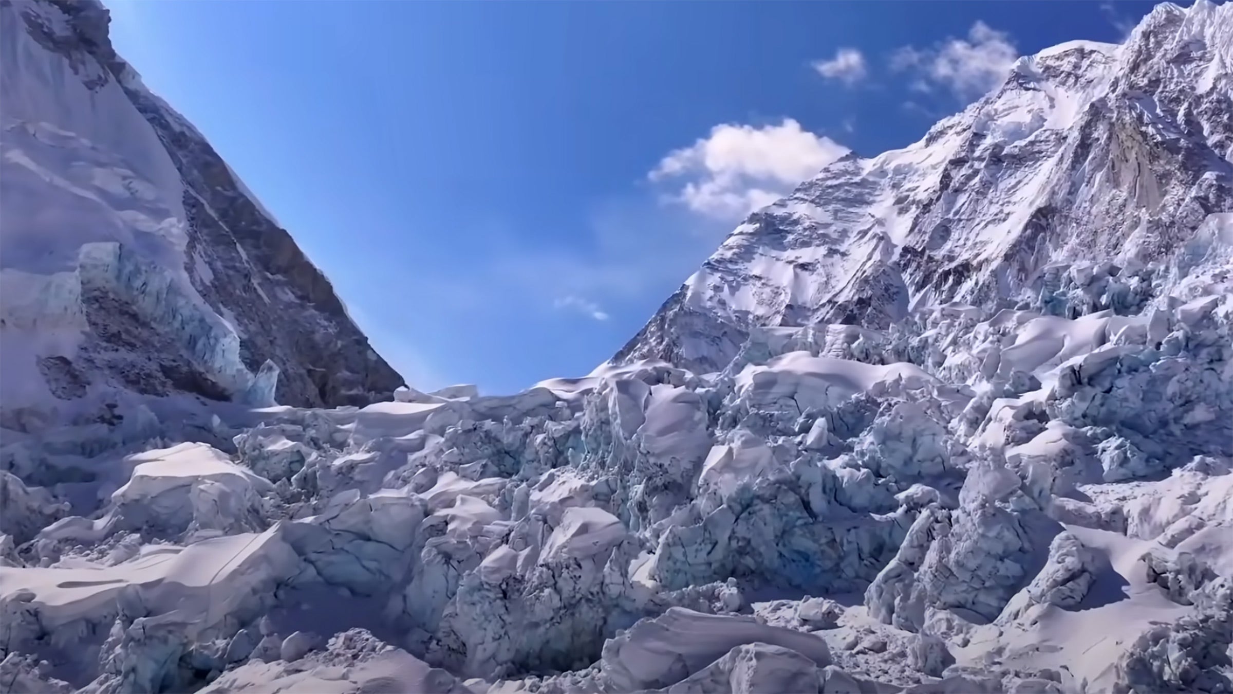
The latest video provides a complete overhead view of the route to the top of Mount Everest. The device follows the traditional Western Cwm route from Nepal—the same one that hundreds of climbers followed this past May to access the summit. Along its trip, the devices flies over the landmarks that Everest aficionados like myself have committed to memory: the Khumbu Icefall, Geneva Spur, Balcony, and Hillary Step, just to name a few. The video shows the Khumbu Glacier’s dangerous ice towers, the soaring walls above the Western Cwm, and the sheerness of the Lhotse Face. It also captures the incredible vertical rise that climbers must tackle after leaving Camp IV at 26,000 feet en route to the top.
There are four separate video clips that are edited together to complete the entire journey.
DJI is at the forefront of drone experimentation on the world’s highest peak. Earlier this spring, the company tested its cargo drone, the FlyCart 30, at Base Camp. Working alongside Nepali officials, DJI engineers piloted the device over the Khumbu Icefall up to Camp I at 19,900 feet while carrying two oxygen tanks. Officials believe the flying devices may someday be used to ferry gear onto the mountain and take��trash back down. For now, the aerial devices will be used mostly for creating vertigo-inducing videos to stare at on your lunch break.