Ecologists and conservationists have long and frustrating lists of hurdles that keep them from doing field work. Aside from the wild, dangerous miles between them and the remote regions of the world they need to examine, there are unfriendly governments and armed militias. There's the high cost and complexity of traveling to remote jungles or tundras. And sometimes the act of transporting oneself to a research site can actually hurt the research — in the Arctic, emissions from gas-powered snowmobiles can skew the air samples that researchers need to capture.
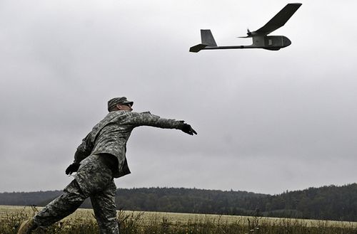
Enter, Unmanned Aerial Vehicles (UAVs), remotely controlled drones, equipped with camera, GPS and a range of other sensors, that have long used for military surveillance applications. Today, conservationists, ecologists and other environmental researchers are turning UAVs to do everything from mapping deforestation to counting wildlife to collecting data in disaster areas, such as offshore oil spills or accidents at nuclear energy plants.
Falling costs and more accessible sensor systems are behind this trend. With funding from National Geographic Society and other groups, Lian Pin Koh and Serge Wich, an ecologist at the ETH Zürich and a biologist at the University of Zürich, respectively, have developed a drone that is customized for conservation work, . They assembled their drone for just $2,000 — compare that to $10,000-50,000 for high-end UAVs.
Koh and Wich have already employed their drone, which is small enough to carry in a backpack, to conduct research in Sumatra. “During their four days of testing, the drone flew 30 missions — collecting hundreds of photos and hours of video — without a single crash. A mission, which typically lasts about 25 minutes, can cover 50 hectares,” says MongaBay.
The pair worked with software developers, using open-source software, to create the program used to set the drone's flight plan via a laptop. If you jump to around the 30-second mark in this clip from their research film, you'll think you're seeing the view not from a pilotless drone by from a helmet camera on a paraglider. The drone uses GPS to guide its path. The films revealed sections of logging as well as stands of oil palm trees are planted on a riverbank, a practice that hurts the river ecosystem.
reports that NOAA has long used UAVs to conduct surveys of ice seals around the Bering Sea — an area “difficult to reach with piloted planes.”
It also describes how the agency hopes its drones can settle a dispute it is having with Alaskan fishermen. To ensure enough food for the endangered Steller sea lion, “NOAA has placed catch limits on fish in the species' food chain near Alaska's Aleutian Islands. But the fishermen argue the species' declining numbers have nothing to do with food shortages,” says Greenwire.
Currently, NOAA uses manned aircraft to perform surveys of Steller sea lions. But bad weather limits how often these planes can fly and because the planes fly at a higher altitude than UAVs, the images the researchers take aren't as good as those from drones. NOAA will test where UAVs can collect more, and more accurate, data on the sea lions.
— Mary Catherine O'Connor
Via: and