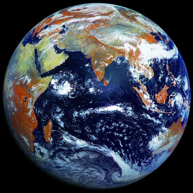
On May 10, this 122-megapixel picture they call the single highest resolution photo of earth. Not long ago, NASA made a spectacular high-resolution image of by combining multiple photos. The single picture above was taken by the Electro-L, a geo-stationary Russian satellite that hovers 22,370 miles away from the equator and snaps a photo every 30 minutes. Each pixel in the photo represents roughly 0.62 of a mile.
James Drake of posted the photo. He also made the below by stringing together seven days of shots. The orange represents vegetation and results from an infrared layer in the photo. Detailed explanations of the orange color can be found on �����Ի� .��
–Joe Spring