New perk: Easily find new routes and hidden gems, upcoming running events, and more near you. Your weekly Local Running Newsletter has everything you need to lace up!
.
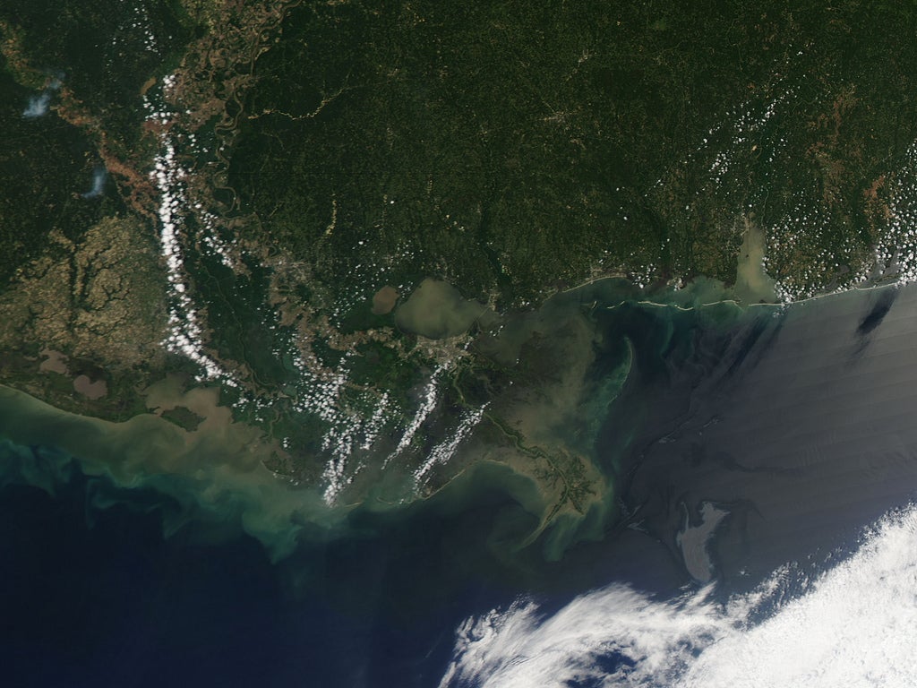
NASA satellite image acquired May 4, 2010.
Two weeks after the April 20 explosion at the Deepwater Horizon rig in the Gulf of Mexico, an oil slick lingered not far from the Mississippi Delta. On May 4, 2010, the Moderate Resolution Imaging Spectroradiometer (MODIS) on NASA’s Aqua satellite captured this natural-color image of the oil slick. The slick appears as an uneven gray shape immediately north of a bank of clouds. Sunlight bouncing off the ocean surface gives the oil slick a mirror-like reflection easily detected by satellite sensors.
Although the oil visible in this image appears fairly distant from the coastline, NatureNews reported that the western edge of the slick had been brushing up against the Mississippi Delta since April 30. Model predictions put the oil slick near the coast of Louisiana by May 4 or 5, but changing winds pushed the oil farther away from land on May 4. Ecologists still worried, however, that the oil might drift into the path of the Loop Current, which carries warm water from the Yucatán Peninsula across the Gulf of Mexico and toward Florida. The current had the potential to spread oil to the shores to Mississippi, Alabama, the east coast of Florida, and the Florida Keys.
The Pentagon approved the deployment of as many as 17,500 National Guard soldiers to assist with cleanup efforts, according to the Associated Press. Meanwhile, well operators considered drilling a relief well—a diagonal well intersecting the original that could be filled with mud or concrete to block the oil.
NASA image by Jeff Schmaltz, MODIS Rapid Response Team at NASA GSFC. Caption by Michon Scott.
Instrument: Terra - MODIS
BP has sealed one of the three leaks spewing oil into the Gulf of Mexico, according to the . It doesn't fix the problem – and apparently doesn't do much to help – but at least it's a step.
The efforts were made possible due to the lack of rough waters and weather, which have hampered containment.
������ “Submersible robots, controlled remotely from a ship on the surface,were able to place a specially designed valve over the end of a leakingdrill pipe lying on the sea floor in water about 5,000 feet deep,” the Times said.
Unfortunately, most of the estimated 210,000 gallons released each day is coming from a different leak, one of two remaining. BP will now focus their efforts on the major leak. The company is reportedly towing a 98-ton containment structure into the Gulf. That structure will be lowered over the leak, allowing BP to pump the oil up to a rig on the Gulf surface. That's the way it will , anyways. Here's hoping it's a success.