A Stunning Descent of New Zealand’s Mount Aspiring
One phone call with native New Zealander Graham Zimmerman led to many more, and, in March 2015, we set off for New Zealand’s South Island with two other friends, Kyle Dempster and Jewell Lund. Our objectives were simple: climb some mountains, eat some meat pies, explore. Months of planning boiled down to a few days of packing and preparation, a string of red-eye flights, and our groggy arrival in Christchurch. From there, we made fast tracks for the Southern Alps, fingers crossed for good weather that never came, with our sights set on the southwest ridge of Mount Aspiring (9,951 feet). Helicopter pilots declined to fly us to the base of our objective, so we opted for the long slog by foot, some 30 miles up the Matukituki Valley. We eventually summited via the southwest ridge. While the climb itself required some heavy trudging, what stood out in hindsight was the array of environments and ecosystems we passed through during our 72-hour descent from Mount Aspiring. We navigated across glaciers and snowfields, jungles and flooded rivers; exchanged greetings with local sheep and shepherds; and eventually arrived in the cascading heart of Fiordland, Milford Sound.
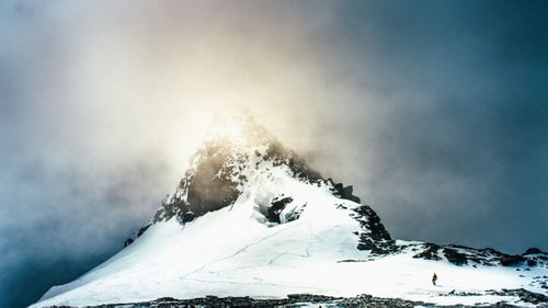
Photo: We reached the summit of Mount Aspiring, at 9,951 feet, around 4:30 p.m. on March 8. Heavy gusts swept across the corniced summit. Over the next 72 hours, we traveled through myriad landscapes and microclimates as we descended Aspiring and back into the Matukituki Valley, eventually wending our way into Fiordland.
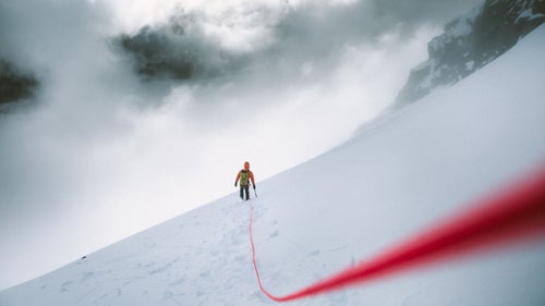
Descending from Mount Aspiring, we were surrounded on all sides by white as the clouds rolled in. We picked our way through unknown territory, eventually setting up a series of rappels that allowed us to descend safely back to the Bonar Glacier at the base of the mountain.
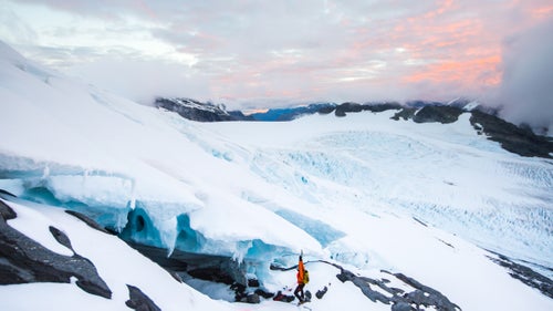
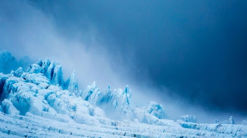
As the last light faded from the sky, the white clouds that had shrouded us during the descent lifted and revealed the expansive and intricate rippling of the glacier below, allowing us to pick a route back to the alpine hut where we would spend the night.
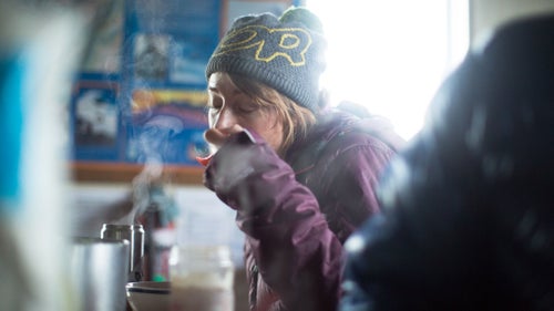
We woke to reports of more rain on the way and enjoyed a cozy breakfast in the Colin Todd Hut before packing our bags to begin the hike back down to the Matukituki Valley.
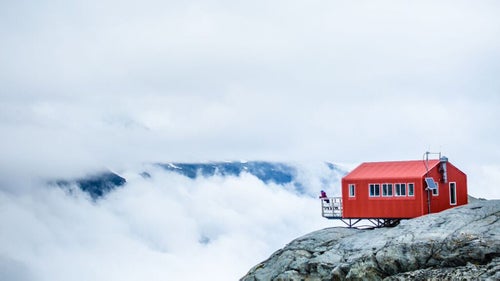
Jewell Lund watched the storm move in from the balcony at Colin Todd Hut.
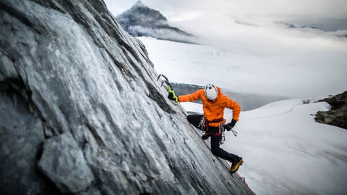
After a couple mugs of coffee, Kyle Dempster’s itchy feet and inquisitive nature led him on an exploratory mission up the granite wall a few hundred yards from the hut.
Another wave of classic New Zealand weather rolled in, signaling that it was time to pack our bags and get back to lower elevations.

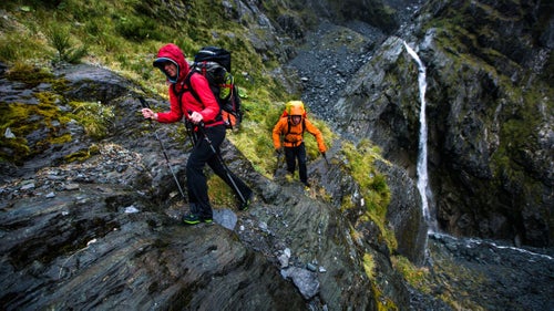
Kyle carefully picked his way across steep, wet granite slabs at the head of the Matukituki Valley.
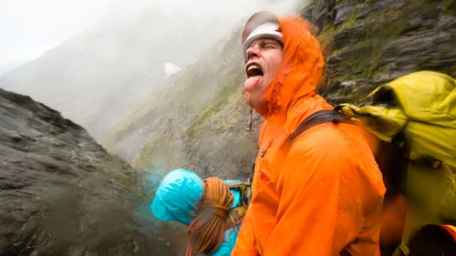
The rain settled in to accompany us for the rest of the day. The steady drizzle turned the slabs around us into a series of cascades, forcing us to set up rappels.
We descended through the last of the steep terrain that marks the head of the Matukituki Valley. From here, our path became less technical. We made good time descending the next six miles through scree fields, jungle, and grasslands.