Storms of America’s Heartland: Terrifying and Surreal Art

By this summer, Long Island, New York, photographer Eric Meola will have logged more than 100 days and perhaps as many as 25,000 miles in the Great Plains over the past three years. It’s all for his latest book project, a personal work-in-progress titled Tornado Alley: The Sky Above the Land Below, and an in New York City, in which he trains his lens on the types of storms that have ravaged the heartland of the U.S. in recent years.
“Photographing the constantly changing shapes and movement of the atmosphere is, for me, an exploration of the ephemeral,” says Meola, who travels with . “My images are meant to capture the dichotomy between the fury of skies torn apart and the tranquil, lonely solitude of the Great Plains. Storms have a surreal grandeur—they’re alive, they’re filled with light, they move, they change shape in front of you. Storm chasing pulls you in and it won’t let go.”
Photo: Supercell in North Platte, Nebraska 2014 A classic large supercell showing inflow bands (carrying moisture into the storm formation) on the right and the precipitation core.

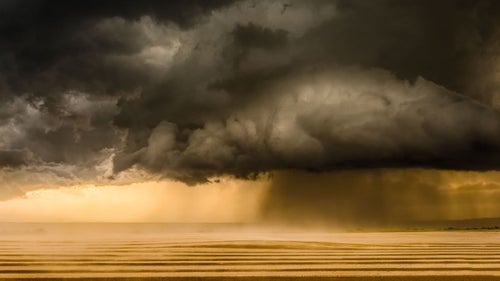
The hail-filled updraft of a supercell in one of the most prevalent areas for storms in tornado alley—the high plains east of Denver.

I made this image very late in the evening, as distant flashes of heat lightning illuminated the clouds. The 15 second exposure was long enough during the clear night to show the stars and the orange glow underneath the cloud was from the distant town lights.
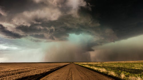
There was enough hail dropping out of this supercell that I only had enough time to expose a couple of hand-held frames. I was mesmerized by the way it hovered right over the center of the dirt road.
Dirt roads and storm chasing don’t mix—the last thing you want is to be stuck in mud as a hail-filled supercell approaches. The crepuscular rays of light give scale to this otherwise ominous supercell that was bearing down on us.

These mammatus clouds formed just before an extreme lightning storm that went on for hours over the sand hills of western Nebraska.

On my very first trip into Nebraska’s sand hills, I was treated to a lightning storm that went on for hours. This is a single exposure which shows the crisp cumulonimbus clouds as well as a single bolt of cloud-to-ground lightning.
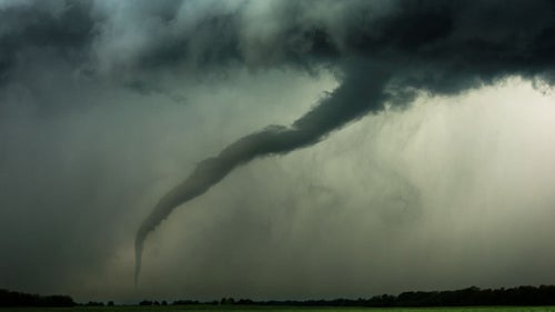
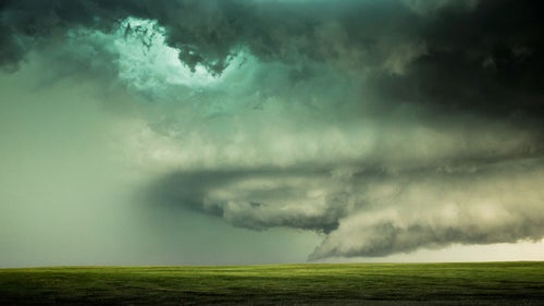
This tornado appeared suddenly over an empty field, just a few hundred yards away—we were only able to watch it for less than a minute before we had to jump back in the van and take off.
This was the most ominous supercell I’ve ever seen, and clearly shows (on the right side of the image) what meteorologists refer to as the “rear flanking downdraft,” which is a slot of descending air that can form tornadoes.
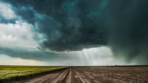
I was fascinated by the shape of this hail-filled supercell which we followed for more than an hour along the Wyoming-Nebraska border.