The Country’s Most Beautiful Mountaineering Route
The Ptarmigan Traverse in Washington State’s North Cascades has had the word “classic” pinned to it nearly from the time it was pioneered in 1938. You don’t get much more high-n-wild in the Lower 48 than on this 35-mile-plus mountaineering trip, which starts in North Cascades National Park and immediately dives south into the Glacier Peak Wilderness.
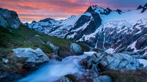
Along the way the route crosses a half-dozen or more glaciers and permanent snowfields. Some climbers rush through the route in three days, but why hurry when you can awaken each day to a cyclorama of Northwest peaks to climb, and views like this? In July our group took a leisurely six days.
The Ptarmigan Traverse begins with 3.7 miles of switchbacks through old-growth forest to Cascade Pass, one of the prettiest day-hiking destinations in the Northwest. Say goodbye to North Cascades National Park as you head to Cache Col. The traverse is as much off-trail backpacking as it is mountaineering; be proficient with an ice axe and crampons, and be comfortable with glacier travel.
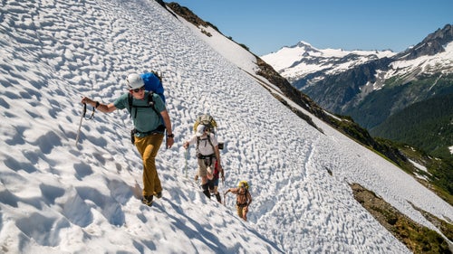
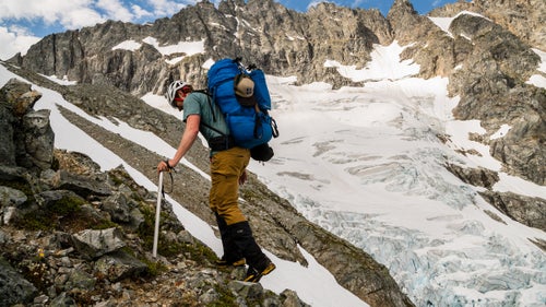
“Loveliness is paid for partly in the currency of suffering,” legendary Northwest climber Fred Beckey wrote in Challenge of the North Cascades. In other words, to be high, you first gotta get high. Here, the party grunts up a slope of Mixup Arm toward Cache Col on the first day, bent by 40-plus-pound packs. We didn’t stint on the whiskey.
Sunset hiking at Kool-Aid Lake, evening of day one. The traverse gets its name from the pioneering trip by members of that 1938 Ptarmigan Climbing Club expedition, according to Northwest climbing historian Lowell Skoog, keeper of the great site, alpenglow.org. Fifteen years later a group that dubbed itself the “What is South of Cascade Pass Anyway?” Expedition returned. The stunning pictures they took, later collected in a book, helped provide impetus for 1968 creation of North Cascade National Park.
A climber ascends a rock rib beside the tumbling Middle Cascade Glacier. The North Cascades National Park Service Complex, which also includes two adjoining national recreation areas, boasts over 300 glaciers as well as countless snowfields. Climbers on the traverse get up close and personal with ice. The glaciers are being hammered by climate change, however.
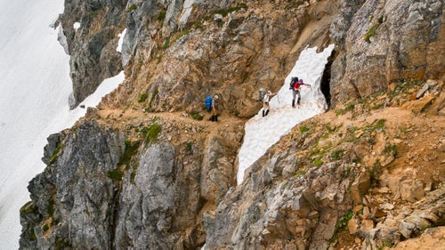
From camp at Kool-Aid Lake, the mountains before you look impassable—which is frequently the case in the ragged North Cascades. But on the Ptarmigan there’s always a way to sneak through. Here, the route follows the Red Ledge, a broad angling ramp, around a spur.
Just another ho-hum lunchtime view. A glissade awaits through the notch, down to a popular camp at Yang Yang Lakes (“lakes so nice they named them twice”). In the shade off-camera rests an enormous mountain goat. The night previous, the goat galloped over the author’s bivvy in the dark, just missing his privates—then the goat followed us the next day in hopes of lapping up the salt in our urine. We dubbed him the Chupacabra.
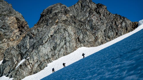
The steep climb out of Yang Yang Lakes, on firm snow. Just out of sight a huge cornice menaced above, warmed by hot sun. A misstep here, or a cornice fall, would’ve resulted in a long, painful slide—or worse. Though much of the Ptarmigan is straightforward for fit, experienced folks, this is still serious, remote country. Don’t count on others to rescue you.
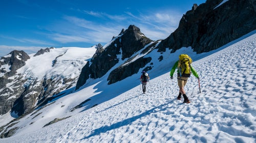
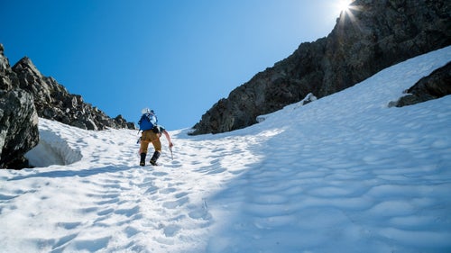
Typical Ptarmigan walking in early July, headed toward the LeConte Glacier and 7,726-foot LeConte Mountain. Depending on how long you take to do it, and when (snow is easier travel than shifty scree) the traverse isn’t wildly arduous. Climbers walk about seven miles a day and ascend perhaps 3,000 feet.
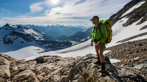
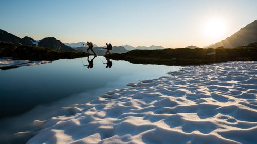
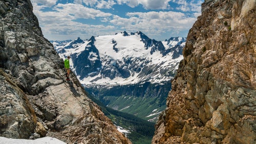
There’s a reason they call the North Cascades the American Alps—mountains beyond mountains. And once you get off the beaten path, you’ll find almost nobody else. Before heading across, the author looks out across the South Cascade Glacier, one of the biggest ice cubes in the tray.