Pro Mountaineer Caroline Gleich Conquers Utah’s Wasatch Range

For the past five years, I’ve been working on a personal project to ski all 90 lines listed in Andrew McLean’s , a skiing-climbing guidebook for Utah’s Wasatch Range. To my knowledge, I am the fourth person and first woman to complete the project. The routes described demand a wide range of skills: endurance for long vertical approaches, trad climbing, top-level ice climbing techniques, and the ability to make controlled ski turns in steep terrain.
A project of this magnitude was possible only because it’s in my backyard. Many of the Wasatch peaks are visible from the Salt Lake Valley and provide a true sufferfest minutes from a major metropolitan center. This season, I decided to focus my efforts on ticking off every last line in the book. I love the challenge the book provided, and I’m grateful for all the partners who shared these experiences with me.
Here, a look back at some of my favorite lines during the project.
Getting ready to drop into the Devil’s Castle Couloir at Alta. Surprisingly, this was one of the tricker lines in the book to ski, despite its relatively easy access. It’s very steep, and for how high and north facing it is, the snow doesn’t stay soft for long. It took me several tries to successfully ski this one.
Setting the skin track at sunrise up Cardiff Ridge to lap the Cardiff Chutelettes.
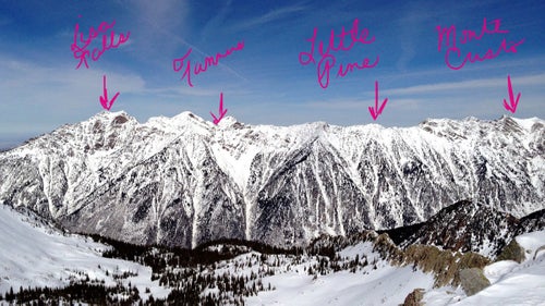
Little Cottonwood’s biggest avalanche paths regularly bury the road—and four parts of my project. The major ones are shown here, but there are about a dozen total lines on the canyon’s north side that I also skied.
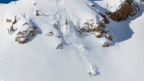
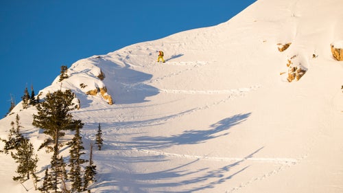
What goes up must come down. Outrunning sluff in the Shield on Cardiff Ridge.
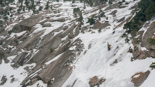
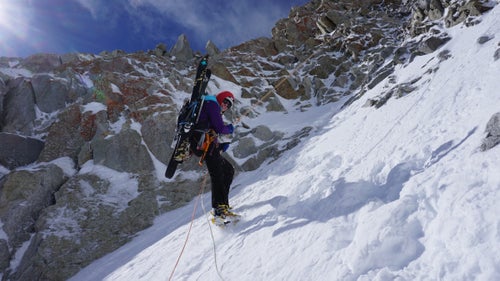
The book’s often-cryptic descriptions of lines keep things interesting. Here, some exploratory ice climbing to ski in the White Pearl, low in Little Cottonwood Canyon.
Walking along Thunder Ridge at first light with Rob Lea, one of my best partners for the project, en route to Montgomery Couloir, a very steep, narrow chute with a 75-foot cliff in the middle. Early starts were necessary so we could ski before the sun warmed the snowpack. You don’t want to know how early we woke up for this.
Emilie Drinkwater completing the rappel on the northeast couloir of the Pfeifferhorn, one of the final lines of the project. After skiing this line, we went back up to ski the Pfeifferhorn’s northwest couloir, making for a legendary ladies’ ski-mountaineering day in the Wasatch backcountry.
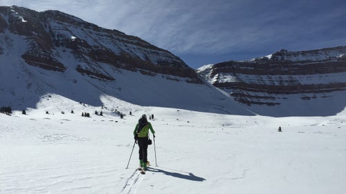
Lea en route to ski King’s Peak, the highest peak in Utah, in the Uintas. A casual 29-mile outing that we felt for days after. This was the only line in the book that was not located in the Wasatch Range. (Photo: Caroline Gleich)
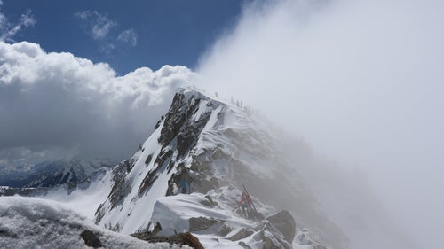
Changing weather on Thunder Ridge, near the summit of North Thunder Peak, en route to ski the Dresden Face and the Hypodermic Needle.
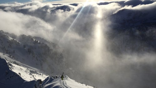
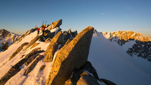
I saw many sunrises in the mountains during this project, but this one on the Superior Ridgeline was among the best.