

The giant Galápagos tortoises’ recovery from the brink of extinction is one of modern conservation’s great success stories. This Wednesday, Google Earth acknowledges that achievement with the release of its Street View imagery to allow people around the globe to ��as they eat, sleep, and travel the islands.
��
The plight of the giant tortoise is a familiar one: Once so abundant that 16th-century explorers dubbed the archipelago “galápago,” the old Spanish word for tortoise, the animals were decimated when humans arrived. Whalers hunted tortoises for meat and stowaway rats on transatlantic vessels poached the animals’ nests.
��
By the 1960s, the number of giant tortoises on Española, one of the oldest and most secluded of the Galápagos Islands, had dwindled to 15, and it looked like the species was destined to go the way of its neighbor, the Pinta Island tortoise, whose last surviving member, Lonesome George, died in 2012, at the age of roughly 102.
��
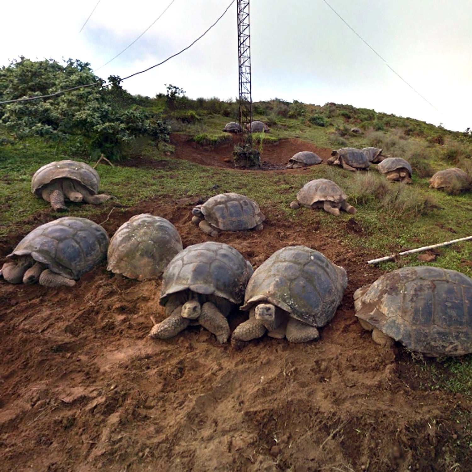
But with the establishment of breeding centers and invasive species eradication programs in the 70s, . Now more than 3,000 giant tortoises have been released from captive breeding programs on Española alone.
��
It was in the midst of this rebirth, in 2013,��that ��and the Directorate of the ��first approached the ��team about a collaboration to collect images of the archipelago.
“The aim was to explore the potential use of street view images for the research and monitoring of Galápagos’ ecosystems,” says Pelayo Salinas de Leon, senior marine ecologist for the foundation.
The first round of images, taken in 2013, marked the first time the Galápagos had been . They were so popular that a second project was commissioned, this time to map the habitat and migratory patterns of the archipelago’s most famous inhabitant: the giant tortoise.
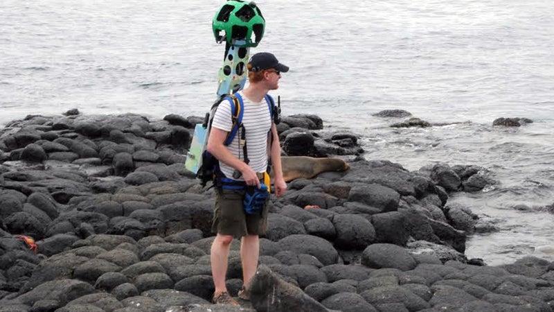
In order to document even the most remote corners of the islands, Google Maps loaned the foundation a Street View Trekker—a 40-pound, GPS-enabled backpack equipped with a spherical 15-lens camera that takes a photo of the wearer’s surroundings every 2.5 seconds.
“The park arranged for the trekker to go to some of the places that are off-limits to tourists, where the tortoise had been restored to its natural habitat,” says��Raleigh Seamster, the project lead from Google Earth Outreach. “People are able to see places—where the turtles eat in the morning, where they sleep at night, their migratory routes—they wouldn’t otherwise be able to visit.”
The Trekker was lugged around the islands for ten days in December 2014 and captured the wide range of environments—highlands and cliffs, mangroves, and coastline—representative of the archipelago. They brought it into areas under different management schemes—some that are open to tourism, some that are restoration sites, and some that are completely protected.
Already the newer images are being compared to the 2013 data to monitor changes in the ecosystem. Salinas de Leon says��the plan is to continue to collect and monitor 3-D imagery on a long-term basis. The potential benefits of the project extend to educators and citizen scientists, Seamster said.
��
“We’re hoping that, by bringing street view there, people will be able to appreciate the efforts that are going on to preserve the islands for future,” Seamster says. “These are places you can’t drive to, can’t visit, and we’re bringing them across the world.”