

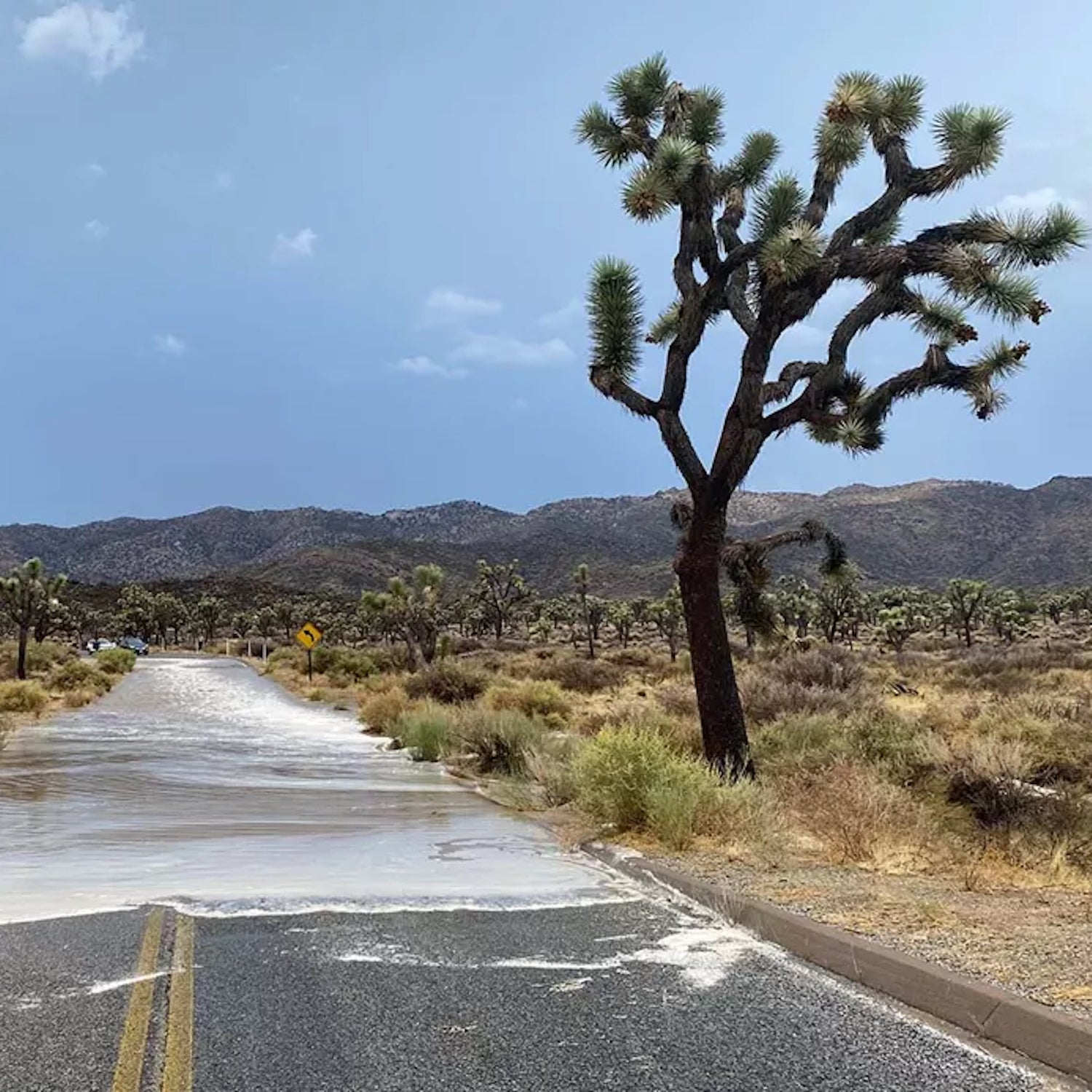
On August 8, Joshua Tree National Park announced that its southern entrance, as well as a five-mile stretch of Pinto Basin Road, between Porcupine Wash and Turkey Flats, due to severe flooding caused by monsoonal rains. Vehicles were damaged. Visitors had to be evacuated. Though the roads were cleared and reopened just two days later, the devastating images of floodwaters raging across familiar park byways have become an all too common sight this summer.
The same day, Death Valley that CA State Route 190, a major artery into the park, will remain closed to traffic from the Trona/Wildrose Junction through Death Valley Junction until at least August 17. After experiencing a last week in which 1.46 inches of rain—roughly 75 percent of the annual average—fell in just three hours, the park was forced to close for several days as nearly 1,000 visitors were stranded by powerful flash floods.
In June, images of catastrophic flooding in Yellowstone dominated headlines as the world’s first national park shuttered its entrances, worked to repair damaged roadways, and evacuated over 10,000 tourists. The park’s north and northeast entrance stations to this day.
It all begs the question–what the hell is going on in the national parks this summer?
, scientists have been predicting for years that climate change would increase extreme rainfall events, with once-rare weather becoming more frequent as the atmosphere heats up. Warmer air temperatures increase evaporation and are physically able to than cooler temps, meaning that the severity of flooding events is likely to increase as the earth gets hotter.
A 2021 study published in stated that climate change is likely to exacerbate the intensity and frequency of fluvial flooding events (floods localized to river basins and their surrounding areas). In addition, coastal flooding is expected to increase as melting glaciers and warming waters contribute to sea level rise.
While it may seem counterintuitive at first glance, the American West is the paradoxical effects of too much fire followed by too much water, a runaway process that can increase the destructive nature of these floods. Wildfires destroy forests and the brush that surrounds them, which weakens the soil structure and when heavy rain occurs.
In the past two weeks alone, the U.S. has experienced (in , , , and ). This doesn’t mean that the level of rainfall observed will only happen once in a thousand years, but rather that in any given year, the chance of an event occurring is 0.1 percent.
It’s a concerning pattern that has led to historic destruction in the parks in recent years. Though June’s media coverage mostly centered on the catastrophic flooding in Yellowstone, Glacier National Park was also forced to , including the path to Avalanche Lake, as flooding and debris impacted the Northern Rockies. Mount Rainier closed last November, after flooding caused significant damage to the area’s suspension bridge, and Acadia to ten miles of carriage roads last June, following a severe rainstorm.
Last year, in an interview with şÚÁĎłÔąĎÍř, Abby Wines, a spokesperson for Death Valley, said that in the 16 years she had worked for the park, she’d already experienced a number of abnormal weather events. “Nine of the ten hottest summers in the history of Death Valley have been in the past 15 years,” she said.
If what was once a 1,000-year rarity is set to become the new normal, our public lands will need billions in increased funding to help mitigate the effects of increasingly extreme weather on America’s best idea.