The Southwest always seems to me like a bit of a fever dream. The country’s deepest canyons, wildest buttes, and broadest deserts spread here from the Gulf of Mexico to the Pacific Ocean, offering a landscape so unlike any other in the country, you might think you’ve left earth altogether. It is a hot, inhospitable territory that demands respect, but it is also outrageously beautiful, with rock outcroppings that seem painted in shades of red and white, blooming cacti, and shifting dunes that undulate like waves onto the horizon.
The easiest and most efficient way to explore the Southwest is by car, bouncing from one breathtaking adventure to the next, so I’ve created seven different road-trip itineraries, one in each state of this stunning slice of our nation. I’ve driven the majority of these routes, while the remaining few are on my list of dream adventures. And each of these has something for everyone—beaches, sand dunes, cliffs, rivers, hikes, bike rides, fishing holes, and more.
Set your playlist, and pack the sunscreen. Here are the seven best road trips in the Southwest.
Destinations Newsletter
Want more of şÚÁĎłÔąĎÍř’s Travel stories?1. Nevada
Las Vegas to the Valley of Fire
đź“Ť Distance: 175 Miles
đźš— Duration: 3 days
The obvious, and most common, road trip from Vegas would be to beeline straight for the Grand Canyon, but you do not want to overlook the suite of public lands that rings Sin City. The fun begins just 20 miles west of downtown Las Vegas at Red Rock Canyon National Conservation Area, a 195,000-acre park that is internationally known for its multi-pitch rock climbing, though my epic adventures here have been of other types.
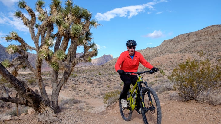
My favorite way to explore Red Rock is by road bike, pedaling the 13-mile Scenic Drive through the heart of the park. The road has one-way traffic and a big shoulder, so there’s plenty of room, and you’ll have both long-range and up-close views of the surrounding red sandstone cliffs and canyons. has bike rentals (from $40 a day). If you show up in the summer, do your adventures early in the morning before the heat gets unbearable.
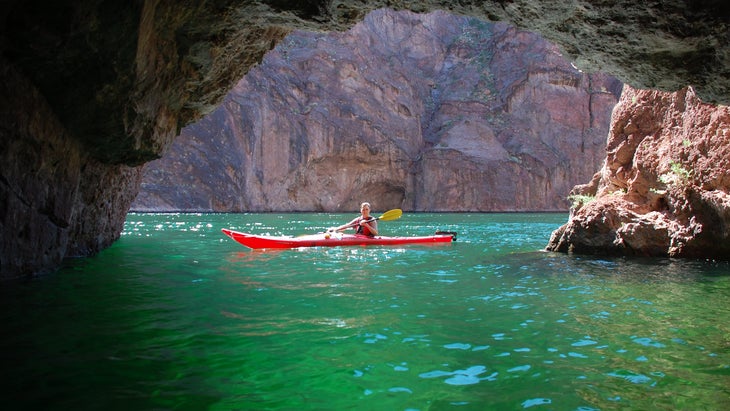
Next skirt around the south side of Las Vegas for 70 miles to Lake Mead National Recreation Area, home to the massive Hoover Dam. I like Lake Mohave, a shallow, narrow reservoir below Hoover that follows the original path of the Colorado River through a series of canyons. If you’re looking for a full-day (or multi-day) adventure, paddle a piece of the 30-mile Black Canyon National Water Trail, which begins at the base of the dam and ends in Arizona, passing beaches, hot springs, and side canyons.
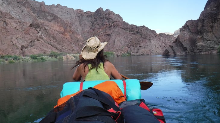
Only boaters with commercial licenses can launch below the dam, so hook up with , which offers DIY rentals and shuttles or guided trips throughout the water trail. Or for a quicker adventure, drive directly to Willow Beach, and paddle two miles upstream to Emerald Cave, a narrow side canyon with clear, shallow water below 75-foot sandstone walls (tours from $139 per person; rentals from $80 per boat).
has tent sites and RV sites in the hills above the sandy beach from $45 a night.
Driving north, you can stop at Valley of Fire State Park, Nevada’s largest state park at 46,000 acres, where red and pink sandstone cliffs and canyons fill the valley, the walls popping out of the tan, scrubby dirt. Catch the area at sunset and you could think the whole valley is on fire. The park is full of short, scenic trails for hikers. The 3.3-mile loop takes in iconic features, from a narrow slot canyon to the sinuous Fire Wave, where the striped sandstone seems to flow like water.
Snag a campsite at one of the two from $10.
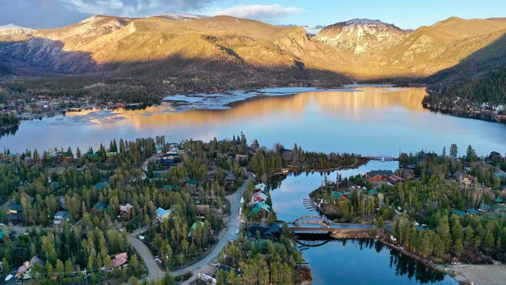
2. Utah
Bryce Canyon National Park to Capitol Reef National Park
đź“Ť Distance: 125 miles
đźš— Duration: 3 days
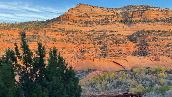
It’s tempting to try to hit all of Utah’s national parks in a single trip, but you’d have to cover more than 1,000 miles and spend more time in your vehicle than on the trails. Instead, focus on this slice of Utah by driving the 122-mile Scenic Byway 12, which connects Bryce Canyon National Park with Capitol Reef National Park, hitting Grand Escalante National Monument in the middle. I drove this route last fall and was in constant awe of its beauty and diversity, as we cruised through sandstone tunnels at one point, then climbed to an aspen forest at another.
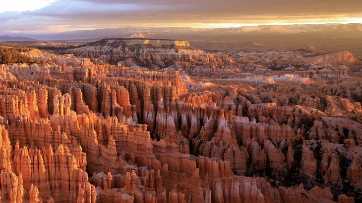
Pick up Highway 12 in the small town of Panguitch, about 50 miles east from Interstate 12, and keep driving east to Bryce Canyon National Park. Bryce, known for its hoodoos (sandstone spires that rise from the valley floor) is one of the country’s smallest national parks at just 35,835 acres, which means you can see a lot in a short amount of time. Combine Queen’s Garden Trail with Navajo Loop Trail for a that begins on the rim of the canyon, then drops into the belly, passing hoodoos, arches, and tall cliffs.
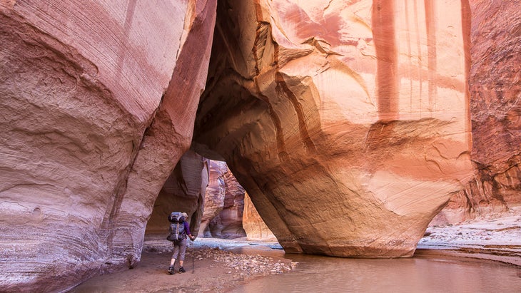
Heading north, Highway 12 moves through the heart of the massive Grand Staircase-Escalante National Monument, a 1.9-million-acre park with expanses of slick rock and sandstone canyons stretching all the way to the horizon. I was lucky enough to spend a couple of days in the monument, scrambling down slot canyons and bushwhacking through the heart of a broad canyon before reaching the lush Escalante River. It’s beautiful but unforgiving terrain that delivers plenty of solitude. Drive the unimproved dirt Hole-in-the-Rock Road (high-clearance two-wheel drive vehicles are usually OK) 33 miles south to the Dry Fork Slots to hike a through Peek-a-Boo and Spooky Slot Canyons, where the passage narrows to about a foot wide at certain points, and scrambling is mandatory. Too adventurous? Try hiking to , a 6.5-mile loop through a smooth canyon that ends at a 124-foot waterfall.
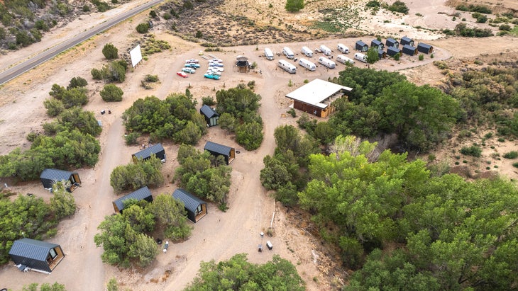
There’s plenty of camping and lodging around the town of Escalante. , inside the monument, offers seven primitive sites ($10 a night) with no frills. Or go upscale and snag a cabin or Airstream at , a camping-and-cabin resort with a drive-in movie theater, pool, and food truck (cabins from $175 a night).
Driving 65 miles further north on Highway 12, you’ll climb Boulder Mountain through Dixie National Forest before hitting the town of Torrey and Capitol Reef National Park. Here, you’ll find historic fruit orchards, sandstone domes, and more canyons than you could ever hope to explore. Start your journey with , a 3.4-mile out-and-back that crosses broad sections of slickrock before ending at a 125-foot-wide natural arch. Or hook up with and go canyoneering, dropping into the belly of narrow canyons deep inside the park ($300 for the first person).
For a longer adventure, check out our sister publication’s “.”
3. Colorado
Colorado National Monument to Rocky Mountain National Park
đź“Ť Distance: 310 miles
đźš— Duration: 3-5 days
Colorado offers a ton of incredible scenery, and this particular road trip takes you from the desert canyons of Colorado National Monument to the high alpine terrain of Rocky Mountain National Park. The diversity of adventure is off the charts, too, with opportunities for sandstone-heavy hikes, big mountain-bike descents, and whitewater rafting.
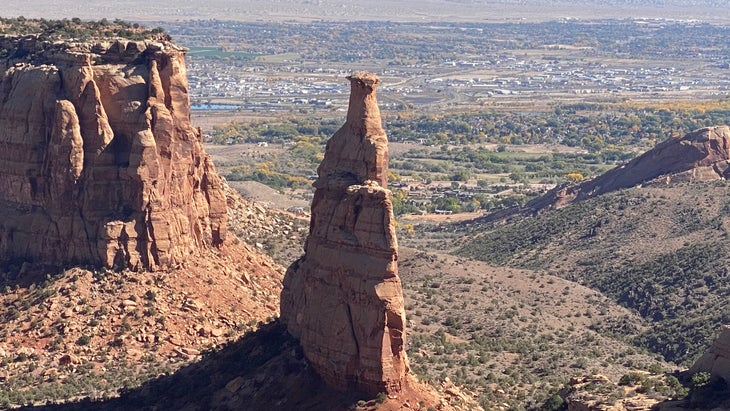
Start near the western border of the state, at Colorado National Monument, a 20,000-acre park with sheer cliffs and vertigo-inducing sandstone towers. Just driving the 23-mile Rim Rock Drive is worth the price of admission, with near-constant views of the canyon below, including of the massive Independence Monument, a 450-foot tall sandstone pillar.
But you’ll definitely want to get out of your car and explore this monument by foot. The Devil’s Kitchen is an easy, 1.2-mile out-and-back that gives you the chance to scramble over boulders and explore narrow sandstone channels. Get up close to Independence Monument on the , a 5.2-mile point-to-point that meanders past some of the monument’s most recognizable rock formations, including the set of rounded pillars dubbed the Coke Ovens and a tower known as the Kissing Couple, because it looks like two people entwined.
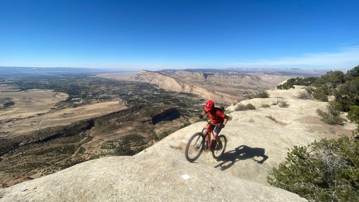
After exploring the monument, head east for 25 miles to the town of Palisade, where you can tackle a piece of the , a 32-mile mostly downhill piece of singletrack that drops 6,000 feet off the rim of the Grand Mesa into the edge of downtown. The trail has multiple access points, so you don’t have to bite off the entire distance. has shuttles and rentals starting in March (check then for prices).
Head 75 miles northeast to Glenwood Springs to spend the night at , which has van-life sites on the Colorado River (from $112 a night) as well as glamping tents and cabins (from $179 a night). You can book a half-day on the Colorado, which includes the 1.5-mile-long class III Shoshone Rapids (from $75 per person), or just soak in one of the 17 different pools at , where each tub is tailored to a different temperature (from $44 per person).
When you’re refreshed, or worn out, drive northeast for 125 miles through to Rocky Mountain National Park, one of the most popular national parks in the country (4.1 million visitors in 2023). Don’t worry, most of those visitors enter through the Estes Park side, while you’ll access the park on the much-less crowded Grand Lake entrance. I remember, on a trip with my kids, seeing a moose in the valley near Grand Lake and marveling that we were the only people on the trail at the time.
Head to the for a choose-your-own-adventure sort of hike. For a short jaunt that packs a big punch, hike the three-mile out-and-back Green Mountain Trail up to Big Meadow, which in the summer is full of wildflowers and hosts the occasional moose. Or if you really want to get after it, combine the Green Mountain Trail, Tonahutu Creek Trail, and Hayach Lakes Trail for a 17-mile out-and-back that culminates at Hayach Lake, a natural pool that sits at 11,000 feet in elevation in the shadow of the craggy Nakai Peak. Turn it into an overnight if you like, choosing among multiple backcountry campsites along the way ($36 fee for a ).
For a longer adventure, check out our sister publication’s “.”
4. Texas
San Antonio to the Gulf
đź“Ť Distance: 250 miles
đźš— Duration: 3-5 days
Texas is big, so you need to narrow your focus for a road trip here, because getting from point A to point B can sometimes take you all day. This particular route starts with some urban exploration in San Antonio and ends on one of the longest undeveloped beaches in the country. In between are quiet swamps, beach campsites, and plenty of paddle trails.
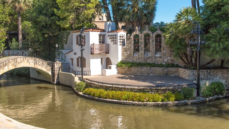
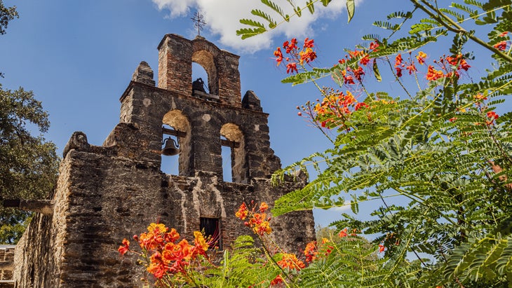
San Antonio might not seem like the perfect place to start an adventure trip, but the city’s 15-mile River Walk, expanded in the late 1990s, has served as an inspiration for other similar projects ever since and it’s still one of the coolest urban bike rides you can do. Five miles of the path cruise through downtown, but the best biking is just south of town in the , an eight-mile linear park that connects historic missions, grasslands, and wildflower meadows, all protected as the San Antonio Missions National Historic Park.
After spinning around San Antonio, drive east towards the Gulf of Mexico, making a pitstop at Palmetto State Park—a small stretch just 25 miles east of San Antonio, that’s home to the sort of tropical jungle you’re more likely to find in Florida—complete with dwarf palmettos blanketing the forest floor. If you bring your own boat or paddleboard, you can slide along the languid San Marcos River, or explore Palmetto’s small Oxbow Lake. Hiking trails lead through swampy marshes with light-green water filling the forest floor. If you’re not in a hurry, pitch a tent in the park’s ($12 a night) before heading to the beach.
Head south on Highway 183 to Mustang Island State Park, which separates Corpus Christi Bay from the Gulf of Mexico. The park protects five miles of Gulf-facing coastline, and has 50 drive-up where you can pitch a tent on the beach ($13 a night, first-come, first-served).
The beach is the obvious draw here. The Gulf is typically calm and warm, although some people are known to surf during hurricane swells. But the park also has more than 20 miles of marked paddling trails that traverse the western edge of the island, weave through islands in Corpus Christi Bay, and offer shallow water for fishing for redfish and speckled trout. runs daily guided trips (from $90 for two people) and rentals (from $50).
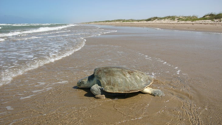
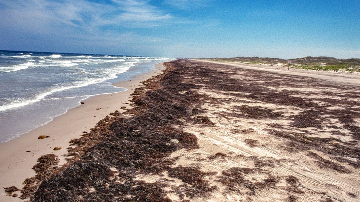
If you need more beach (and who doesn’t?) scoot 15 miles down the coast to Padre Island National Seashore. If you have a 4WD vehicle, you can down-island for up to 60 miles until you leave the crowds behind. The national seashore is a hot spot for birding, with 380 different species reported, thanks to the island’s location on a major migration route. Look for the endangered piping plover or the super colorful painted bunting.
5. New Mexico
Taos to the Bisti Badlands
đź“Ť Distance: 275 miles
đźš— Duration: 3-5 days
I haven’t spent enough time in New Mexico. Or seen enough of it. The last time I was there, on a fly-fishing trip, I couldn’t bring myself to leave the Taos area. So many fish, so many green chili dishes. But I regret my solitary focus, because the state has much to offer. This particular road trip delivers a variety of adventure and landscapes that I’m convinced only New Mexico has.
The trip begins with a bang by rafting a tumultuous section of the Rio Grande, just 30 miles southwest of Taos. Different run options offer a variety of adventure, but the classic is a 17-mile portion through the Rio Grande Gorge, also dubbed the Taos Box because it is walled by black basalt cliffs. The trip brings a full day of whitewater action, with a six-mile section of non-stop class II and III rapids known as The Racecourse. If the weather is warm enough, you can swim in a few pools along the way, and good guides will point out petroglyphs on the rock walls. Book your trip with and you’ll get hot fajitas for a riverside lunch (from $110 per person).
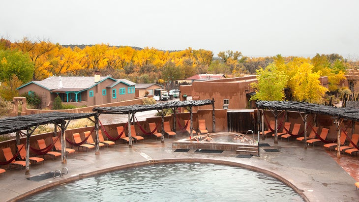
Spend the night at the wellness retreat of Ojo Caliente Mineral Springs Resort and Spa, where the natural springs feature arsenic, Lithia, soda, and iron, all minerals thought to have healing properties (from $239 a night).
Keep heading southwest to , a super volcano that erupted 1.2 million years ago, creating a 14-mile-wide circular depression that has evolved into a lush basin full of creeks and meadows. Think of Valles Caldera as a mini Yellowstone, complete with hot springs, wildlife-viewing opportunities, and broad grasslands. A large elk population calls the caldera home (look for them in the meadows during early morning and evening), and keep an eye out as well for prairie dogs and coyotes. The Valle Grande Exploration Trail is a short, .8-mile walk through a prairie to a manmade pond that served as a watering hole when the area was a private cattle ranch. The South Mountain Trail is a bit more involved, taking you four miles up a narrow valley and to the top of South Mountain, where you’ll enjoy a view of the entire basin.
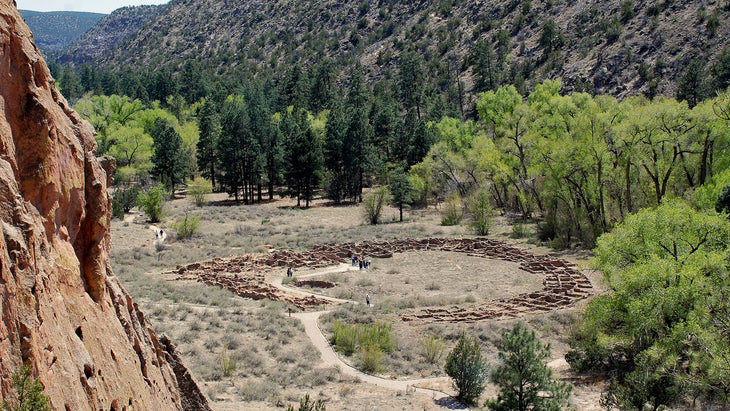
You’ll only be 20 miles west of Bandelier National Monument, which protects 33,000 acres of canyons and mesa that were the Ancestral Puebloans’ home until 1550. They used blocks of soft volcanic rock to build homes at the bases of cliffs, carving additional rooms into the walls themselves. Hike the 1.4-mile Pueblo Loop Trail to see some of these archeological sites first hand. You’ll even get to climb ladders into some of the rooms carved into the side of cliffs. Grab a campsite at the monument’s ($20 a night, reserve up to six months in advance).
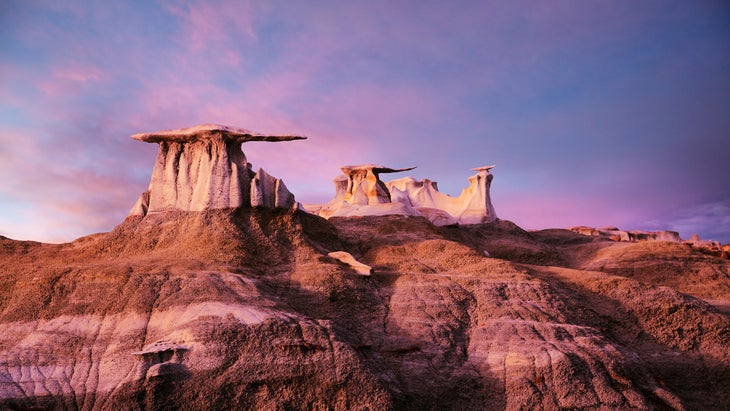
It’ll add some mileage, but you need to cap this road trip off with a walk on the moon, or at least, as close as most of us will ever come to walking on the moon. The , in northwestern New Mexico, are loaded with some of the strangest rock formations you will ever see, with cap stones and some massive cliffs actually in the shapes of manta rays, all rising from rolling taupe shale hills. The Bisti Badlands are part of the BLM’s 60-square-mile Bisti/De-Na-Zen Wilderness Area, which has no formal trails or paved roads. The De-Na-Zin parking area, off county road 7500, will give you access to the dry Bisti Wash, which you can hike into the heart of the badlands to see all of the weirdness for yourself.
6. Arizona
Grand Canyon to Monument Valley
đź“Ť Distance: 250
đźš— Duration: 3-5 days
I spent most of my youth believing Arizona was a desert wasteland, but in recent years I’ve had the chance to turn that around with some of the state’s wonderful signature adventures. Yes, much of Arizona is desert, but it is no wasteland. It’s a vibrant landscape full of life and adventure. I’ve driven ATVs across the desert, biked lonely gravel roads near the border of Mexico, and ridden a mountain bike into a cactus on the outskirts of Scottsdale. In short, I love Arizona, and as much fun as I’ve had in that state, I still have so much to discover. The following road trip meanders through Northern Arizona, beginning in Grand Canyon and connecting a few waypoints that I still need to tick off my bucket list.
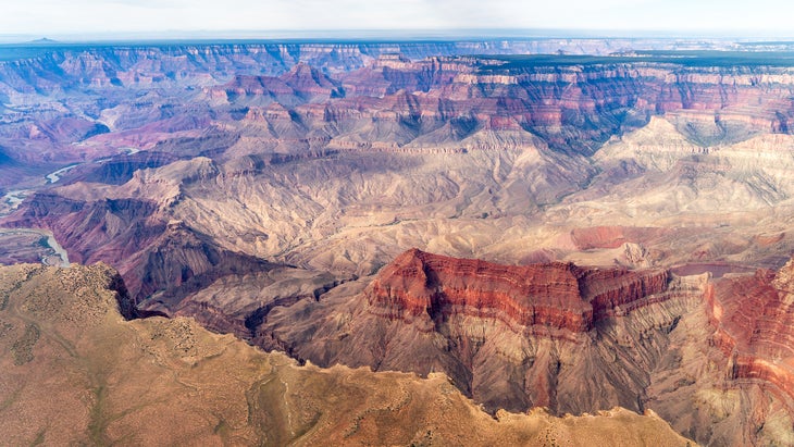
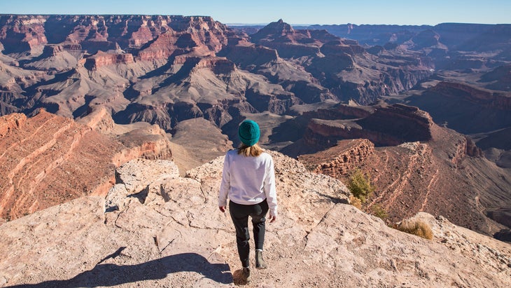
You could argue that all adventure trips in Arizona need to feature Grand Canyon National Park, and I wouldn’t disagree, so we’re hitting that 6,000-foot-deep ditch first. Also, Grand Canyon Village is just 1.5 hours from Flagstaff, so it’s a logical first stop. Is the Grand Canyon crowded? Yes. But the vast majority of visitors stick to a few scenic overlooks. The last time I was at the South Rim, I lost the crowds after hiking about a mile on the . But you’re going to do a lot of hiking on this road trip, so consider biking The Hermit Road, which hugs the south rim of the canyon for seven miles from the village, offering copious views along the way. The best part? It’s closed to private vehicles from March through November. rents cruisers (from $30).
Try to get a room at , an iconic national park lodge if there ever was one (from $391 starting in March). Or snag a coveted site at , which is first-come, first- served.
Heading north for 130 miles, you’ll hit the Vermilion Cliffs National Monument, a 280,000-acre geological wonder of buttes, canyons, and cliffs that tends to get overshadowed by its grand neighbor. Still, you may have seen photos of the swirling pink and tan sandstone layers of rock in the Coyote Buttes known as The Wave. It’s a stunning scenic reward that requires a tough hike through the desert. Accessing the Coyote Buttes requires a ($6). Grab one four months in advance, or try your luck with the daily lottery.
If you can’t score a permit, try hiking the 1.2-mile out-and-back through White Pocket. There are no marked or maintained trails in the monument, but cairns will guide you through more wavy sandstone features. Wherever you hike, look towards the sky for the endangered California Condor, which are hatched and released in the monument each year. And bring (or rent) a 4WD vehicle, as there are no paved roads inside the monument. Grab a site at the BLM’s , which views a cluster of sand-white buttes ($12 per site, first come/first serve).
Roughly 100 miles east, near the border of Utah, sits the 91,696-acre , a broad valley where 1,000-foot-tall sandstone towers rise abruptly from the earth. You can see some of the most iconic features, the Mitten Buttes and Merrick Butte, from the visitor center, but you’ll want to hike the Wildcat Trail, a four-mile loop that wraps around the West and East Mitten Buttes. It’s the only self-guided trail open within the park, so to explore any more requires hiring a local Navajo guide with . A number of operators run auto tours of the 17-mile scenic loop road within the park, but consider booking a stargazing tour, also with Monument Valley Tribal Tours, that focuses on nighttime photography, framing the buttes within the context of the Milky Way and surrounding stars (from $95).
7. California
So Cal Coast to Mojave Desert
đź“Ť Distance: 300 miles
đźš— Duration: 4-5 days

Because this is a collection of road trips through the Southwest, I’m focusing on Southern California, as the terrain in the area is more complementary to the Southwest vibe than, say, that of California’s Redwood National Park or Yosemite Valley.
This trip starts on the coast and ends with the dunes in the Mojave Desert, so there’s plenty of sand along the way, as well as big rocks, desert camping, and hiking. Keep the L.A. fires in mind when you’re traveling to Southern California. Hopefully the worst of that fire will be in the rearview by the time you make this trip, and while this route steers clear of the burn areas, the disaster has impacted residents throughout the region. Be considerate.
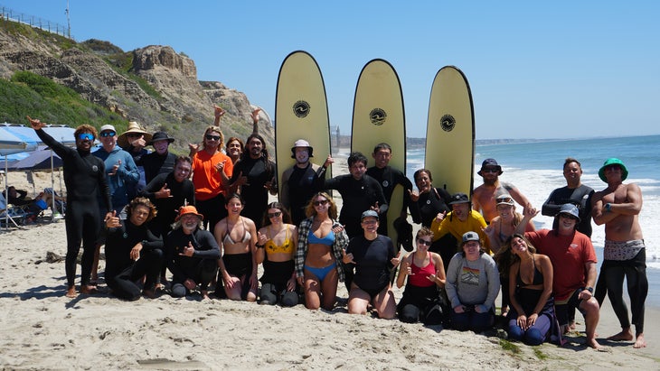
California’s coast is loaded with state parks, but San Onofre State Beach has a rugged character that’s hard to match, with cliffs rising directly from the beach and whales and dolphins often spotted in the water. If you fancy yourself a worthy surfer, you can paddle into the lineup at the world-famous Trestles break on the north end of the park, which has been ground zero for Southern California’s surfing culture since the 1940s. The park offers beginner breaks, too. In fact, San Onofre has one of the more gentle waves in Southern California. offers beginner lessons at the San Onofre Bluffs Beach, which is flanked by 100-foot cliffs (from $100 per person).
Try to score a site at the (reserve up to six months in advance, starting at $45 a night) or San Mateo Camp, a couple of miles inland.
Leave the beach and head east, making a pit stop at the sleeper destination Anza-Borrego Desert State Wilderness, an often overlooked member of California’s crowded public-lands portfolio. The park is packed with palm oases, slot canyons, and after a wet winter, fields of wildflowers. Stretch your legs on the , a three-mile out and back that begins near the park’s visitor center and climbs up a canyon, ending at an overlook of a palm oasis (currently recovering from a previous wildfire) with a seasonal waterfall.
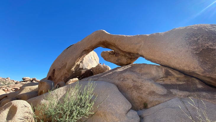
Continuing east for 60 miles, and you’ll wrap around the Salton Sea to hit Joshua Tree National Park’s southern entrance (if you’re tired or showing up late, look for free campsites on BLM land between I-10 and the park’s entrance). Spring is a great time to visit the park, as the temperatures are manageable, and the local cacti and Joshua Trees for which the park is named could still be sprouting flowers. Lace up your hiking boots and hit the trails. The easy 1.4-mile is a no-brainer loop that delivers you to a natural arch, with plenty of opportunity to scramble on sandstone boulders along the way. For a bird’s-eye view of the park, climb the 5,456-foot Ryan Mountain via its and for a vista stretching clear to the 11,000-foot San Gorgonio Mountain. I tried running to the top of Ryan Mountain the last time I was in the park, but the 1,000-foot elevation gain got the better of me.
Aside from the BLM land near the south entrance, the park has six with sites you can reserve up to six months in advance. They’re all good.
Still want more desert? Great, because you’re heading 70 miles north of Joshua Tree into the heart of the Mojave National Preserve, 1.6 million acres of dunes, cliffs, and cactus that somehow only gets half a million visitors a year. You have to hike the , a 45-square-mile expanse that will have you thinking you’re in the Sahara. The popular three-mile Kelso Dunes Trail will take you to the top of the tallest mound, which rises 650 feet.
Also, the easy, mile-long Lava Tube Trail provides access to an actual lava tube, where the sun pours in through a “sky light” in the stone. Wherever you explore, keep an eye out for the desert tortoise, a threatened species that lives in the Mojave’s valleys and moves slowly through the heat. The preserve has three developed campgrounds. Try to reserve a spot at , which has potable water ($25 per night).
Graham Averill is şÚÁĎłÔąĎÍř magazine’s national-parks columnist. He’s been in love with road trips since he read Jack Kerouac’s On the Road at age 17. His longest road trip to date was a month-long romp through the Southwest with his wife and twin then four-year-olds. Recently, he wrote about bucket-list golf courses, the best hikes in Joshua Tree National Park, and the nine national parks that will need timed-entry reservations this year. One of the weirdest places he’s ever slept for a story was a renovated lookout tower in the middle of the ocean.