

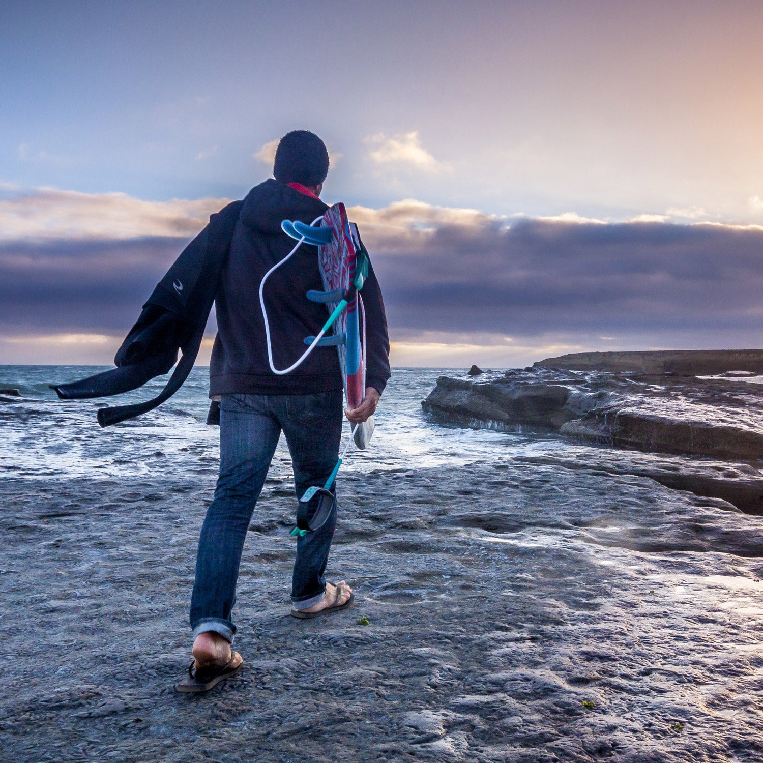
Fall is the perfect time to get in the car and find some waves. So pack a wetsuit and some boards then embark on one of the following quests for surf-induced happiness.
Central California
San Francisco to Big Sur
231 Miles, 3 to 5 Days
Best Season: Summer, Fall, Winter
Bring: 5/4 wetsuit, booties, hood
To Hunter S. Thompson, the end of Geary Boulevard in San Francisco was “the end of the line,” but for surfers, it’s the beginning of three miles of sandy shores and powerful waves at Ocean Beach. The area is a swell magnet during the winter months, though afternoon onshore flows can turn the surf into a chaotic mess. When the wind picks up, head south along Highway 1 through Half Moon Bay, home of the world-famous big-wave break Mavericks. Further south, Santa Cruz has the most consistent waves on the coast, with Steamer Lane and Pleasure Point pulling in year-round swell. Highway 1 continues along Monterey Bay road hugs the Santa Lucia Mountains as it winds through Big Sur. Many surf spots down here are difficult to access, but breaks like Sand Dollar Beach are only a short hike from the parking lot and have camping near by.
New Jersey
Sandy Hook to Cape May
127 Miles, 1 to 2 Days
Best Season: Fall, Winter, Spring
Bring: Boardshorts (fall), 6/5/4 wetsuit, gloves, booties, and hood (winter).
From September through April the Jersey Shore is a mecca for surfers across the Northeast, and the Garden State Parkway is the gateway to the state’s fine surf and diverse coastal culture. Sandy Hook (Exit 117) is the northernmost break, and the lineup offers views of Manhattan’s skyline. Catch a show at the Stone Pony in Asbury Park (Exit 100A) and delve into the grunge/punk rock culture of the New Jersey surf scene. Seaside Heights of MTV Jersey Shore fame (Exit 82A) boasts the Shore’s most iconic boardwalk while just south of town, Island Beach State Park has almost ten miles of preserved shoreline. Cape May sits at the far end of the Parkway (Exit 0), and peninsula is home to a colorful array of Victorian B&Bs, a vastly different skyline from the view at Sandy Hook.
North Carolina
Kitty Hawk to Hatteras and Back
141 Miles, 2 to 3 Days
Best Season: Fall, Winter, Spring
Bring: Boardshorts (fall), 5/4 wetsuit, booties, gloves, and hood (winter), four-wheel-drive
Once the stomping grounds of the fearsome pirate Blackbeard, North Carolina’s barrier islands are now a hub for surfing, kiteboarding, and fishing. Highway 12 runs from Kitty Hawk to Hatteras, and the main thoroughfare never strays more than a mile from the Atlantic Ocean. Bring a 4×4 and with a permit you’ll be able to drive right up to many of the spots. Though sleeping on the beach is not allowed, there are plenty campgrounds at locations like Kill Devil Hills, Frisco, Avon, Buxton, and Hatteras. The quality of surf on the islands shifts with the sand, but when the swell pumps the S-Turns just north of Rodanthe and the Hatteras jetties just north of Cape Point are safe bets. If it’s flat, take a kitesurfing lesson at or check out the , which commemorates the ships and sailors lost off the coast.
Baja
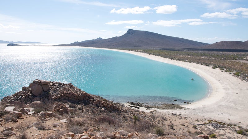
San Diego to El Rosario and Back
570 Miles, 5 to 14 Days
Best Season: Fall, Winter
Bring: 4/3 wetsuit and booties, four-wheel-drive, Spanish-English dictionary
If your sense of adventure is undeterred by warnings like kidnapping, carjacking, and highway robbery (actual terminology from the State Department’s ), then Northern Baja could be your ultimate surf road trip. Mexico Federal Highway No. 1 heads south from Tijuana and runs all the way to Cabo San Lucas. However, unless you’re going out for months, it’s best to turn around at El Rosario, which is 306 kilometers south of the border. Many of the popular breaks along this stretch, like K-38, Shipwrecks, San Miguel, and Cuatros Casas, are less than an hour from Highway 1, and they have established campgrounds or hostels. The extra money to stay at these sites is worth the extra security.
Wisconsin
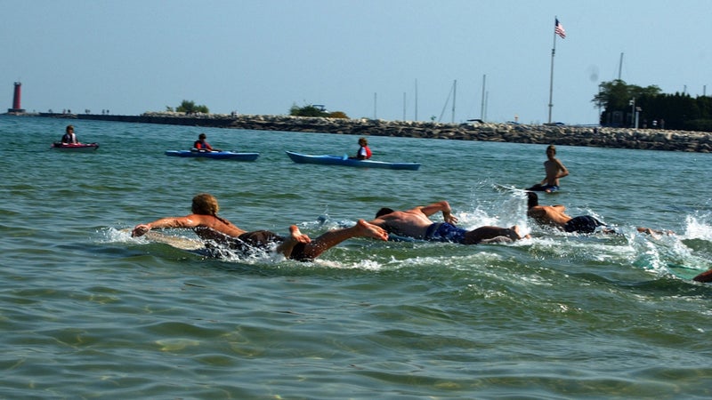
Milwaukee to Algoma
73 Miles, 1 to 2 Days
Best Season: Fall, Winter
Bring: 6/5/4 wetsuit, booties, gloves, hood, Brett Favre jersey
Wisconsin may not abut a mighty ocean, but the shores of America’s Dairyland still see surf. The best waves occur in the fall and winter months, so scoring on the Great Lakes generally requires thick, full-body neoprene and a willingness to break icicles off your eyelashes. Sheboygan is the heart of the Great Lakes surf scene, and the town is home to Elbows, one of the most popular breaks on Great Lakes, and EOS, the only dedicated surf shop in Wisconsin. County Road LS winds along Lake Michigan to Manitowoc and Lakeshore Road continues along the shoreline to Kewaunee and Algoma. Along the way, keep an eye on the bays and breakwaters for waves.
Oregon
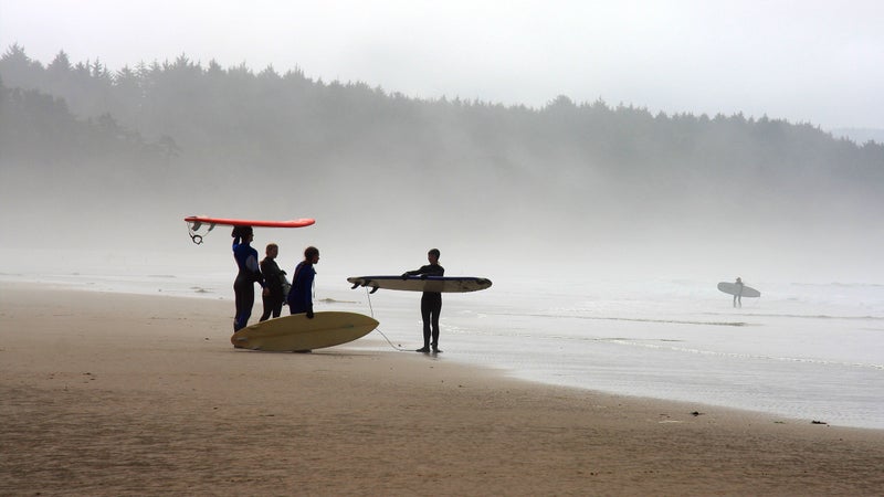
Astoria to Brookings
338 Miles, 5 to 7 Days
Best Season: Fall
Bring: 5/4 wetsuit, booties, gloves, hood, raincoat
While Oregon is better known for year-round skiing on Mount Hood and the fixie crowd in Portland, the Beaver State also has 363 miles of coastline along Highway 101. In the winter, powerful storms in the Gulf of Alaska send massive waves to spots like Nelscott Reef in Coos Bay. Florence, Newport, and Seaside have some of the most established surf scenes on the coast and are south facing, which make them relatively protected during the swells of the winter months. However, the fall is the best time to explore the points, coves, and beaches of Oregon, when the weather, wind, and swell have the best chance of cooperating.