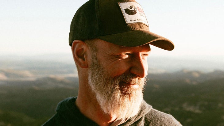
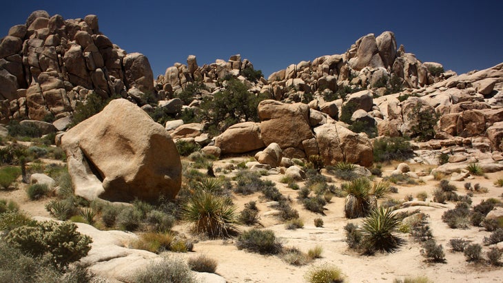
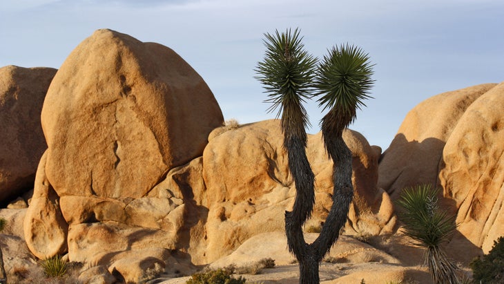
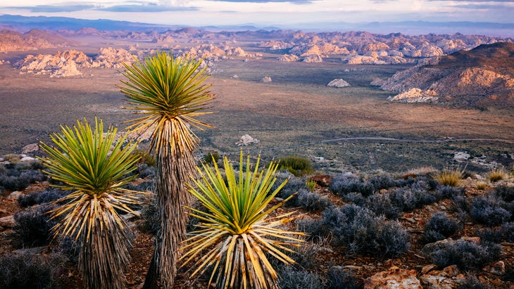
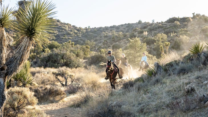
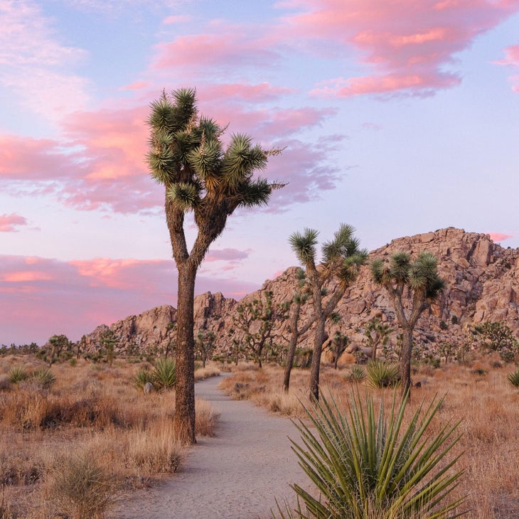
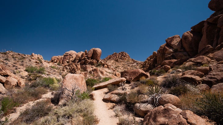
Joshua Tree National Park is my favorite desert landscape. There’s something magical about its collection of tan, monzogranite boulders, craggy peaks and hidden oases with lush palms and cool pools. I’ve spent countless days in the park, knocking out short hikes close to paved roads, and rambling for hours off trail through a maze of rocks, canyons, and cacti. The park might be most famous for its rock climbing (the bouldering, in particular, is world class), but I’d argue it’s a hiker’s dream with endless opportunities to explore two unique desert landscapes within its borders; the low, flat, and hot Colorado Desert in the eastern section of the park, and the high elevation, mountainous Mojave Desert to the west.
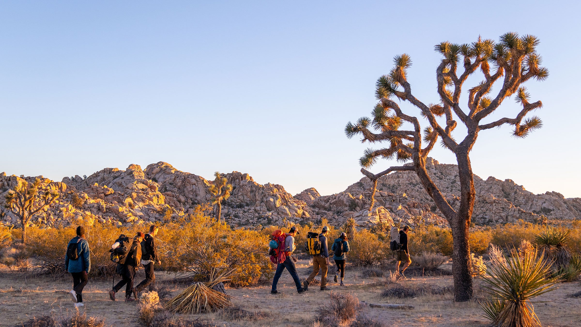
The majority of the 800,000-acre park is designated Wilderness and free of established trails, and while I’ve had a lot of fun “bushwhacking” my way across slices of this desert landscape, I’m going to stick with established trails to keep it easy. (There are plenty.) If you’re interested in a long off-trail journey, check out the local suggestion for a area of the park in this Backpacker story.
Destinations Newsletter
Want more of ���ϳԹ���’s Travel stories?Pro Advice for Hiking in Joshua Tree
My advice for trekking through Joshua Tree: Don’t overlook the nature trails. Normally, I avoid hiking routes that are less than a couple of miles long because they’re the most crowded in any given national park, but the easy “nature trails” inside Joshua Tree travel through the park’s most interesting terrain, delivering you to boulder gardens, patches of wildflowers, and Joshua trees galore. And given the rocky nature of Joshua Tree, a 1-mile loop through a field of boulders can offer a day’s worth of scrambling potential. So tack one of these nature trails onto the end of your adventure, or better yet, spend an entire day driving around the park, knocking off 2-mile loops and out-and-backs until your legs quit.
And remember that you’re in the desert here. People visit in the summer (I’ve done it myself) but expect triple digit temps, so plan your adventures for early morning or evening and carry plenty of water. Fall and spring are more civilized seasons, as the temps rarely exceed the 80s.
By Far and Away, Here Are the Best Hikes in Joshua Tree
It’s hard to pick “the best” trails in any park, because it’s a subjective concept. The truth is, I really like hard trails where there’s a high probability of getting lost, and Joshua Tree has plenty of those. But scrambling through the desert while rationing your last drops of water isn’t everyone’s bag, so I’ve cast a wide net in curating my list below, considering a variety of abilities and interests. With that in mind, here are hands-down the 11 best hiking trails inside Joshua Tree National Park.
Arch Rock Trail
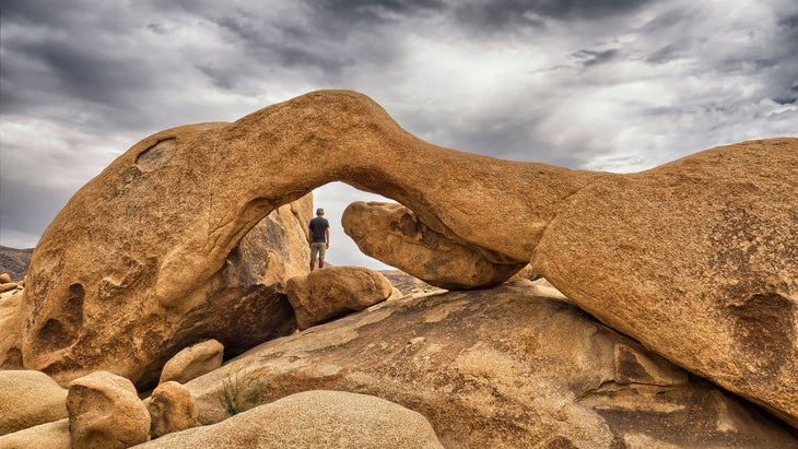
🥾 Distance: 1.4 miles
🏜️ Why I Love It: It’s an easy hike to cool rocks with lots of optional scrambling.
One of the most popular trails in Joshua Tree, is a flat and easy 1.4-mile lollipop loop that crescendos at a small natural arch. Most of the trail to the arch is a straight forward, sandy walk through the desert, but I still like this hike because the area surrounding the arch is loaded with sandstone boulders and canals. It’s like an all-rock playground for scramblers and explorers.
Hidden Valley Trail
🥾 Distance: 1 mile
🏜️ Why I Love It: It might be the coolest “nature trail” in this park.
You want to see some rocks? This 1-mile has stones galore, as it circles through a flat expanse of land enclosed in a ring of massive boulders forming imposing tan walls. It’s a flat cruise, with full “nature trail” status, complete with interpretive signage about the plants and animals that inhabit the Mojave Desert landscape, but it offers a short highlight reel of the terrain, including Joshua Trees, cactus, and often climbers sending the rock walls throughout the valley.
Split Rock Loop
🥾 Distance: 2 miles
🏜️ Why I Love It: Lots of wildflowers in season, big rocks, and the chance to add on mileage.
This easy, wanders through clusters of tan, sandstone boulders, the most famous of which is Split Rock, a 20-foot tall, rounded boulder with a sinuous fissure right through its heart. The trail is also a great place to see wildflowers, including the orange desert mariposa lily, blooming in April and May, and the bright red desert paintbrush, in summer. You can combine this hike with Skull Rock Loop (see below) for a nearly 3.5-mile loop from the same trailhead.
Skull Rock Trail
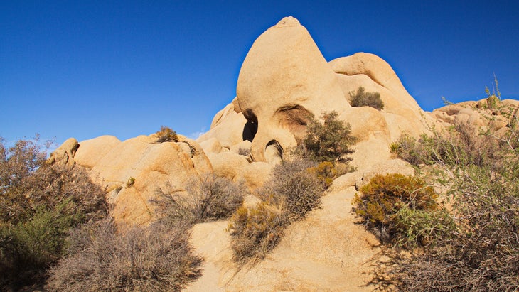
🥾 Distance: 1.8 miles
🏜️ Why I Love It: The namesake rock is cool, but the real fun happens on optional rock scrambles deeper on the trail.
This boulder, which does indeed look like a skull, might be the most iconic feature inside the park (you might find a line of people waiting for photos with the boulder on busy days). That skull is also visible from the main park road, so you’re not on this hike for the rock. You tackle it because this gives you a chance to explore so many other sandstone features as it passes through the Jumbo Rocks area of the park, cruising through tight canals and giving you the opportunity to scramble to the top of countless boulders. The whole area reminds me of the terrain from the Saturday-morning live action series from my childhood, “Land of the Lost.”
Ryan Mountain
🥾 Distance: 3 miles
🏜️ Why I Love It: It’s a steep climb to a big-time view.
People might not automatically associate Joshua Tree with towering peaks with sweeping views, but delivers just that, rising to 5,456 feet in the center of the park. The 3-mile out and back is tough, gaining more than 1,000 feet to the summit. It’s a broad peak, with views in every direction taking in taller peaks beyond the park, including the 10,000-foot San Jacinto and 11,000-foot San Gorgonio, the highest peaks in the region. A pile of stones marks the true summit.
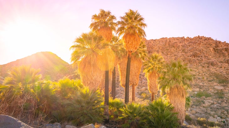
FortyNine Palms Oasis Trail
🥾 Distance: 3 miles
🏜️ Why I Love It: It leads to an actual oasis!
Yep, this is a legit oasis in the middle of the desert. The hike is moderate, climbing 300 feet over a ridge before descending into a desert canyon, which directs water into an oasis that supports surprisingly lush flora, including the eponymous palm trees. As you might imagine, the oasis attracts all kinds of animals, even bighorn sheep. Just don’t try to take a swim; the park asks you to stay out of the oasis to protect the habitat and the wildlife that depend on it. In fact, during the summer (from August to October) the trail is closed entirely to protect the sheep herds that rely on the surface water that can be found in the oasis.
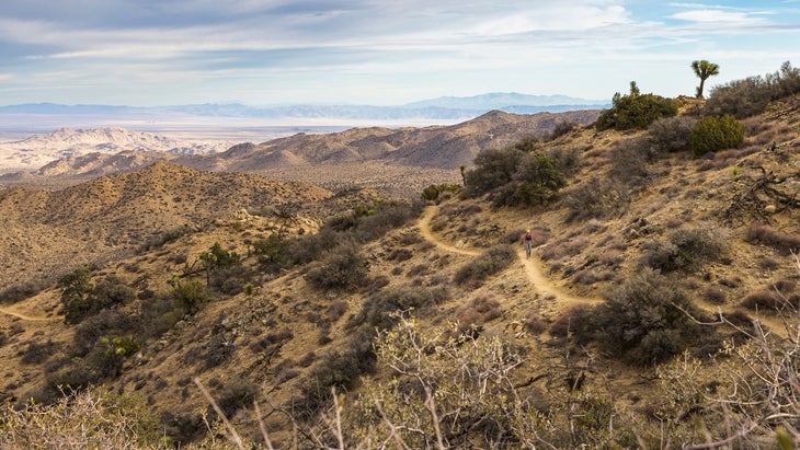
Panorama Loop Trail
🥾 Distance: 6.5 miles
🏜️ Why I Love It: It’s a longer trek that gets you away from the crowds.
Much of this , which begins on the edge of Black Rock Canyon Campground, has you climbing and descending the 4,000 and 5,000-foot ridges of the Little San Bernardino Mountains, where you’ll find long range views of the 11,000-foot peaks within the Sand to Snow National Monument just outside the park, as well as the mountains inside the Mojave National Preserve. But you’ll also hike through a dense grove of Joshua Trees, and enjoy it all without the crowds; this trail receives less hikers than many others inside the park because it’s difficult (more than 1,200 feet of gain) and just note there are no boulders that look like faces along the path.
California Riding and Hiking Trail
🥾 Distance: 37.5 miles (point to point)
🏜️ Why I Love It: The challenge and the solitude of this long trail are enticing.
This is as close as you can get to a Joshua Tree thru-hike on a maintained path, as the forms a 37.5-mile horseshoe from Black Rock Canyon Campground, on the northwestern edge of the park, to the northern entrance of the park, traversing a valley on the edge of the Little San Bernardino Mountains through the heart of the park. Multiple access points and side trails allow you to go after pieces of the CRHT, but if you want to hike end to end, most people take at least two long days, staying at Ryan Mountain Campground as their overnight ($20, up to six months in advance). You’ll get solitude, long range views into the park, and more Joshua Trees than you could possibly count. Bring water, or stash water caches beforehand, as there’s no water along the route.
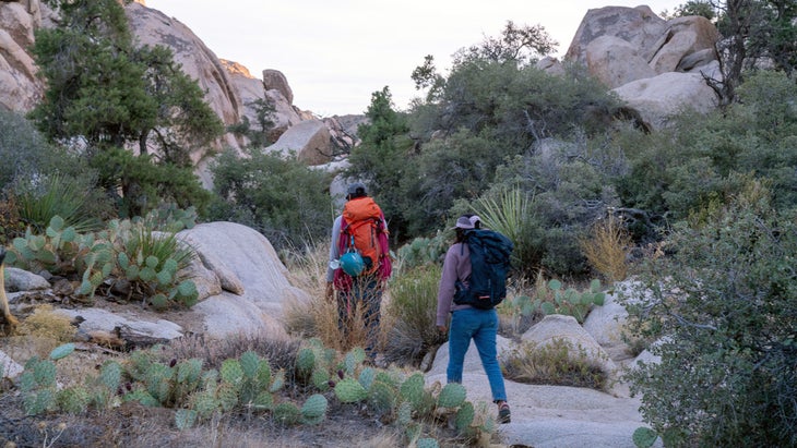
Boy Scout Trail
🥾 Distance: 16 miles
🏜️ Why I Love It: Mandatory scrambling, groves of Joshua Trees, and cool canyons await the hardy.
This is popular as an overnight backpack (get a and only camp in designated areas) that begins with an open desert landscape speckled with Joshua Trees before dropping into the Wonderland of Rocks, an area full of cliffs, canyons, and domes. The trail continues to descend into Indian Cove and will drop more than 1,000 feet before it’s over, so plan ahead for that climb back to your car. There’s some mandatory scrambling through the Wonderland area, and much of the descent and ascent is over sandy terrain, so it’s not an easy hike by any means, but the terrain is varied as you’ll travel over broad desert, through slot canyons, and over boulders as you access the park’s remote backcountry.
Mastodon Peak
🥾 Distance: 3 miles
🏜️ Why I Love It: This short trail has a lot of diversity, from groves of palm trees to historic relics.
This could be one of the best short loops in the park, as the passes through a spring supporting an oasis before climbing to the top of the peak for a view of the southern portion of the park. Follow the Lost Palm Springs Trail from the Cottonwood Springs Oasis parking lot through the aforementioned spring where tall palms and wildflowers bloom. Once you branch off onto the Mastodon Peak Loop, you’re in for some stair climbing and switchbacks before an optional, but fun, scramble delivers you to the true summit. It’s a 360-degree view from the top, taking in much of the park and the surrounding mountain ranges. You’ll also pass the remnants of a gold mine that was in operation until the 1970s.
Barker Dam Trail
🥾 Distance: 1.1 miles
🏜️ Why I Love It: This easy trail leads to super cool rock art created by the original occupants of this land.
This easy, has the boulders and Joshua Trees that you might expect, but also visits a rock art site and a historic dam that was built by early ranchers, so you get a look at the human history of the park as well. The rock art consists of a collection of petroglyphs and pictographs found inside a small cave next to the trail. And of course, there’s a small pond trapped by the dam, collecting water, although the depth of water depends entirely on the amount of rain the area receives.