

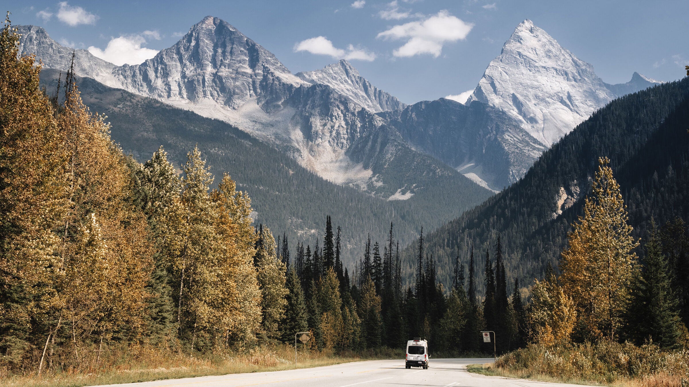
Canada’s westernmost province, British Columbia spans a whopping 364,764 square miles. That’s enough room to swallow California whole, then gobble up Oregon and Washington and still have space left over for a dessert the size of Maine.
It’s also one of the most beautiful areas in the world to take a road trip.
More than 40,000 islands and islets dot B.C.’s meandering coastline, which encompasses everything from sandy beaches to rock cliffs. Ten iconic mountain ranges, from the Coast Mountains on the province’s west side to the Canadian Rockies along its eastern border with Alberta, create a seemingly endless connection of peaks and valleys that serve up every outdoor adventure imaginable.
I moved to B.C. from Colorado in 2017, drawn by the vast wilderness, rugged beauty, and low population density. I live in the small town of Nelson, located deep in the interior, in a subrange of the Columbia Mountains, sandwiched between the West Arm of Kootenay Lake and an inland temperate rainforest. I learned to slow down while driving, not just for the scenery and the absence of multi-lane highways, but because anyone behind the wheel in B.C. will undoubtedly cross paths with a bear, a moose, or a bighorn sheep. Sometimes all in the same day.
This is prime road-tripping country. I suggest starting and ending in Vancouver, home to one of Canada’s largest airports and half of the province’s 5 million people. My recommended route quickly moves away from the crowds. It sticks to the lower third of the province, where there are enough roadways and infrastructure to make this trip possible. There are multiple ferry crossings navigating the province’s numerous coastal inlets and, in the interior, the lush Columbia River Valley.
This route hits all of southern B.C.’s best destinations for outdoor adventure, from sea kayaking to rock climbing to alpine hiking and mountain biking. Because there are more than 200 distinct First Nations here, each with its own unique traditions and history, the road trip includes Indigenous cultural experiences wherever possible.
If you’re planning to go electric, provides electric vehicle resources, including links to EV service networks to find available charging stations.
What follows is my favorite B.C. road trip, broken down into daily segments. You can drive it comfortably in eight days, or stay longer in each place and stretch it out. The best time to go is in the shoulder seasons, just after the snow melts in the late spring, or before it starts to fly again in the late fall.
If you buy through our links, we may earn an affiliate commission. This supports our mission to get more people active and outside. Learn more.
1. Vancouver to Port Renfrew
🚗 Distance: 136 miles, including ferry
➡️ Route: Once you’re out of the city, the idyllic Juan De Fuca Hwy/BC-14 W traces Vancouver Island’s remote southwest coast.
You’ll kick off with a car ferry ride across the cobalt blue waters of the Salish Sea, from the city of Vancouver to Swartz Bay on mountainous Vancouver Island. Drive past Victoria, B.C.’s bustling capital city, and follow the West Coast Highway along the island’s rocky southern shoreline to Port Renfrew, a hamlet of fewer than 200 people.
Port Renfrew calls itself the Tall Tree Capital of Canada, and it’s hard to argue. The coastal community is situated at the end of a finger-shaped inlet on the rainy southwest side of Vancouver Island, where some of the biggest trees in the country have been discovered. Formerly a logging town, Port Renfrew has since rebranded itself as an ecotourism destination, with the Pacheedaht First Nation leading the effort to increase amenities for visitors.
The Best ���ϳԹ���s in Port Renfrew
Two of Vancouver Island’s greatest coastal hiking trails start (or end) in Port Renfrew: the 29-mile , to the southeast, and the 47-mile , to the northwest. Portions of the Juan de Fuca can be done as point-to-point day trips with a car. The West Coast Trail is more remote, with no road access beyond Port Renfrew.
Visit to meet “Canada’s gnarliest tree,” a 200-foot tall red cedar that’s buttressed by an enormous tangle of roots, and other charismatic old-growth giants. Volunteers with the Ancient Forest Alliance built and maintain the short-but-rugged trail that traverses the grove’s boggy bottom.
Drive up the logging road to admire “Big Lonely Doug,” the second-largest Douglas fir in Canada, appearing even taller than its 230 feet among the stumps of a clearcut.
To see the Red Creek Fir—the largest living in the world at nearly 44 feet in diameter —you’ll want a high-clearance vehicle and the confidence to follow a particularly rough logging road for about 7 miles sans cell phone coverage. Don’t forget to look up, all the way up. Big Red’s crown spans 75 feet.
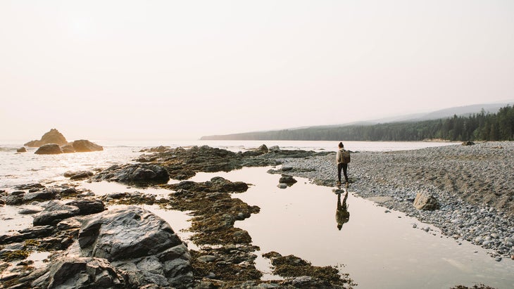
Botanical Beach, one of the richest intertidal zones on the entire west coast of Canada, is a five-minute drive from town. The tide pools here teem with marine life, from anemones to urchins.
For the best surfing on the south side of the island, drive head east to Sombrio Beach or Jordan River. Wetsuit required.
Where to Stay in Port Renfrew
If you’re dreaming of a log cabin at the end of the world, Wild Renfrew’s at Snuggery Cove are hard to beat. The upscale dwellings come in a variety of sizes, some with kitchens, private beaches, and fire pits (from$259, two-night minimum stay required).
For a single night (and more budget-friendly) stay, head to the recently renovated (from $129). Dogs are welcome.
Pacheedaht Campground, owned and operated by the Pacheedaht First Nation, occupies a gorgeous strip of sandy beach where Gordon Creek empties into the inlet. Choose from forest sites, beach sites, or RV sites.
Where to Eat and Drink in Port Renfrew
is the place for gourmet comfort food like Renfrew Lager battered cod and chips, craft beer on tap, and wildlife watching (harbor seals and bald eagles are guaranteed).
For breakfast and lunch, opens at 4:30 a.m. to fuel even the earliest adventure. There are no grocery stores in town, so plan accordingly.
2. Port Renfrew to Tofino
🚗 Distance: 213 miles
➡️ Route: Take Pacific Marine Rd to Cowichan Valley Hwy to the Trans-Canada Highway, which follows the bustling east coast of the island before you exit west to Tofino.
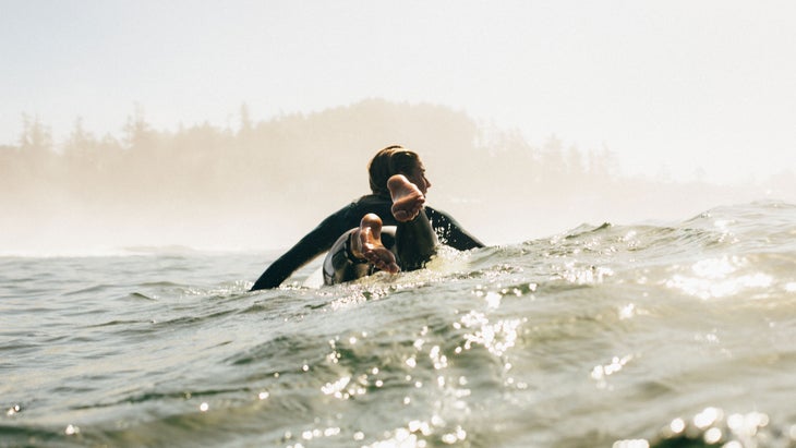
The westernmost road in all of Canada dead-ends in Tofino, a small town at the tip of a peninsula on Vancouver Island’s rugged, mostly uninhabited west coast. Tofino’s surrounding 20-plus miles of flat, sandy beaches and consistent waves are an anomaly in Canada, making it the country’s unofficial surf capital.
While surfing is a big draw, it’s not the only reason to make the drive. Tofino is located inside the Clayoquot Sound UNESCO Biosphere Reserve, and at the northern gateway to the vast coastal temperate rainforests of Pacific Rim National Park Reserve, enabling a variety of world-class wilderness adventures.
The Best ���ϳԹ���s in Tofino
Tofino is situated in the ha’houlthee (traditional territory) of the Tla-o-qui-aht First Nations. Visit the to learn about Indigenous history and culture, marine life, and the coastal temperate rainforest ecosystem.
Get in on a group surf lesson with , a Tofino institution since 1999, taught by female-only instructors. Wetsuit and surfboard included. All genders are welcome.
Experienced surfers can head straight to Chesterman Beach, Cox Bay, or Long Beach. Cox Bay is the site of all the big annual competitions, including the Rip Curl Pro Tofino/Canadian Surf Championships in April, and the Queen of the Peak Women’s Surf Championships in October. For gentler waters for stand-up paddleboarding, hit MacKenzie Beach or the Tofino Inlet.
Kayaking the wild coastline of Clayoquot Sound draws paddlers from all over the world. Tofino has nearly as many kayaking outfitters as it does surf shops, with options for all experience levels.
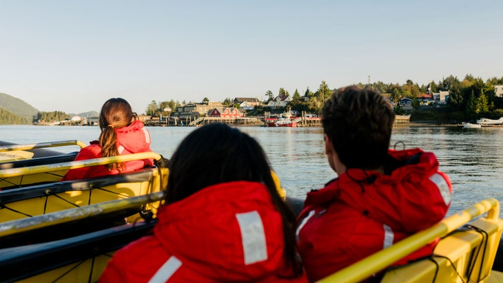
A wildlife-watching boat tour is a must while in Tofino. Black bears emerge from the rainforest to munch on mussels, and each spring, more than 20,000 gray whales swim through Clayoquot Sound while migrating north from Baja. Orcas, humpback whales, dolphins, sea lions, seals, sea otters, and a variety of aquatic birds like puffins also call these waters home.
Trails for hiking, running, and biking surround Tofino, winding through old-growth forests, dropping down to hidden beaches, and climbing up to scenic viewpoints. The recently completed (pronounced ups-cheek ta-shee) trail, is a paved, multi-use 15-mile path through Pacific Rim National Park, connecting Tofino to the hamlet of Ucluelet.
Where to Stay in Tofino
Tofino’s newest accommodation, , cultivates a playful 70s vibe with its hip décor and unexpected amenities (from $255). Think: retro arcade, psychic’s den, and sunken living room lobby. Its restaurant , where locally-sourced ingredients are cooked by live fire, is already a local favorite.
In addition to 63 chic, modern guest rooms, (from $309) offers the in town. Its curates some of the top ocean experiences in the area, including guided deep-sea fishing for halibut, tuna, salmon, and lingcod; trips aboard a luxury powerboat to reach further-flung kayaking and stand-up paddleboarding destinations in Clayoquot Sound; and access to a private floating sauna in a hidden cove accessible only by boat.
The , located three miles outside of town on Chesterman Beach, is legendary for storm watching during the colder months of the year.
Where to Eat and Drink in Tofino
For a remote town of just 2,000 people, Tofino punches above its culinary weight. Several of its restaurants could hold their own in the world’s greatest cities. One of the newest, founded by a couple originally from South Korea by way of Vancouver, brings a modern take on Korean classics to the island. creates meals inspired by the local fishing and foraging culture like “seacuterie,” a platter of tuna conserva, boiled mackerel, and smoked salmon pastrami served alongside various breads, tapenades, and salsas.
The , located on Chesterman Beach, dishes up a fine-dining experience using British Columbia-sourced meat, fish, and produce, served with floor-to-ceiling ocean views. On the Rocks Bar, located on the restaurant’s upper level, is perfect for hand-crafted cocktails sipped during sunset.
3. Tofino to Powell River
🚗 Distance: 165 miles, including ferry
➡️ Route: Pacific Rim Hwy/BC-4 E winds its way through the rainforest, back to the east coast. There, both the Inland Island Highway or Island Highway W will get you to the ferry station—choose Island Highway West to be closer to the water, so long as you don’t mind the slower pace.
Take the car ferry from Comox (B.C. Ferries Little River Terminal) to reach the B.C. mainland, and post up in the coastal town of Powell River. The original townsite is a National Historic District, with more than 400 buildings remaining from the early 1900s, including Canada’s oldest continually operating theater. Initially a paper mill town, Powell River has since been resettled by artists, adventurers, and entrepreneurs seeking an alternative to big-city life in Vancouver.
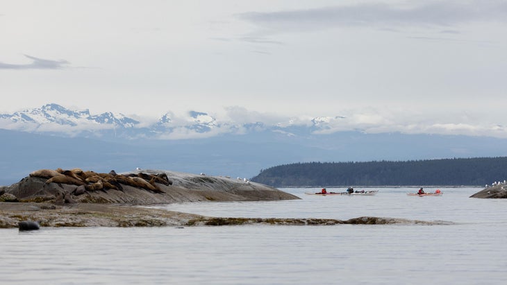
Some 13,000 people call remote Powell River home, navigating logging roads to access the abundant hiking, mountain biking, and rock-climbing in the Coast Mountains behind town. The Salish Sea sits on Powell River’s front doorstep, and up the coast to the north, Desolation Sound—the largest marine park in B.C.
The Best ���ϳԹ���s in Powell River
With 16 backcountry huts set along its 112 miles, the is Canada’s longest hut-to-hut hiking trail. For a day trip, trek uphill through a mossy forest of arbutus trees and Douglas fir to the Manzanita Hut. The eponymous bluff provides a panoramic view of the Salish Sea, looking out to the Copeland Islands and Savary Island.
Powell River’s regional district is known as qathet, meaning “working together, bringing together” in the Central Salish language of the Tla’amin First Nation. Here, volunteers maintain more than 200 miles of mountain biking trails. Connect with the for trail maps, to join a group ride, or to hire a guide.
The Eldred Valley’s vast granite walls soar 3,000 feet above the valley bottom. Picture Yosemite National Park, but in the rainforest, with no people and no amenities, save for a rustic campsite. Get beta (and a guidebook) at the . Then drive the Goat Lake Mainline logging road for 34 miles to reach the CAD campsite, named in memory of Colin Arthur Dionne who, along with his partner Christie, pioneered climbing in the area.
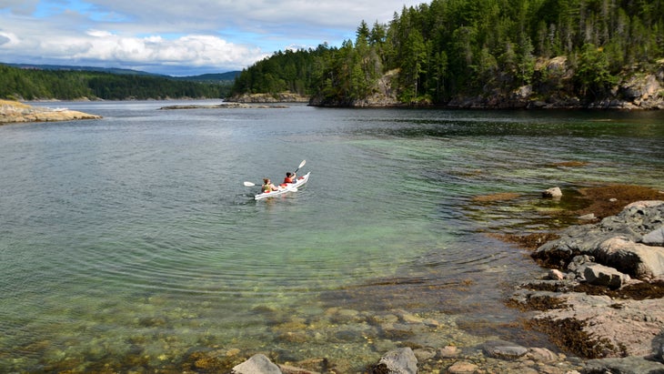
Rent a sea kayak from at the Lund marina for a short but scenic paddle over to the Copeland Islands Marine Provincial Park archipelago. For Desolation Sound, Terracentric offers multi-day guided kayaking and camping expeditions for groups of four or more.
The Powell Forest Canoe Route is a wilderness adventure covering 35 miles across a chain of eight backcountry lakes, backed by the craggy Coast Mountains. Plan for at least five days, and five portages through old-growth forests where black bears still roam.
“Zunga” is a word that originated in Powell River, referring to catapulting yourself into a body of water via a rope swing (the water gets surprisingly warm during the summer season). Ask around for the best spots, or stop in at Townsite Brewing, which named its pale ale after the practice.
Where to Stay in Powell River
Indulge in Powell River’s historic charm with a stay at the , a boutique heritage hotel with modern sensibilities like a washing station and storage for your mountain bike (from $165). in nearby Lund puts you a stone’s throw from launching a kayak in the Salish Sea. The cabins require a three-day minimum stay during the summer season (from $85).
Where to Eat and Drink in the Area
Boaters flock to Nancy’s Bakery, located at the Lund marina, known up and down the coast for its blackberry cinnamon buns. In Powell River, combines great coffee, local ingredients, and qathet region art. Dine at for views of the Salish Sea and to-die for Salt Spring Mussels, served in a tangy white-wine creole butter broth. Most locals—whether they drink alcohol or not—end up at après outdoor adventure. The first microbrewery on the Sunshine Coast puts just as much care into its small-batch kombucha as it does its craft beer. Kids are welcome.
4. Powell River to Squamish/Whistler
🚗 Distance: 121 miles, including ferry
➡️ Route: Pleasant driving along the Sunshine Coast Hwy/BC-101 S followed by the stunningly scenic Sea-to-Sky Hwy/BC-99 N
It takes two car ferry crossings to navigate the inlets and fjords that keep Powell River so blissfully isolated from the rest of the B.C. mainland. Both crossings are exquisitely scenic, with little development to interrupt the natural coastline of rocky bluffs and cedars set beneath the snow-capped Coast Mountains.
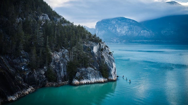
The wilderness splendor doesn’t stop there. The Sea-to-Sky Highway is arguably the most picturesque road in all of BC. It traces Howe Sound north to Squamish, the rock-climbing capital of Canada, then continues on to Whistler, North America’s largest ski area. These two mountain towns are separated by 36 miles, yet deeply intertwined in terms of outdoor adventure. It’s nearly impossible to live in one without also recreating in the other.
Similarly, the Squamish and Lil’wat First Nations, the first stewards of these lands, are also strongly connected. The Squamish Lil’wat Cultural Centre, located in Whistler, celebrates these ties and is a must-visit. Time your trip to have lunch at the Centre’s Thunderbird Café; order the Bannock tacos.
The Best ���ϳԹ���s in Squamish and Whistler
Stawamus Chief Mountain, at 2,300 feet, presides over Squamish. Its massive cliff face is among the largest granite monoliths in North America. Climbers from all over the world come to test their mettle on 1,000+ climbs and bouldering routes in the area, many soaring high above Howe Sound. teaches brand new beginners, along with more advanced courses in multi-pitch climbing and rock rescue. The new enables non-climbers to ascend the Chief, using ladder-like rungs and safety cables.
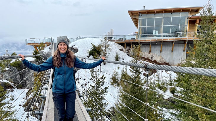
Hikers can summit the Chief via a steep trail on the south side. Even more popular is the adjacent Sea to Summit Trail, an equally steep 4.5 mile trek that ends at the top of a tourism gondola, with a viewing platform for panoramic photos of Howe Sound and its surrounding peaks, and a well-appointed café. Pro tip: Catch the gondola down. It’s a fun, spine-tinglingly steep ride with killer views (and saves your quads).
Whistler Bike Park opens in May and is widely considered one of the best destinations for lift-assisted downhill mountain biking on earth. For everything else, Squamish serves up five world-class riding zones with more than 300 trails. Beware the local sandbagging. Blues are more like blacks, or at the very least, dark blues. Visit to rent gear, to hire a guide, and get tips on which area is right for you.
B.C. is the birthplace of heliskiing, and once the snow melts, it becomes a prime heli-hiking and heli-biking destination. has been flying adventurers into the peaks surrounding Squamish and Whistler for 30 years now, and is the world’s first carbon neutral full-service helicopter company.
Squamish’s wilderness spa, , offers hot and cold therapy in the outdoors—in a meadow beneath a mountain cliff, or in the forest beside a stream. A wellness facilitator guides a private, three-hour immersive experience for you and your friends, alternating between the hot sauna and the cold plunge pools.
Where to Stay in Squamish
In downtown Squamish, the provides 20 comfy rooms alongside a craft brewery with floor-to-ceiling windows looking out at the Chief (from $170). For apartment-style suites with full kitchens and in-room laundry, choose the contemporary (from $389). To be in nature, but still close to town, book a chalet at .
Where to Eat and Drink in Squamish/Whistler
You can’t miss at , a long-time favorite for brunch (served from 9am to 3pm every day). The doles out casual gourmet grub from a food truck, with indoor/outdoor seating and a buzzy atmosphere that includes a full-service bar. Get the Bahn Mi, featuring Johnston’s farm seasoned pork loin and belly. For farm-to-table fine dining, head to in Whistler (reservations recommended).
5. Squamish to Revelstoke
🚗 Distance: 354 miles
➡️ Route: Relatively straightforward mountain driving on BC-99 N and the Trans-Canada Hwy/BC-1 E
Driving east into the vast B.C. interior, the flora shifts from coastal temperate rainforest to the semi-arid grasslands and ponderosa pines of the Thompson River Valley. As you get closer to Revelstoke, it morphs back to the same lichen-draped Western red cedar, spruce, and Douglas fir trees seen on the coast.
Welcome to B.C.’s inland temperate rainforest, a rare ecosystem kept moist year-round by the abundant snowfall. An average of 35 feet of snow falls on Revelstoke every winter. Mount Copeland, a nearby peak, holds Canada’s record for the most snowfall in a single season—a mind-bending 80 feet. Needless to say, most of the town’s 8,200 residents are avid skiers and snowmobilers, and numerous professional snowsports athletes live here, like Leah Evans and Greg Hill.
But the fun doesn’t end when the powder melts. Some say Revy gets even better, with alpine hiking, mountain biking, and whitewater rafting. It’s also a hotbed of environmentalism, with locals working to preserve what’s left of the region’s old-growth forests from logging. B.C.’s newest conservancy, the Incomappleux, protects more than 140,000 acres of ancient trees in the wilderness southeast of town.
The Best ���ϳԹ���s in Revelstoke
While Revelstoke has some easy trails in the greenbelt alongside the Illecillewaet and Columbia rivers, it’s the area’s alpine hiking that’s considered among the best in Canada. The above-treeline trails are plentiful in Revelstoke Mountain Resort, and nearby . The local rite of passage is to trek to the top of (4.8 miles one-way). You can see Begbie’s unmistakable triple peak from almost anywhere in town. The trail is relentlessly steep, but pays off at the top with a bird’s eye view of the Columbia River and the seemingly endless peaks of the Monashee Mountains.
From lower-elevation trails through the mossy rainforest to alpine adventures in the Monashee and Selkirk mountains, Revelstoke’s mountain-biking scene is legendary. Start at , where the Revelstoke Cycling Association maintains 25 miles of quintessential Revy singletrack interconnected with logging roads. Don’t miss Flowdown (blue), a local favorite for its playful, old-school flow. Progress to , arguably one of the greatest alpine mountain-biking experiences on the planet.
Revelstokians paraglide from Revelstoke Mountain Resort year-round. Visiting pilots can check with for the essential information. Newbies can get a taste for the experience by booking a tandem flight to soar with an experienced pilot from Mount Mackenzie down to the banks of the Columbia River—the highest vertical commercial tandem paragliding launch in North America.
Starting in May, Revelstoke’s longest running river rafting outfitter, , guides half-day trips through the thrilling class IV whitewater of the Illecillewaet River. Wetsuits provided.
Where to Stay in Revelstoke
has a range of accommodations including camping and RV sites, cabins ranging from rustic to upscale, and luxury geodesic domes (from $54).
Revy’s newest high-end accommodation, , has an ideal location on the banks of the Columbia River (from $159). Walk across the street to access the trails of Revelstoke National Park.
Where to Eat and Drink in Revelstoke
, one of the original microbreweries in the area, is still a favorite more than 25 years later. Ask if any experimental beers are available. Locals get their coffee at , along with their trendy eats like avo toast and gluten-free soups. , a delicious, upscale café open for breakfast and lunch, sources its ingredients from Terra’s organic farm, located 3 miles away. Everyone loves the for its mix-and-match menu of tacos, burritos, and enchiladas, not to mention its Caesar, the national cocktail of Canada, made with El Jimador Reposado instead of vodka.
6. Revelstoke to Nelson
🚗 Distance: 156 miles, including ferry
➡️ Route: A single-lane highway parallels the scenic shorelines of Upper Arrowhead and Slocan lakes.
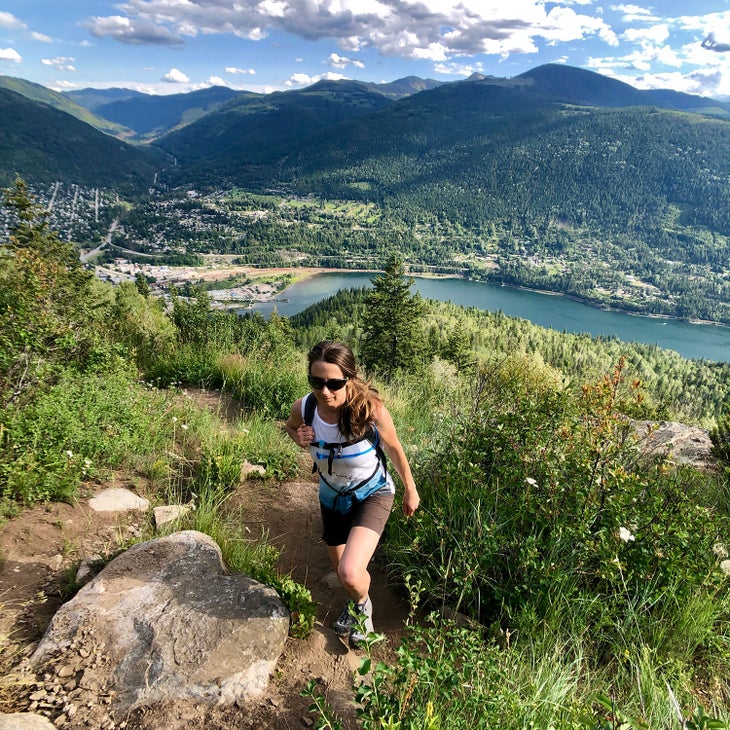
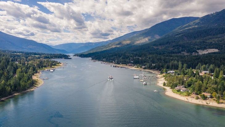
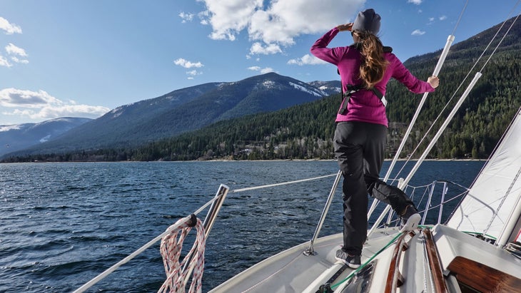
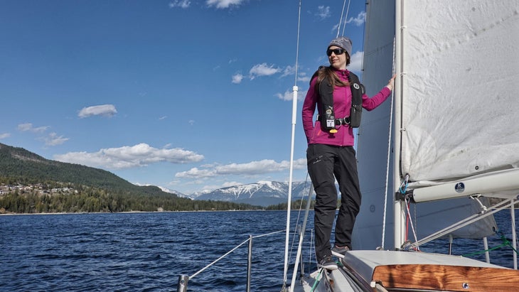
You’re heading to my hometown! And I’m going to share some of my favorite things to do. From Revelstoke, follow the rugged river valley between the Monashee and Selkirk mountain ranges, then skirt the northern edge of Valhalla Provincial Park to reach the West Arm of Kootenay Lake and the notoriously laid-back Nelson, where shops still close for powder days. This quaint town of 10,000 boasts a surprisingly robust sailing community, world-class skiing, and a food and arts scene that rivals cities ten times its size.
During the Vietnam War, the hippie enclave of Nelson became a haven for American draft dodgers, drawing even more progressive idealists and non-conformists, and cementing the town’s contrarian Zeitgeist. Artists, naturalists, writers, and adventurers continue to find their way to Nelson. It’s the home of magazine, the , and the —an annual 4-day campout and rave at a 500-acre farm along the Salmo River.
The Best ���ϳԹ���s in Nelson
When the snow melts out, Whitewater Ski Resort transforms into a hiker’s paradise. The classic day hike is summiting (pronounced why-murr), the iconic ridgeline that overlooks the resort. Don’t be fooled by the short distance of 4 miles out-and-back—it’s a steep, challenging trek, compounded by exposure and a bit of scrambling. From the top, you can look into both Valhalla and Kokanee provincial parks, an endless string of peaks stretching all the way to the horizon. For a less taxing route in the vicinity, try the new (6.3-miles out-and-back) leading to the summit of White Queen.
The West Kootenay bouldering scene is arguably the fastest growing in Canada, with tons of high-quality gneiss and granite coupled with talented, motivated locals establishing new routes faster than anyone can document. The latest has close to 1,000 bouldering problems, and since it was printed in 2020, multiple new areas have been developed containing nearly 600 more routes. Get the latest updates at . Or go bouldering with the guidebook author himself, Allen Rollin, who is also the founder of . Transportation and bouldering pad included.
Nelson is the only town in the BC interior that’s fielded a , an epic annual event where teams race 746 miles from Port Townsend, Washington to Ketchikan, Alaskan through Canada’s Inside Passage. The , a non-profit group of local sailors, hosts friendly competitions at the local marina including the Beer Can Races, held every Wednesday and Sunday from May to October. They are always looking for crew, including brand new beginners. Captain Penny Caldwell teaches private and small group lessons through her company . Want to continue your road trip with a unique camping sailboat in tow? Nelson-based is the only commercial SCAMP builder in Canada.
The sand beach at Nelson’s Rotary Lakeside Park is the perfect place to launch a stand-up paddleboard. In the summer months, rent a SUP by the hour at the Nelson District Community outbuilding located at the water’s edge. Or for $65 a day from in town. Paddle east to reach Red Sands Beach, Nelson’s infamous nude beach located on the edge of the forest; or go west to explore the wildlife-rich bays adjacent to Nelson’s waterfront walking trail, then paddle straight across the West Arm to the rock cliffs on the other side to see the petroglyphs (look for the hidden cave inside the rock wall).
Mountain bikers love Nelson for its distinct type of trails, nostalgically referred to as classic BC-style (Read: highly technical singletrack with long vertical descents full of airs, bridges, steeps, roots, and rock slabs). Many of the town’s surrounding trail networks were hand-built, and some have been around for longer than any of the people who ride them. The builds and maintains 180+ trails spanning 168 miles. Hit their website for trail maps and conditions reports.
Take a scenic drive along Kootenay Lake to reach , owned and operated by the Lower Kootenay Band, Yaqan Nukiy, which means “where the rock stands.” Besides the large hot springs pool overlooking the lake and the peaks beyond, Ainsworth features a rare natural hot springs cave. Walking through the cave’s various chambers, among the otherworldly-formations created by the mineral rich water, is a different kind of adventure. Public entry is Wednesday through Sunday and by reservation only. Leave time for lunch (or dinner) at to experience Indigenous-inspired cuisine like skillet-roasted Salt Spring mussels with wild boar sausage served alongside house made bannock.
Where to Stay in Nelson
Nelson’s more than 300 heritage buildings give its downtown core a distinct charm, exemplified by the at the corner of Vernon and Ward streets (from $170). The elegant Hume harkens back to 1898 and, in addition to its boutique hotel rooms, offers two standout restaurants, an English-style pub, the Spirtbar nightclub, and a luxury .
The Hummingbird Lodge and Campground opened in July 2023. It is located at the boundary of Whitewater Ski Resort and , offers RV and tent 15 forested camping sites, 10 RV sites, a stylish two-bedroom suite, and a café (from $35).
Where to Eat and Drink in Nelson
Nelson boasts more restaurants per capita than San Francisco. A stroll down Baker Street, the main drag, validates that claim, with multiple restaurants and cafes on every block, and spilling over into the side streets. is a favorite with both locals and visitors for its casual atmosphere and yummy street-style tacos. Newcomer occupies a stylish space with a contemporary Italian-inspired menu to match. Its pizzas are the best in town.
Foodies head to for craft cocktails and healthy farm-to-table gourmet like free range half roasted chicken for two with seasonal vegetables. is an authentic Japanese restaurant with exceptionally good sushi served in a friendly, unpretentious setting.
7. Nelson to Vancouver
🚗 Distance: 410 miles
➡️ Route: Crowsnest Hwy/BC-3 W to Trans-Canada Hwy/BC-1 W over two un-intimidating mountain passes.
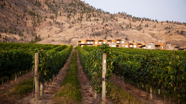
Halfway between Nelson and Vancouver lies Osoyoos, the southern gateway to the Okanagan Valley, Canada’s most celebrated wine region. The south Okanagan is a rare (for Canada) desert ecosystem, specifically a shrub-steppe semi-desert. Its warm, sunny days, low humidity, and cool nights create ideal conditions for growing red varietals, and Osoyoos produces award-winning merlots, cabernet sauvignons, and cabernet francs.
Imagine the best of California and Colorado wine countries combined into a single dreamscape of lakeside vineyards and orchards, with rolling foothills covered in sagebrush and pine set against a backdrop of arid mountain peaks. The cerulean-blue waters of Osoyoos Lake are said to be the warmest of all of Canada’s freshwater lakes, reaching 75 degrees in the summer.
The Best ���ϳԹ���s in Osoyoos
Visit the (pronounced in-ka-meep), a state-of-the-art interpretive center, to learn about the past, present, and future of the Osoyoos Indian Band. Explore indoor and outdoor cultural and ecology exhibits (including meeting a rattlesnake up close), hands-on displays, and two multi-media theater experiences. In the late spring and summer, interpretive guides lead walking tours through the grasslands of the 50-acre property, which includes a traditional village complete with a pit house and sweat lodge.
The scenic backroads and gently rolling terrain of were made for wine-tasting by bike. Starting in April, offers daily tours of local vineyards astride a Cube Hybrid One. You’ll be able to go farther and faster thanks to the pedaling boost from a 250-watt Bosch Performance series electric motor.
The rock-climbing season at Skaha Bluffs Provincial Park, located 45 minutes north in Penticton, starts as early as March courtesy of the warm, dry climate. More than 60 crags encompassing about 1,000 routes—mostly mid-grade sport climbing—can be found here. Skaha gets busy in the summer, but spring is blissfully mellow. are the local experts for the area, with more than 30 years in the biz.
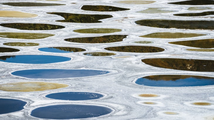
Don’t miss the pullout off of Highway 3 West to view Spotted Lake, a sacred site for healing known as kłlilx’w by the Sylix Okanagan People. The small lake has an usually high mineral content, and as the weather gets warmer, the water begins to evaporate, leaving behind rich mineral deposits in an explosion of color ranging from blue to green to yellow.
Where to Stay in Osoyoos
The 226 adobe-style condos and villas of , located adjacent to the Nk’Mip Desert Cultural Centre, come with full kitchens and fantastic views of Anarchist Mountain or Osoyoos Lake (from $284). There are EV charging stations on site and dog-friendly suites by request. Plus the , which specializes in treatments using local ingredients like sage oil.
offers roomy, condo-style suites in a variety of configurations, many with BBQs and private outdoor patios overlooking the water (from $200). Dogs are welcome, and have easy access to the pet-swim area of the local beach, located one block from the resort. The resort’s is the South Okanagan’s newest destination restaurant, dishing up regional cuisine with fine wine pairings, like 63 Acres braised short ribs with cabernet sauvignon.
Where to Eat and Drink in Osoyoos
is the first Indigenous-owned winery in North America. In the spring and summer, the award-winning winery also serves food alfresco style. Enjoy your wine with farm-to-table cuisine like wild mushroom gnocchi from the winery’s outdoor patio overlooking the vineyard and Osoyoos Lake beyond.
at Spirit Ridge Resort dishes up modern regional classics with an Indigenous flair. The restaurant’s name refers to the influence of the “Four Food Chiefs,” representing the four elements of Indigenous cuisine, according to the Syilx People of the Okanagan Nation: Bear, Salmon, Bitterroot, and Saskatoon Berry. Its weekend brunch is really something special, with options like Beetroot Cured Salmon Benny and Banana Bread French Toast.
Located just above town on what’s known as the Black Sage Bench, is an organic and biodynamic estate vineyard. Its restaurant offers unforgettable two- or three-course fixed menus featuring Okanagan Valley meats and produce, and sweeping desert and vineyard views.
stands out for putting a taproom in a wine country town. (And for doing it in 2020, and surviving the pandemic). Besides craft beer served in “crowlers,” jumbo-sized cans that hold about two pints, North Basin Brewing Co. also serves live music and comedy, hosts food trucks, and provides a huge outdoor patio that’s family- and dog-friendly. Patrons are welcome to BYOF (bring your own food), either from home or by ordering delivered from a number of participating local eateries.
Hope to see you on the road.
Jayme Moye (on Instagram ) has driven portions of this B.C. route dozens of times since relocating to Canada. She finally drove the entire thing in one go last year. And this past summer, she took a week with her husband and their dog to sail the length of Slocan Lake.