


Before you go off the grid camping and hiking, tap the latest apps that will help you plan your trip, your trails, and where to pitch your tent. Even if you don’t have service, many of these apps will remain handy.
AllTrails
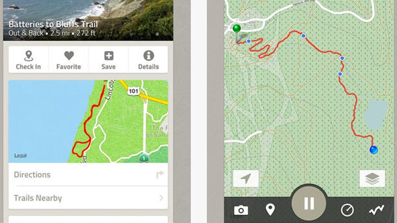
A catalog of hiking routes in the U.S. and Canada, (free) enables browsing for trails closest to you, whether on public lands or in your neighborhood. Track your activities with your phone’s GPS and add photos and write reviews for trails you’ve completed—as well as consult the records of other app and . Comprehensive trail details include descriptions, length, an elevation guide, prominent features, and recommendations on optimal months for that destination.
Camp Finder
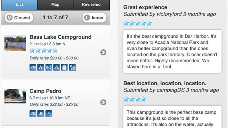
Compiled by , ($3) provides campground details for more than 18,000 sites, including those in national parks and forests, state parks, and Bureau of Land Management areas. Browse by location, then filter the results according to your needs, including camping-club discounts, campground amenities, and on-site activities. The description of each campground includes photos, directions, and reviews by fellow travelers.
National Parks by National Geographic
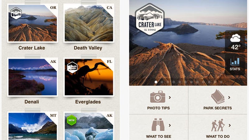
Known for stunning photography and in-depth reporting, National Geographic’s take on a app (free) doesn’t disappoint. The free version includes photo galleries, visitor info, maps denoting trailheads and campgrounds, and recommended itineraries for one- and two-day stays at the most-visited parks, from Arches to Zion. Make an in-app purchase ($2) to get insider secrets and tips on what to see and do and where to stay, all curated by National Geographic editors. Although offers a more comprehensive list of historical parks, monuments, battlefields, preserves, memorials, and other destinations, if you’re looking for national parks, the National Geographic app’s coverage is tops.
National Parks Field Guide
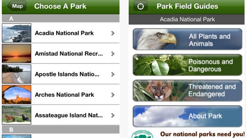
While visiting National Parks, this interactive app (free) will be your trusty companion for identifying birds, mammals, reptiles, and amphibians, as well as native flora. Once you’ve identified the park you’re visiting, the app allows you to navigate by species or by category—such as poisonous and dangerous, or threatened and endangered species. You can easily browse through the pictures to confirm your sightings via helpful callouts to each species’ distinguishing features.
Point de Vue
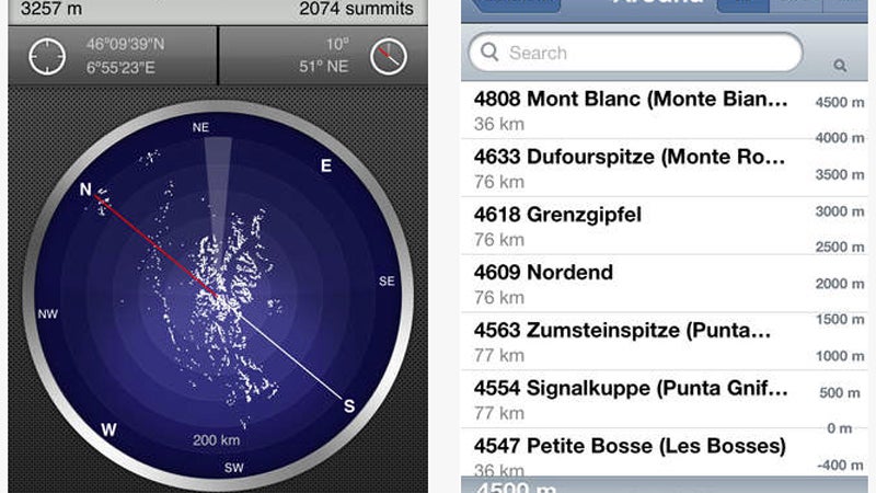
Is the Rocky Mountain National Park fourteener Mount Elbert or Mount Antero? ($4) will help you decide by synthesizing a view of the landscape in question, then dishing out a labeled map. The app includes maps for any location in the world, working on- and offline, and with or without GPS. Once you’ve set your location and heading, it notes distances to, and the elevation of, peaks—especially useful when views of summits are obscured by clouds.