

“You don’t have to be an avid hiker to enjoy a hike on the PCT,” says Eli Boschetto, author of . “In many locations, it’s very accessible, and it can be hiked in smaller portions that visit some of the most scenic locations.” With 2,650 miles of path to traverse, the Pacific Crest Trail is daunting to many, despite its convenience��for��the entire West Coast. For those who like the idea of exploring the PCT��but aren’t mentally or physically��prepared for the full Cheryl Strayed Wild experience, there are plenty of short treks to consider. According to the ,��none of the following��routes have been directly impacted by the recent wildfires.��From the North Cascades to the Sierra, here are our favorite day hikes along the PCT.
Kendall Katwalk
Length: 12 miles round-trip
Difficulty: Strenuous
Trailhead: Kittitas County, Washington��(47.4278, -121.4135)
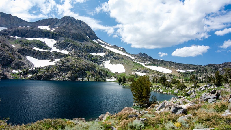
One of the lengthier hikes on the��list, offers incredible views of Washington’s Alpine Lakes Wilderness. Rugged peaks and old-growth forest are decorated��with wildflowers in the summer and vibrant foliage in the fall. Best tackled between June and November, this hike has a 2,700-foot elevation gain that’s spread out over nearly seven miles and��features��360-degree views of the rocky cliff faces and surrounding wilderness. To get to the trailhead, head east on I-90 and take Exit 52 for Snoqualmie Pass, where you’ll find a marked Pacific Crest Trail parking lot. Though only about an hour from Seattle, travelers can also bunk up in the quaint town of North Bend, about 23 miles west of the trailhead.
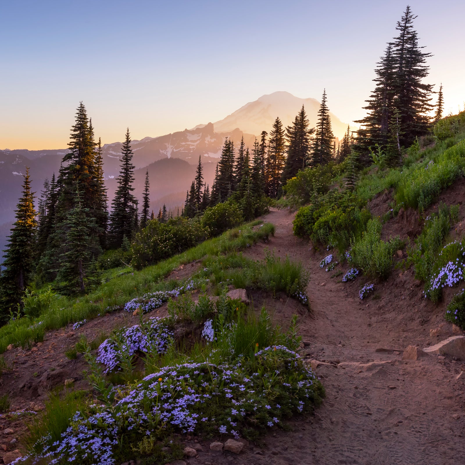
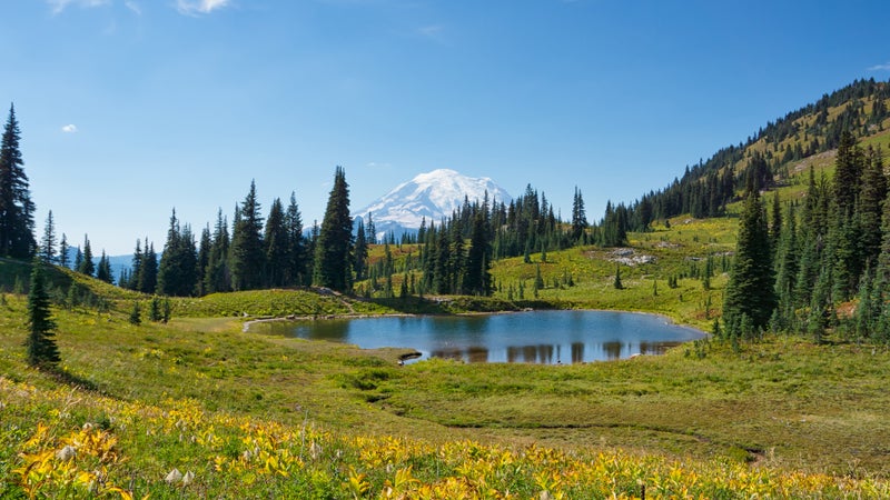
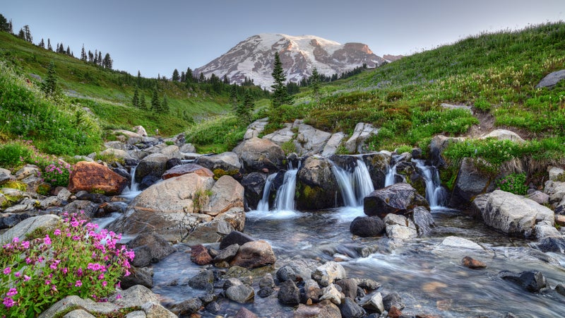
Chinook Pass to Crown Point
Length: 16 miles round-trip
Difficulty: Moderate to strenuous
Trailhead: Between Enumclaw and Naches (Yakima County), Washington��(46.872222, -121.516389)
This on Mount Rainier may be the longest on the list, but it’s also one of the most scenic sections of the PCT. The eight-mile path from the Naches Peak Loop Trailhead in Chinook Pass to Crown Point in the is home to many alpine lakes and sprawling meadows—including Sheep Lake, Sourdough Gap, and Basin Lake—as well as elk and mountain goats. Once you reach Bear Gap Junction, about five miles in, continue along the PCT to Bullion Basin and Crown Point, where you’ll be surrounded by��views of mountains, wildflowers, and wilderness. Be sure to pick up a either online or at a local Forest Service office before heading out.
Indian Heaven Trail
Length: 3.3-plus��miles one-way
Difficulty: Moderate to strenuous
Trailhead: Skamania County, Washington��(46.047000, -121.756300)
A favorite of the Pacific Crest Trail Association, begins at Cultus Creek Campground, on the border of in the South Cascades, about 100 miles northeast of Portland, Oregon. Start on Indian Heaven Trail��33 by the campground, where huckleberries and wildflower meadows are accompanied by views of Mount Rainier and Goat Rocks, an extinct volcano in the Cascade Range��to the north. The hike has a significant��1,500-foot elevation gain, but you can tack on a few extra miles by continuing on the PCT at either Deer Lake or Cultus Creek Trail 108 to make a loop. Be sure to have a Northwest Forest Pass on hand.
Timberline Lodge to Zigzag Canyon
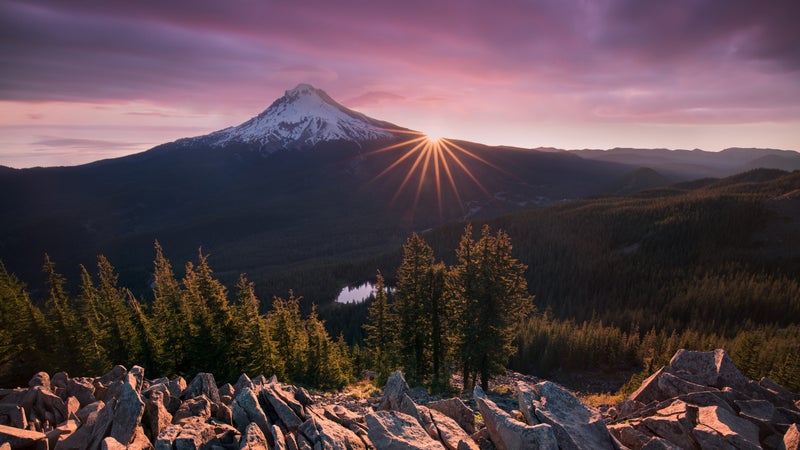
Length: 5 miles round-trip
Difficulty: Moderate
Trailhead: Government Camp, Oregon��(45.332892, -121.711432)
Known primarily for its wildflowers and breathtaking meadow expanses, this out-and-back hike��on Mount Hood is best tackled between July and October. Great for birdwatchers and casual hikers, the path is moderately trafficked, and the nearly 885 feet of��elevation gain��results in a pretty significant workout. For more serious hikers, continue past Zigzag Canyon to Paradise Park—an area full of scenic��alpine meadows—by taking Paradise Park Trail 757, about four miles in.
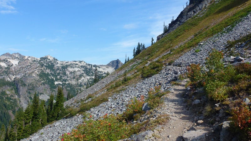
McKenzie Pass to Little Belknap��
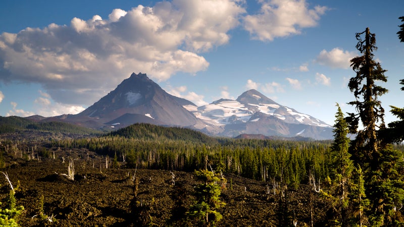
Length: 4.6 miles round-trip
Difficulty: Moderate to strenuous
Trailhead: Sisters, Oregon��(44.260404, -121.810006)
About 18 miles west of the town of Sisters, this hike��begins where the PCT crosses Route 242 at McKenzie Pass. Hike through ancient lava fields, with extensive views of the Three Sisters range and Mount Washington, before coming upon the��stunning panoramas��of Black Butte and Black Crater at the Little Belknap Crater summit. Note that because the trail is quite rocky and exposed, temperatures can get high, so opt to tackle this route in the spring or fall. A��newly implemented��Central Cascades Permit System is being delayed until 2021 due to COVID-19, so make sure you read up on before you head out next year.
Mount Ashland Meadows
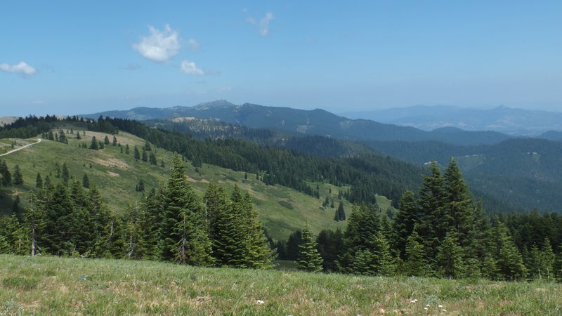
Length: 8.1 miles round-trip
Difficulty: Moderate
Trailhead: Jackson County, Oregon��(42.07349, -122.69715)
This section��is a favorite of Matt Wastradowski, coauthor of Moon’s guide. As the highest peak in the Siskiyou Mountains, Mount Ashland offers panoramic views of Black Butte, Mount Shasta, and the surrounding Klamath National Forest. Start at the Pacific Crest Trailhead where it intersects with Mount��Ashland Ski Road, making your way through a mix of woods and meadows��for the first few miles before the path opens up at Grouse Gap, a popular shelter and picnic area. Because the trail is mostly flat and the meadows make for easy turnaround points, it’s a great hike for families with kids.
Castle Dome via Crags Trail
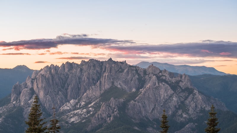
Length: 5.6 miles round-trip
Difficulty: Moderate to strenuous
Trailhead: Castella (Shasta County), California��(41.162455, -122.298590)
This short route��in Northern California is known for its exposed granite cliffs��and sweeping valleys. From the entrance near Vista Point Road, follow the sign that says Crags Trail. The path becomes harder to distinguish as you enter Castle Crags Wilderness in Shasta-Trinity National Forest, where you’ll find monolithic cliffs, crevices, and jagged rock formations, as well as the unbeatable views of Mount Shasta in clear conditions. Those who aren’t sure about the 2,100-foot elevation gain can head west for a couple of miles at the PCT intersection (about a mile in) and still catch some great views of Castle Crags. No permit is required, and��dogs and bikes are not allowed.
Carson Pass to Lake Winnemucca
Length: 5 miles round-trip
Difficulty: Moderate
Trailhead: South Lake Tahoe/Kirkwood, California��(38.694303, -119.988829)
About 30 miles south of Lake Tahoe, this popular path��is leisurely enough for both families and novice hikers. The trail is known for its gorgeous wildflowers in the summer, though it’s also beautiful in the fall, when the leaves begin to change and the weather starts to cool. Lake Winnemucca makes for an ideal lunch break, and it’s��popular for swimming and fishing. If you’re hiking with little ones or older parents, there’s always the option to cut it short and stop at Frog Lake instead. Just make sure to arrive early, as this hike is a favorite among locals and the parking lot off California Highway 88 fills up fast.
Storm Canyon Lookout to Kwaaymii Point
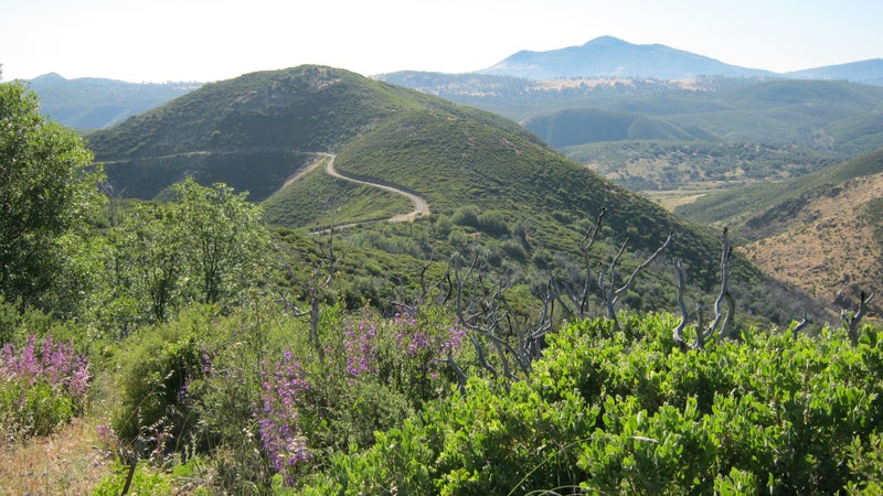
Length: 11.2 miles round-trip
Difficulty: Easy to moderate
Trailhead: San Diego County, California��(32.896192, -116.448812)
Located in the , less than 60 miles east of San Diego, is fitting for day hikers and amateur backpackers. The hike begins at the Storm Canyon Vista Trailhead, along Sunrise Highway, and continues north along a wide track��with little elevation gain, eventually passing Pioneer Mail Picnic Area, site of a historic stagecoach route. On a clear day, you’ll enjoy epic views of the Anza-Borrego��desert and the surrounding Cleveland National Forest throughout the hike. Dispersed camping restrictions begin at mile 13.5 and end at mile 53.2, north of Pioneer Mail Picnic Area, so your best bet is to��camp��at Laguna Campground (from $26)��in the Laguna Mountain Recreation��Area.