
Ski hills are major landforms, not just vertical playgrounds. New tools like Google Earth allow us to glimpse the entirety of the mountains on which ski resorts reside, and even zoom in, tilt, and twirl to experience the pitch and roll of these areas.
Thank DigitalGlobe for many of those gobsmacking, manipulatable 3D images, which, it’s fair to say, have fundamentally changed our perspective of the world’s landscapes. The Westminster, Colorado-based provider of high-definition geospatial imagery currently has four satellites circling the earth, each the size of a small SUV. Collectively, they make 60 passes around the globe each day to monitor the state of the world for a variety of clients, including the federal government and the United Nations. The company recently focused its lenses on the South Pacific to help the Fijian government assess damage to the island nation in the wake of Cyclone Winston, and has helped the World Resources Institute spot forest fires in Indonesia in near-real time.
Here, we present a curated collection of images curated by the company. The photos show the nexus of built and natural environments, and, perhaps, call into question just how far we’ve pushed development—and commerce—into fragile montane ecosystems. DigitalGlobe says these images, if collected into a time series, could even detect evidence of climate change.
(DigitalGlobe)Big Sky, Montana
What began as a gleam in the eye of NBC News anchorman Chet Huntley morphed into Montana’s Big Sky, today the country’s largest ski resort, which, with the addition of Moonlight Basin in 2012, offers passholders a 360-degree, 4,000-foot-plus-vertical skiing experience. In this August 2012 photo, Big Sky’s Alto Ridge ramps to the 11,166-foot summit of Lone Mountain as the pistes spill towards the village, while the peak’s crenellated West Wall fans out to the northeast (the coveted Big Couloir is just out of view).
Telluride, Colorado
This image of old Colorado mining town was captured in September 2012, just before the aspens changed color that year. The town is set in a box canyon in the heart of the San Juan Mountains, which contain the highest concentration of 13,000- and 14,000-foot peaks in the Lower 48. The photo shows the small spur of the ski area just above town, spackled with black diamond pistes that deliver skiers into town via any one of a number of famed bump runs, including Bushwacker, Kant-Mak-M, and Lower Plunge, visible in the center of the photo.
Mammoth Mountain, California
11,053-foot Mammoth Mountain’s 3,500 skiable acres were photographed from the northeast in December 2008, showing off the massive, tentacled system on the peak’s lee side. (The windward side is scraped clean by fronts coming off of Mammoth Pass, in the upper lefthand corner of the photo). The winter of 2008-2009 wasn’t one of Mammoth’s epic snow seasons—the mountain gets an average of 400 inches of snow each year—but the 470 inches of snow was enough to extend skiing there until July 4, 2009. The dark body of water halfway up the mountain is the resort’s snowmaking reservoir.
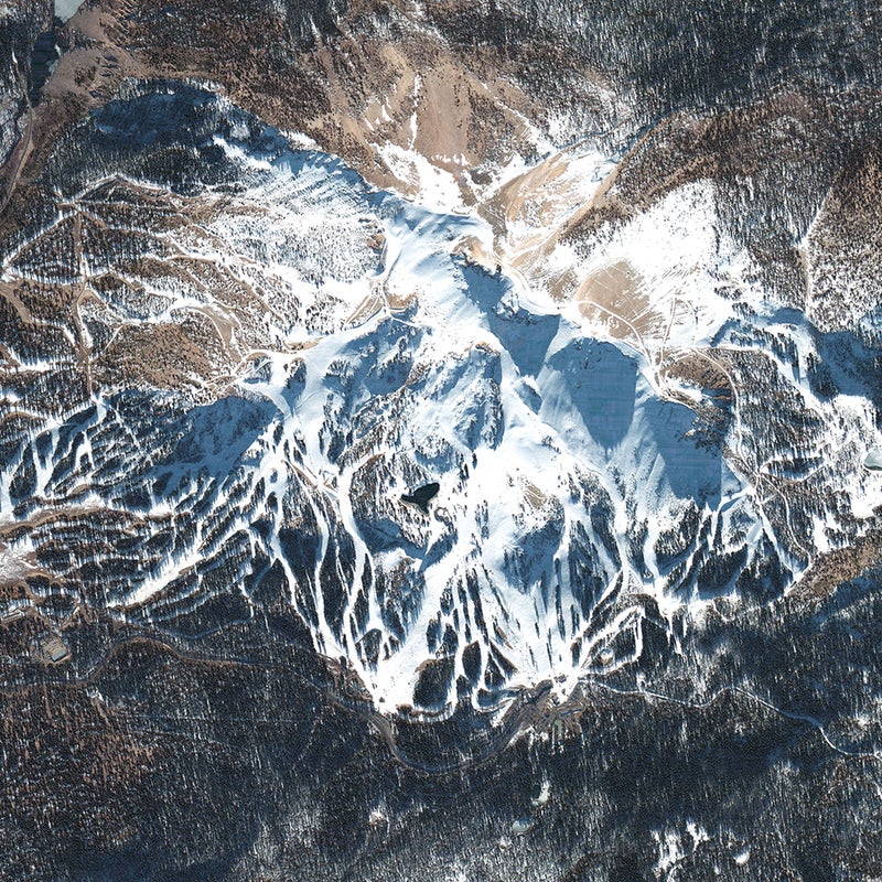
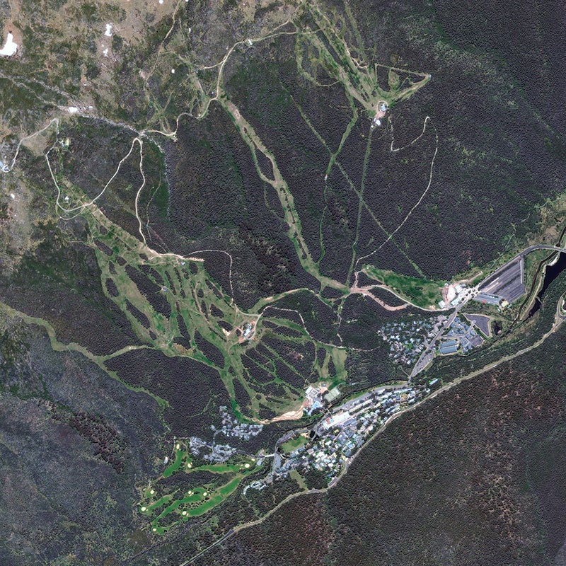
Thredbo, Australia
A photo from the spring of 2014 shows Thredbo’s southeast-facing slopes within Australia’s Kosciuszko National Park, just 100 air miles from the Tasman Sea. Looming above is the highest mountain in the country (and one of the original Seven Summits), 7,310-foot Mt. Kosciuszko.
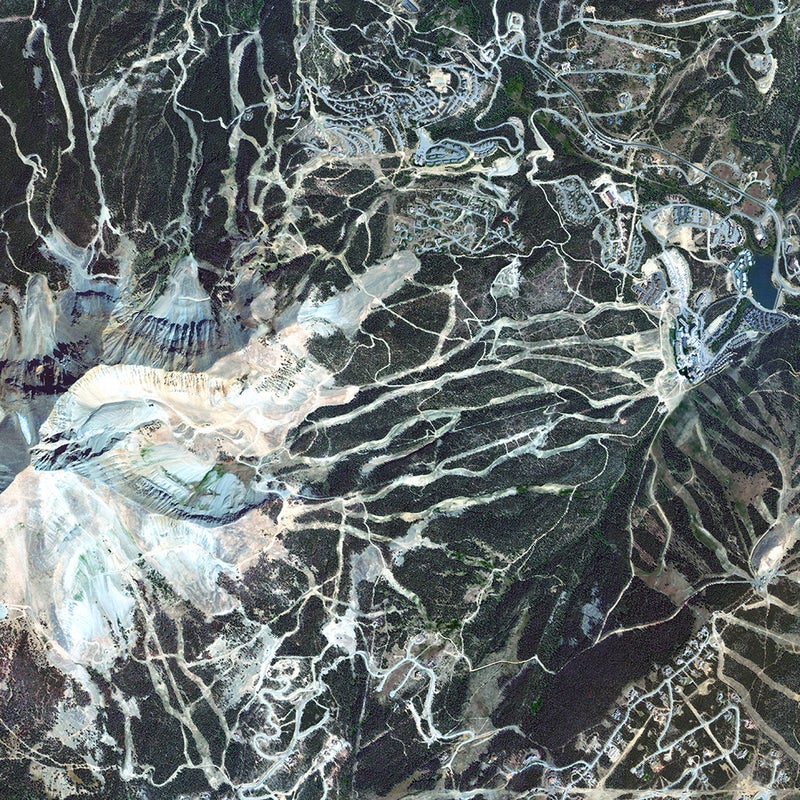
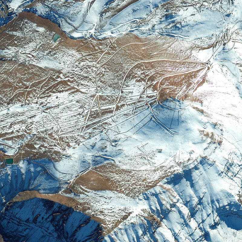
El Colorado, Chile
This May 2013 image shows the cat track winding around the conical slopes of Chile’s El Colorado, the closest ski area to Santiago (about a one-hour drive). El Colorado slopes lie between two other Andean resorts, La Parva (visible on the photo’s upper margin) and Valle Nevado. The three are interconnected by a series of lifts and, all told, comprise the Tres Valles ski area, with 7,000 skiable acres, 40 chairlifts, and four base villages.
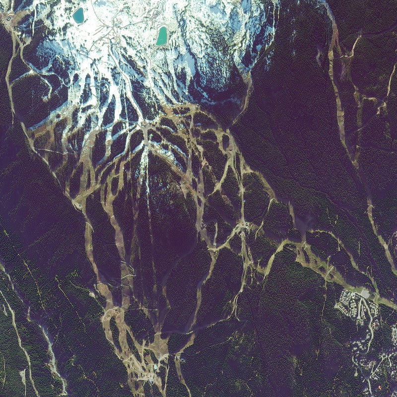
Whistler, B.C.
This October 2013 photo shows the stunning sprawl of British Columbia’s Whistler and Blackcomb complex. The site of the 2010 Winter Olympics, these ski mountains have amassed a tick list of superlatives—the largest combined ski area in North America, the longest continuous lift system in the world, over 8,000 acres of terrain, and an abundant maritime snowpack. The southeastern piste is the Dave Murray Downhill, where American Lindsey Vonn picked up her 2010 gold medal in the downhill. Look closely and you might make out the nearly two-mile Peak2Peak Gondola that links Whistler to Blackcomb.
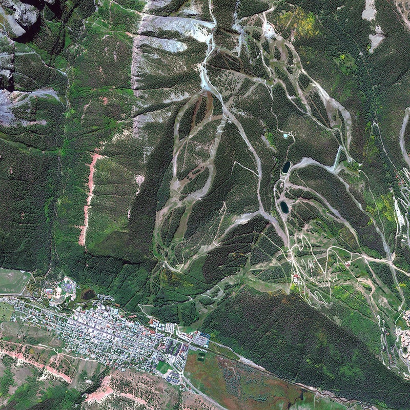
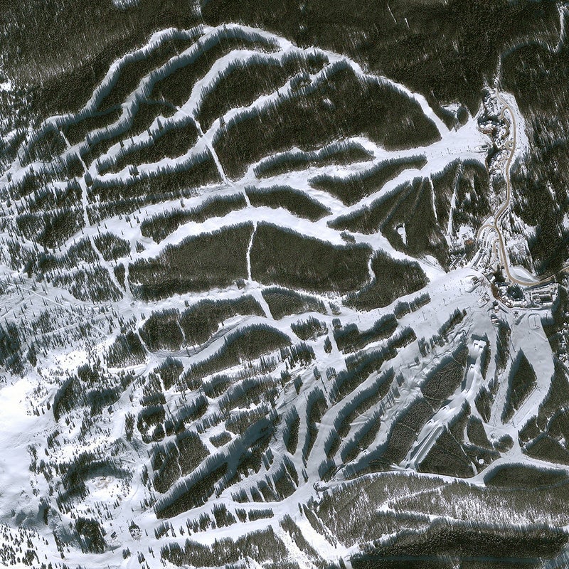
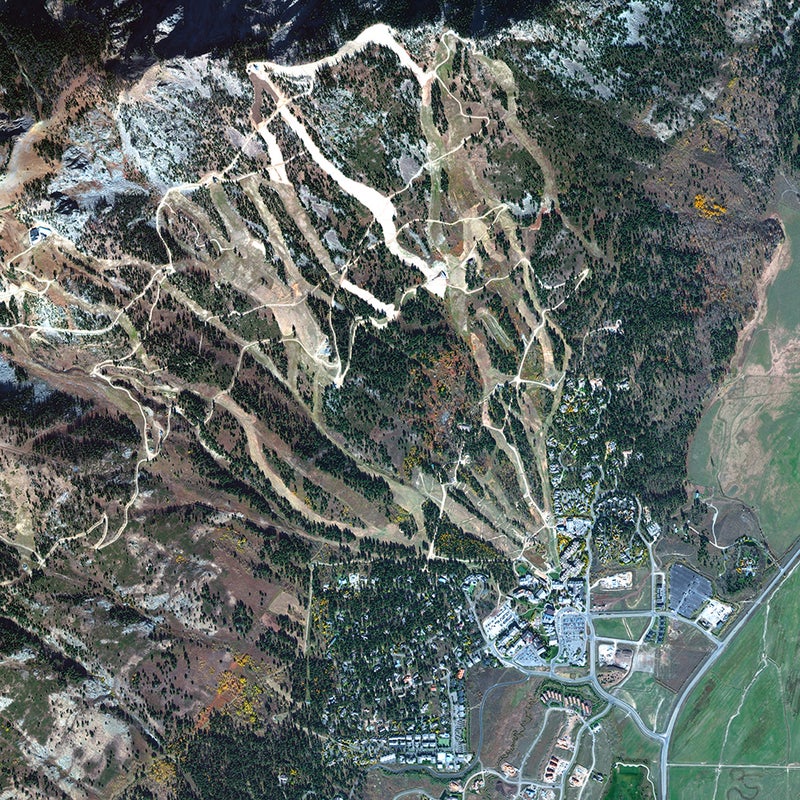
Breckenridge, Colorado
This shot, taken in January 2013, shows Breckenridge Ski Resort’s wild terrain, which tops out inbounds on the resort’s Peak 9, at 12,998 feet. Here we see Peak 7’s lower runs funneling into the Independence Superchair, with intermediate slopes spilling down to luxury condominiums.
Cerro Catedral, Argentina
Cerro Catedral Alta Patagonia occupies the foothills of the southern Andes, just under an hour’s drive from the Lake District’s city of Bariloche. This shot, taken in July 2010, shows the western edge of Lake Gutierrez. The resort abuts the resort town of Villa Catedral.
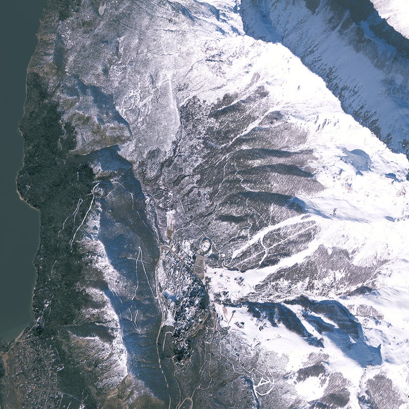
Jackson, Wyoming
Jackson Hole, one of the flagship resorts of the American West, shares a range with Grand Teton National Park. And in fact, most of the broad valley in which the town sits (visible on the right margin of the photograph) is also national parkland. The photo, taken in October 2015, captures the nexus of the resort’s broad ski boulevards—Gros Ventre, Sundance, and Lower Werner—spilling into Teton Village.
Paradiski, France
Paradski encompasses an enormous swath of France’s Graian Alps, including the resorts of Les Arcs, Peisy-Vallandry, and La Plagne. The area is splayed at the base of the massif of le Vanoise: Mts. Pourri, Grande Motte, Grande Casse, and Bellecôte. This October 2012 image shows the gladed pistes of Peisy-Vallandry merging into the hamlets of the same name. In the upper right is the base of the Aiguille Rouse, beyond which lies Vanoise National Park, France’s first national park.
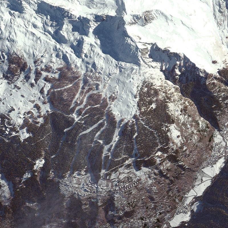
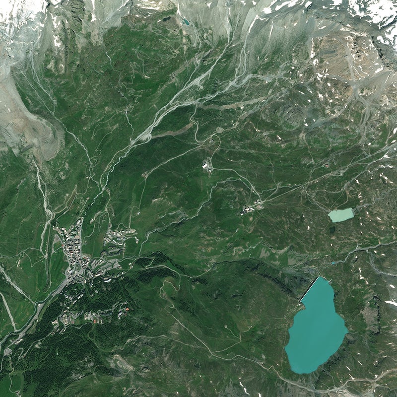
Matterhorn, Switzerland
From Zermatt to Cervinia, the Matterhorn Ski Paradise encompasses a sweep of the southern Penine Alps, from the Rothorn, Monte Rosa, to the Matterhorn and beyond: over 223 miles of slopes, 54 lifts, and year-round skiing, thanks to the Matterhorn Glacier Paradise. This image was taken in August 2013.