

continues to expand its range, taking desk jockeys to some of the planet's most remote corners. But one thing you won't ever see in the images? Surprise spiders. Keeping the 's 15 lenses free of debris (and bugs) is a common challenge for the teams capturing immersive panoramas of ever-wilder locations.
“While we were walking through low-hanging trees, spiders would drop into the camera mast and start spinning their webs,” says Program Manager Raleigh Seamster, who helped in 2013. The low-tech solution: stopping regularly to swat away buildup around the lenses. It's a small hurdle as the tech giant seeks to digitize the world for the purposes of conservation, education, and armchair travel.
As Google captures views of increasingly difficult-to-reach places (most recently the Sherpa community of Khumbu), we present eight of our favorites, plus the stories behind the incredible images. It’s not wasting time on the Internet if you’re exploring the world, right?
Aconcagua Summit, Argentina
It's the only way any of us will ever summit the world's highest mountain outside of Asia faster than Kilian Jornet or Karl Egloff. The view to the summit is also a treasure trove of information for anyone planning to climb Aconcagua.
On their 17-day trek, the Street View team covered as many campsites as possible so that future visitors can better plan their route. Google ���ϳԹ���r (yes, that's a real job title) Dan Fredinburg says the team brought off-the-shelf Canon cameras for this trip, and the staff didn't handle the cold well. “We had to take off our gloves to get the best shot,” he says. “We spent the better part of our days handing the cameras back and forth so one person could take photos and the others could jump up and down and blow into their hands to warm up.”
Gombe National Park, Tanzania
More than 50 years after Jane Goodall began her in this park, a Street View team captured Gombe's primates still doing what they do best: fishing for termites and sunning on the beach. (The Trekkers were a little more out of their element. “We were warned to watch for the trifecta: poisonous snakes, army ants, and killer bees,” says Allie Lieber, program manager at Google Earth Outreach.)
The end goal: get more people interested in far-flung conservation. Goodall herself explains it best. “Through my time at Gombe, I learned first-hand how important it is for each of us to understand the world we share. Only when we truly understand will we begin to care, and only when we truly care will we take action.”
Northern Lights, Finland
The Street View team used a camera system on a tripod to capture these views from the middle of a frozen lake. Then they waited for an aurora to show up—not guaranteed on any given day. Now there's a backup plan for those of us who dream of seeing the northern lights but are never in the right place at the right time.
Top of Forest Zip Line, Amazon
This is no tourist's zipline. In order to create the perfect path from the top of the forest canopy to the floor, professional zipliners and a team from Google Earth Outreach partner transported their equipment by boat and foot in search of a once-in-a-lifetime view. “The Amazon Forest canopy is a remote place, and very few people will ever get to experience it for themselves,” Karin Tuxen-Bettman, program manager at Google Earth Outreach, says. “Street View imagery is the next best thing to actually being there.”
Sled Dogs, Canadian Arctic
The icy Canadian city of Iqaluit is hard enough to travel through without also having to lug a 40-pound camera system. Google sent a team there in the winter, when temperatures drop below minus 25 degrees Fahrenheit. The trip was back in the early days of the Trekker, so taking it on a dogsled ride was “very experimental,” Tuxen-Bettman says. “I remember we had to hold on very tight, as Frobisher Bay had a lot of chunks of ice.” In addition to the frozen tundra, the team and partner gathered images and information —a vast improvement for a town where most streets and points of interest hadn't even made it onto Google Maps.
Base Camp, Mount Everest
Wasting no time, Google sent a team (all new to mountaineering) to Base Camp for one of the first Street View collects in 2011. “While the team was in Namche Bazaar, a magnitude 6.6 earthquake hit nearby Sikkim, India,” Fredinburg says. “The trip ended with three days of thunderstorms and mudslides around the region.” Read more about Google's latest Everest project in our dispatch about the plan.
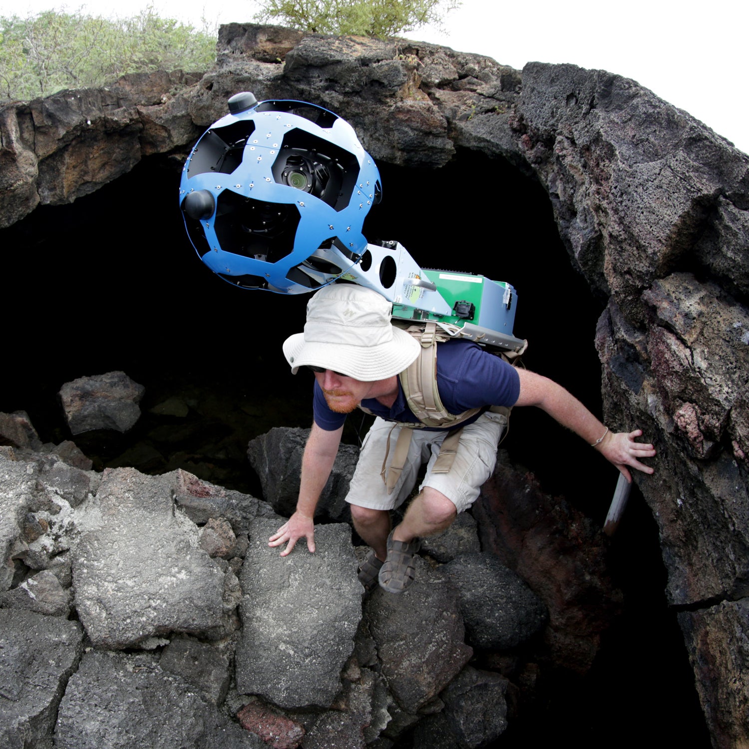
Galapagos Islands
The iconic marine wildlife of the Galapagos lives on its own schedule, and to get the best view, you often need to show up early. “We usually needed to wake in the wee hours of morning to travel several hours by boat in time to see the animals,” Seamster says. Along with partners and the , the Trekkers also navigated lava fields, mangroves, and forested areas to find wildlife that can't be seen anywhere else.